TopoQuest Logo
Do you find TopoQuest useful?
Help keep TopoQuest running and adding new maps/features by donating!
Bitcoin:  19c7KJd3qBynnjoSw5npx9KScwjBe4ifkT
Litecoin:  LXs6TkuXGGXo1vDsWCkWVdjQX94eUKd6ui
Home View Maps Find Maps Find Places Resources & Links


Pelion East, South Carolina Topographic Map

USGS Map Title: Pelion East, SC
USGS Map MRC: 33081G2
DRG (GeoTIFF) Download: o33081g2.tif


Neighboring USGS Topographic Map Quads:


  Barr Lake, SC  
33081H3
 

  Lexington, SC  
33081H2
 

  Southwest Columbia, SC  
33081H1
 

  Pelion West, SC  
33081G3
 

  Pelion East, SC  
33081G2
 

  Gaston, SC  
33081G1
 

  Wagener, SC  
33081F3
 

  Pond Branch, SC  
33081F2
 

  Swansea, SC  
33081F1


Map MRC Location:

N34°
W82°
N34°
W81°
H8 H7 H6 H5 H4 H3 H2 H1
G8 G7 G6 G5 G4 G3 G2 G1
F8 F7 F6 F5 F4 F3 F2 F1
E8 E7 E6 E5 E4 E3 E2 E1
D8 D7 D6 D5 D4 D3 D2 D1
C8 C7 C6 C5 C4 C3 C2 C1
B8 B7 B6 B5 B4 B3 B2 B1
A8 A7 A6 A5 A4 A3 A2 A1
N33°
W82°
N33°
W81°

Pelion East, SC USGS 1:24K Topographic Map Preview:
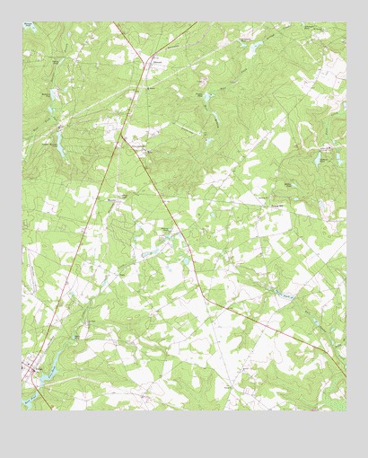
Pelion East, SC USGS Topographic Map
Click on map above to begin viewing in our Map Viewer.

This topographic map contains these locations and features:
Feature Name Type Latitude Longitude GNIS ID View Map
Antioch CemeteryCemeteryN33.7626°W81.1634°1244083View Map
Antioch ChurchChurchN33.7629°W81.1651°1244898View Map
Bachman CemeteryCemeteryN33.7535°W81.1576°1244093View Map
Bear CreekStreamN33.8652°W81.1601°1244994View Map
Bethel CemeteryCemeteryN33.8340°W81.2009°1244102View Map
Bethel ChurchChurchN33.8338°W81.2012°1246781View Map
Bethel Independent ChurchChurchN33.8340°W81.2029°1220579View Map
Boggy BranchStreamN33.7702°W81.1293°1220859View Map
Craft PondLakeN33.8189°W81.2118°1221812View Map
Crossroad School (historical)SchoolN33.7602°W81.1682°1244146View Map
Crystal Springs LakeReservoirN33.8355°W81.2353°1221863View Map
Darden AirportAirportN33.8394°W81.1814°1251896View Map
East Fork Scouter BranchStreamN33.8449°W81.2384°1222187View Map
EdmundPopulated PlaceN33.8615°W81.2001°1247641View Map
Edmund School (historical)SchoolN33.8602°W81.2004°1244170View Map
Edmund School (historical)SchoolN33.8557°W81.2023°1244171View Map
Falcon Airport (historical)AirportN33.8424°W81.2173°1251881View Map
Feigles PondReservoirN33.8509°W81.1787°1237756View Map
Fort PondReservoirN33.7613°W81.2386°1247807View Map
Goodwin PondReservoirN33.8310°W81.1359°1222767View Map
Guignard PondReservoirN33.8675°W81.1654°1222931View Map
Guignard Pond Dam D-0974DamN33.8677°W81.1632°1239213View Map
Harmony ChurchChurchN33.8188°W81.1545°1245911View Map
Hidden Valley Country ClubLocaleN33.8349°W81.1312°1242402View Map
Hobson PondReservoirN33.8084°W81.1928°1223198View Map
Hollow PondLakeN33.8227°W81.1450°1223230View Map
Hunt BranchStreamN33.8493°W81.1787°1223395View Map
Hutto PondLakeN33.7737°W81.2299°1223418View Map
Larkin Glen CemeteryCemeteryN33.8715°W81.1418°1244236View Map
Lexington County Airport at PelionAirportN33.7911°W81.2466°1251951View Map
Lexington County Fire Service PelionBuildingN33.7614°W81.2489°2578450View Map
Lexington County Fire Service Sharpes HillBuildingN33.8138°W81.1924°2578834View Map
Lexington County Fire Station 13BuildingN33.8641°W81.1994°2578563View Map
Lynch BranchStreamN33.7521°W81.2495°1235865View Map
MacedonPopulated PlaceN33.8174°W81.2137°1231513View Map
Moragne PondReservoirN33.8743°W81.2497°1224643View Map
Mount Hebron Lutheran ChurchChurchN33.8540°W81.2020°1249579View Map
Mount Pleasant ChurchChurchN33.8727°W81.1337°1224782View Map
New Hope ChurchChurchN33.7785°W81.2251°1224986View Map
PelionPopulated PlaceN33.7632°W81.2448°1250054View Map
Pelion DivisionCivilN33.7871°W81.2457°1938382View Map
Rast PondReservoirN33.7531°W81.2473°1237766View Map
Redmond PondReservoirN33.8516°W81.2383°1225799View Map
Reichter - Richter CemeteryCemeteryN33.7846°W81.1284°1244338View Map
Sand Hill School (historical)SchoolN33.8727°W81.1337°1244373View Map
Schumpert PondLakeN33.8746°W81.1416°1226448View Map
Sharon ChurchChurchN33.7579°W81.1693°1250846View Map
Sharpes HillPopulated PlaceN33.8157°W81.1543°1231796View Map
Sharpes Hill School (historical)SchoolN33.8146°W81.1579°1244382View Map
Shealy PondLakeN33.8621°W81.2354°1226545View Map
South Carolina Noname 32007 D-0972 DamDamN33.7579°W81.2420°1237726View Map
South Carolina Noname 32018 D-0976 DamDamN33.8335°W81.1282°1237745View Map
South Carolina Noname 32019 D-0977 DamDamN33.8307°W81.1362°1237746View Map
South Carolina Noname 32025 D-0978 DamDamN33.7863°W81.1454°1237753View Map
South Carolina Noname 32026 D-0975 DamDamN33.8521°W81.1779°1237755View Map
South Carolina Noname 32033 D-0971 DamDamN33.8357°W81.2359°1237763View Map
South Carolina Noname 32035 D-0955 DamDamN33.8385°W81.2498°1237767View Map
Spires PondReservoirN33.7875°W81.1488°1226792View Map
TestoPopulated PlaceN33.7938°W81.2129°1227988View Map
West Fork Scouter BranchStreamN33.8449°W81.2384°1235874View Map

Note: Coordinates in the location and feature list above are referenced to NAD83 datum.


Copyright (C) 2008-2024 Ryan Niemi / Sunset Dynamics ... All Rights Reserved