TopoQuest Logo
Do you find TopoQuest useful?
Help keep TopoQuest running and adding new maps/features by donating!
Bitcoin:  19c7KJd3qBynnjoSw5npx9KScwjBe4ifkT
Litecoin:  LXs6TkuXGGXo1vDsWCkWVdjQX94eUKd6ui
Home View Maps Find Maps Find Places Resources & Links


Pelona Mountain, New Mexico Topographic Map

USGS Map Title: Pelona Mountain, NM
USGS Map MRC: 33108F1
DRG (GeoTIFF) Download: o33108f1.tif


Neighboring USGS Topographic Map Quads:


  Fullerton, NM  
33108G2
 

  Shaw Mountain, NM  
33108G1
 

  Luera Mountains West, NM  
33107G8
 

  Rail Canyon, NM  
33108F2
 

  Pelona Mountain, NM  
33108F1
 

  Mojonera Canyon, NM  
33107F8
 

  O Bar O Canyon East, NM  
33108E2
 

  Indian Peaks West, NM  
33108E1
 

  Indian Peaks East, NM  
33107E8


Map MRC Location:

N34°
W109°
N34°
W108°
H8 H7 H6 H5 H4 H3 H2 H1
G8 G7 G6 G5 G4 G3 G2 G1
F8 F7 F6 F5 F4 F3 F2 F1
E8 E7 E6 E5 E4 E3 E2 E1
D8 D7 D6 D5 D4 D3 D2 D1
C8 C7 C6 C5 C4 C3 C2 C1
B8 B7 B6 B5 B4 B3 B2 B1
A8 A7 A6 A5 A4 A3 A2 A1
N33°
W109°
N33°
W108°

Pelona Mountain, NM USGS 1:24K Topographic Map Preview:
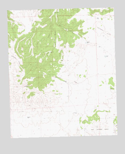
Pelona Mountain, NM USGS Topographic Map
Click on map above to begin viewing in our Map Viewer.

This topographic map contains these locations and features:
Feature Name Type Latitude Longitude GNIS ID View Map
Bear Track CanyonArroyoN33.7170°W108.0876°929535View Map
Bear Track TankReservoirN33.7086°W108.0763°1848281View Map
Boulevard TankReservoirN33.6782°W108.0583°1847423View Map
Bruja SpringSpringN33.6997°W108.0618°1847422View Map
Chimney Water WellWellN33.7298°W108.0578°919775View Map
CienegitaLocaleN33.6828°W108.1006°936541View Map
Continental Divide Wilderness Study AreaParkN33.6764°W108.1062°935830View Map
Cornelius TankReservoirN33.6704°W108.0081°1847426View Map
Fullerton Spring TankReservoirN33.7464°W108.0705°1847420View Map
Juanita CanyonValleyN33.7303°W108.0737°1847421View Map
Mountain TankReservoirN33.6449°W108.1057°1847424View Map
Pelona MountainSummitN33.6764°W108.1062°909539View Map
Pelona WellWellN33.6478°W108.0478°1847425View Map
Prairie LakeLakeN33.7029°W108.0126°1847427View Map
Red TankReservoirN33.7396°W108.0206°1847428View Map
Rock Corral CanyonArroyoN33.7009°W108.0926°929664View Map
Shaw CanyonArroyoN33.7251°W108.0445°929554View Map
Stallings TankReservoirN33.7165°W108.0338°1848189View Map

Note: Coordinates in the location and feature list above are referenced to NAD83 datum.


Copyright (C) 2008-2025 Ryan Niemi / Sunset Dynamics ... All Rights Reserved