TopoQuest Logo
Do you find TopoQuest useful?
Help keep TopoQuest running and adding new maps/features by donating!
Bitcoin:  19c7KJd3qBynnjoSw5npx9KScwjBe4ifkT
Litecoin:  LXs6TkuXGGXo1vDsWCkWVdjQX94eUKd6ui
Home View Maps Find Maps Find Places Resources & Links


Rail Canyon, New Mexico Topographic Map

USGS Map Title: Rail Canyon, NM
USGS Map MRC: 33108F2
DRG (GeoTIFF) Download: o33108f2.tif


Neighboring USGS Topographic Map Quads:


  Rael Spring, NM  
33108G3
 

  Fullerton, NM  
33108G2
 

  Shaw Mountain, NM  
33108G1
 

  Salvation Peak, NM  
33108F3
 

  Rail Canyon, NM  
33108F2
 

  Pelona Mountain, NM  
33108F1
 

  O Bar O Canyon West, NM  
33108E3
 

  O Bar O Canyon East, NM  
33108E2
 

  Indian Peaks West, NM  
33108E1


Map MRC Location:

N34°
W109°
N34°
W108°
H8 H7 H6 H5 H4 H3 H2 H1
G8 G7 G6 G5 G4 G3 G2 G1
F8 F7 F6 F5 F4 F3 F2 F1
E8 E7 E6 E5 E4 E3 E2 E1
D8 D7 D6 D5 D4 D3 D2 D1
C8 C7 C6 C5 C4 C3 C2 C1
B8 B7 B6 B5 B4 B3 B2 B1
A8 A7 A6 A5 A4 A3 A2 A1
N33°
W109°
N33°
W108°

Rail Canyon, NM USGS 1:24K Topographic Map Preview:
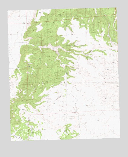
Rail Canyon, NM USGS Topographic Map
Click on map above to begin viewing in our Map Viewer.

This topographic map contains these locations and features:
Feature Name Type Latitude Longitude GNIS ID View Map
Anderson TankReservoirN33.6332°W108.1903°1848263View Map
Batton CanyonValleyN33.6862°W108.1867°1848260View Map
Batton PondLakeN33.6877°W108.1858°886113View Map
Big TankReservoirN33.6426°W108.1518°1848254View Map
Chute TankReservoirN33.7375°W108.2332°1848252View Map
Coyote CanyonValleyN33.6253°W108.1845°905468View Map
Green TankReservoirN33.7033°W108.2140°1848268View Map
Heifer TankReservoirN33.6409°W108.2187°1848264View Map
Highway TankReservoirN33.7442°W108.1889°1848257View Map
Hobarts TankReservoirN33.6576°W108.1648°1848253View Map
Horse TankReservoirN33.6325°W108.2268°1848265View Map
Indian House CanyonValleyN33.7103°W108.1867°1848258View Map
Indian House TankReservoirN33.7148°W108.1792°1848256View Map
Lower Divide TankReservoirN33.6446°W108.1793°1848262View Map
Rail CanyonValleyN33.7123°W108.1989°893612View Map
Rincon TankReservoirN33.6547°W108.2367°1848266View Map
Thompson TankReservoirN33.6999°W108.1822°1848259View Map
Upper Divide TankReservoirN33.6595°W108.1982°1848261View Map
West CanyonValleyN33.6945°W108.2409°1848267View Map

Note: Coordinates in the location and feature list above are referenced to NAD83 datum.


Copyright (C) 2008-2025 Ryan Niemi / Sunset Dynamics ... All Rights Reserved