TopoQuest Logo
Do you find TopoQuest useful?
Help keep TopoQuest running and adding new maps/features by donating!
Bitcoin:  19c7KJd3qBynnjoSw5npx9KScwjBe4ifkT
Litecoin:  LXs6TkuXGGXo1vDsWCkWVdjQX94eUKd6ui
Home View Maps Find Maps Find Places Resources & Links


O Bar O Canyon East, New Mexico Topographic Map

USGS Map Title: O Bar O Canyon East, NM
USGS Map MRC: 33108E2
DRG (GeoTIFF) Download: o33108e2.tif


Neighboring USGS Topographic Map Quads:


  Salvation Peak, NM  
33108F3
 

  Rail Canyon, NM  
33108F2
 

  Pelona Mountain, NM  
33108F1
 

  O Bar O Canyon West, NM  
33108E3
 

  O Bar O Canyon East, NM  
33108E2
 

  Indian Peaks West, NM  
33108E1
 

  Canyon Creek Mountains, NM  
33108D3
 

  Black Mountain, NM  
33108D2
 

  Spring Canyon, NM  
33108D1


Map MRC Location:

N34°
W109°
N34°
W108°
H8 H7 H6 H5 H4 H3 H2 H1
G8 G7 G6 G5 G4 G3 G2 G1
F8 F7 F6 F5 F4 F3 F2 F1
E8 E7 E6 E5 E4 E3 E2 E1
D8 D7 D6 D5 D4 D3 D2 D1
C8 C7 C6 C5 C4 C3 C2 C1
B8 B7 B6 B5 B4 B3 B2 B1
A8 A7 A6 A5 A4 A3 A2 A1
N33°
W109°
N33°
W108°

O Bar O Canyon East, NM USGS 1:24K Topographic Map Preview:
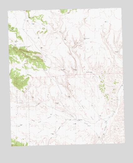
O Bar O Canyon East, NM USGS Topographic Map
Click on map above to begin viewing in our Map Viewer.

This topographic map contains these locations and features:
Feature Name Type Latitude Longitude GNIS ID View Map
Acker Water WellWellN33.5192°W108.1806°918847View Map
Beaver CanyonValleyN33.5067°W108.1548°903709View Map
Buck PassGapN33.5931°W108.2448°1848224View Map
Buck Pass TankReservoirN33.5963°W108.2439°1848222View Map
Casey TankReservoirN33.6074°W108.2447°1848223View Map
Chu Chu TankReservoirN33.5843°W108.1304°1848209View Map
Coyote TankReservoirN33.6124°W108.2245°1848226View Map
Coyote Water WellWellN33.6214°W108.1845°919774View Map
Crutchfeld Water WellWellN33.5098°W108.2034°919773View Map
Crutchfield CampLocaleN33.5103°W108.2037°1848218View Map
Dyer TankReservoirN33.5778°W108.2128°1848221View Map
Gap TankReservoirN33.5835°W108.2407°936652View Map
Homestead TankReservoirN33.5685°W108.1761°1848214View Map
Horse Camp CanyonValleyN33.5206°W108.1753°911900View Map
Lake TankReservoirN33.6124°W108.1415°1923464View Map
Lower TankReservoirN33.5694°W108.1919°1848213View Map
Main Water WellWellN33.6148°W108.2298°919703View Map
North Homestead TankReservoirN33.5974°W108.1679°1848211View Map
Northwest TankReservoirN33.5387°W108.1975°1848217View Map
O Bar O CanyonValleyN33.5070°W108.1545°1848231View Map
Oak TankReservoirN33.5449°W108.2264°1848220View Map
Petes TankReservoirN33.5972°W108.1897°1848212View Map
Post Office Water WellWellN33.5206°W108.1462°919650View Map
Prairie TankReservoirN33.5194°W108.2406°1848219View Map
Railroad CanyonValleyN33.5559°W108.1259°909961View Map
Rock TankReservoirN33.5440°W108.1866°1848215View Map
Shipping Pasture TankReservoirN33.6178°W108.2282°1848227View Map
The Turkey TrackLocaleN33.5220°W108.1764°1848216View Map
Upper TankReservoirN33.5898°W108.2158°1848225View Map
West Shipping Pen TankReservoirN33.5492°W108.1595°1848210View Map

Note: Coordinates in the location and feature list above are referenced to NAD83 datum.


Copyright (C) 2008-2025 Ryan Niemi / Sunset Dynamics ... All Rights Reserved