TopoQuest Logo
Do you find TopoQuest useful?
Help keep TopoQuest running and adding new maps/features by donating!
Bitcoin:  19c7KJd3qBynnjoSw5npx9KScwjBe4ifkT
Litecoin:  LXs6TkuXGGXo1vDsWCkWVdjQX94eUKd6ui
Home View Maps Find Maps Find Places Resources & Links


Pemadumcook Lake, Maine Topographic Map

USGS Map Title: Pemadumcook Lake, ME
USGS Map MRC: 45068F8
DRG (GeoTIFF) Download: o45068f8.tif


Neighboring USGS Topographic Map Quads:


  Rainbow Lake East, ME  
45069G1
 

  Abol Pond, ME  
45068G8
 

  Trout Mountain, ME  
45068G7
 

  Nahmakanta Stream, ME  
45069F1
 

  Pemadumcook Lake, ME  
45068F8
 

  Norcross, ME  
45068F7
 

  Jo-Mary Mountain, ME  
45069E1
 

  Ragged Mountain, ME  
45068E8
 

  Cedar Lake, ME  
45068E7


Map MRC Location:

N46°
W69°
N46°
W68°
H8 H7 H6 H5 H4 H3 H2 H1
G8 G7 G6 G5 G4 G3 G2 G1
F8 F7 F6 F5 F4 F3 F2 F1
E8 E7 E6 E5 E4 E3 E2 E1
D8 D7 D6 D5 D4 D3 D2 D1
C8 C7 C6 C5 C4 C3 C2 C1
B8 B7 B6 B5 B4 B3 B2 B1
A8 A7 A6 A5 A4 A3 A2 A1
N45°
W69°
N45°
W68°

Pemadumcook Lake, ME USGS 1:24K Topographic Map Preview:
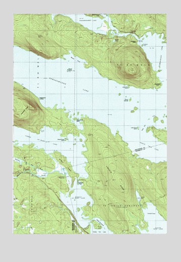
Pemadumcook Lake, ME USGS Topographic Map
Click on map above to begin viewing in our Map Viewer.

This topographic map contains these locations and features:
Feature Name Type Latitude Longitude GNIS ID View Map
Ambajejus CampsLocaleN45.7345°W68.8975°561223View Map
Ambajejus FallsFallsN45.7364°W68.8989°561224View Map
Ambajejus PointCapeN45.7103°W68.8800°561226View Map
Buckhorn CampsLocaleN45.6548°W68.9473°563114View Map
Buckhorn Camps Seaplane BaseAirportN45.6542°W68.9489°582192View Map
Cooper BrookStreamN45.6581°W68.9573°564342View Map
Cooper Brook DeadwaterSwampN45.6628°W68.9634°564345View Map
Jo-mary IslandIslandN45.6639°W68.9567°568853View Map
Jo-Mary LakeLakeN45.6761°W68.9704°568855View Map
Lincoln CoveBayN45.6364°W68.8867°569602View Map
Lincoln PondLakeN45.6462°W68.8983°569605View Map
Lincoln RidgeRidgeN45.6550°W68.9120°569606View Map
Little Porus IslandIslandN45.6853°W68.8975°569986View Map
Lone Pine PointCapeN45.7081°W68.9050°570170View Map
Lower Jo-Mary StreamStreamN45.6850°W68.9445°570511View Map
Middle Jo-Mary LakeLakeN45.6437°W68.9478°571250View Map
Moose CoveBayN45.7248°W68.9495°571590View Map
Moose IslandIslandN45.7187°W68.9553°571600View Map
Moose PondLakeN45.7346°W68.9179°571619View Map
Mud BrookStreamN45.6595°W68.9717°571844View Map
Nicks GutChannelN45.6842°W68.8925°572167View Map
Passamagamet FallsFallsN45.7492°W68.9259°573044View Map
Passamagamet LakeLakeN45.7460°W68.9423°573045View Map
Pemadumcook LakeLakeN45.7018°W68.9299°573138View Map
Porus IslandsIslandN45.7012°W68.9037°573699View Map
Stephensons LandingPopulated PlaceN45.7009°W68.9787°579740View Map
Sweet Potato IslandIslandN45.6784°W68.9445°576605View Map
T1 R9 WELSCivilN45.7191°W68.8877°2748714View Map
T4 Indian Purchase TownshipCivilN45.6341°W68.8796°1987353View Map
Telephone TrailTrailN45.7298°W68.9525°576703View Map
The Boom HouseLocaleN45.7317°W68.8939°576766View Map
Turkey Tail IslandsIslandN45.6298°W68.9325°577412View Map
Turkey Tail LakeLakeN45.6254°W68.9269°577413View Map
Twin LakesReservoirN45.6758°W68.8810°1773888View Map
White Horse IslandIslandN45.6903°W68.9492°578353View Map

Note: Coordinates in the location and feature list above are referenced to NAD83 datum.


Copyright (C) 2008-2024 Ryan Niemi / Sunset Dynamics ... All Rights Reserved