TopoQuest Logo
Do you find TopoQuest useful?
Help keep TopoQuest running and adding new maps/features by donating!
Bitcoin:  19c7KJd3qBynnjoSw5npx9KScwjBe4ifkT
Litecoin:  LXs6TkuXGGXo1vDsWCkWVdjQX94eUKd6ui
Home View Maps Find Maps Find Places Resources & Links


Peola, Washington Topographic Map

USGS Map Title: Peola, WA
USGS Map MRC: 46117C4
DRG (GeoTIFF) Download: o46117c4.tif


Neighboring USGS Topographic Map Quads:


  Pomeroy, WA  
46117D5
 

  Alpowa Ridge, WA  
46117D4
 

  Stember Creek, WA  
46117D3
 

  Rose Springs, WA  
46117C5
 

  Peola, WA  
46117C4
 

  Potter Hill, WA  
46117C3
 

  Stentz Spring, WA  
46117B5
 

  Pinkham Butte, WA  
46117B4
 

  Harlow Ridge, WA  
46117B3


Map MRC Location:

N47°
W118°
N47°
W117°
H8 H7 H6 H5 H4 H3 H2 H1
G8 G7 G6 G5 G4 G3 G2 G1
F8 F7 F6 F5 F4 F3 F2 F1
E8 E7 E6 E5 E4 E3 E2 E1
D8 D7 D6 D5 D4 D3 D2 D1
C8 C7 C6 C5 C4 C3 C2 C1
B8 B7 B6 B5 B4 B3 B2 B1
A8 A7 A6 A5 A4 A3 A2 A1
N46°
W118°
N46°
W117°

Peola, WA USGS 1:24K Topographic Map Preview:
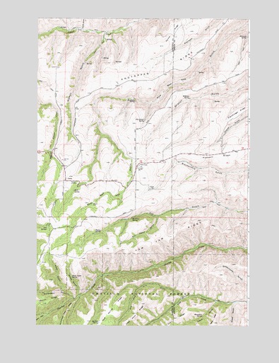
Peola, WA USGS Topographic Map
Click on map above to begin viewing in our Map Viewer.

This topographic map contains these locations and features:
Feature Name Type Latitude Longitude GNIS ID View Map
Alder SpringSpringN46.2779°W117.4927°1533297View Map
Bagley SpringSpringN46.2877°W117.4656°1503115View Map
Big Mud SpringSpringN46.2513°W117.4631°1503354View Map
Bill Welch GulchValleyN46.2940°W117.4282°1503372View Map
Cabin GulchValleyN46.2596°W117.3941°1503697View Map
Cape Horn RidgeRidgeN46.2590°W117.4380°1503799View Map
Cottonwood SpringSpringN46.2668°W117.3777°1514016View Map
Donaldson CreekStreamN46.2607°W117.4777°1504506View Map
Donaldson GulchValleyN46.2615°W117.4782°1504507View Map
Dry Fork Lick CreekStreamN46.2615°W117.4127°1504564View Map
Flerchinger SpringSpringN46.3335°W117.4360°1504930View Map
Hatten WellWellN46.2996°W117.4668°1505421View Map
Iron SpringsSpringN46.2900°W117.4936°1505751View Map
Iron Springs Guard StationLocaleN46.2918°W117.4891°1511469View Map
Kidwell GulchValleyN46.3668°W117.4596°1505971View Map
Knotgrass RidgeRidgeN46.3524°W117.4249°1506017View Map
McGilvra SpringSpringN46.2941°W117.4437°1506566View Map
Moonshine SpringSpringN46.2538°W117.4020°1506777View Map
Pataha Research Natural AreaLocaleN46.2874°W117.4982°1533298View Map
PeolaPopulated PlaceN46.3090°W117.4830°1511222View Map
Pioneer CemeteryCemeteryN46.3085°W117.4767°1507460View Map
Robinson SpringSpringN46.3677°W117.3766°1507837View Map
Sheep GulchValleyN46.2629°W117.4752°1531509View Map
Sheep GulchValleyN46.2590°W117.3832°1531510View Map
Sheep Gulch SpringSpringN46.2699°W117.4796°1508275View Map
Sourdough RidgeRidgeN46.2521°W117.3782°1513209View Map
Spring GulchValleyN46.3702°W117.4727°1508640View Map
Weatherly SpringSpringN46.3410°W117.4457°1509343View Map
Williams SpringSpringN46.3424°W117.4099°1509537View Map
Wolf SpringSpringN46.3049°W117.4780°1509605View Map

Note: Coordinates in the location and feature list above are referenced to NAD83 datum.


Copyright (C) 2008-2024 Ryan Niemi / Sunset Dynamics ... All Rights Reserved