TopoQuest Logo
Do you find TopoQuest useful?
Help keep TopoQuest running and adding new maps/features by donating!
Bitcoin:  19c7KJd3qBynnjoSw5npx9KScwjBe4ifkT
Litecoin:  LXs6TkuXGGXo1vDsWCkWVdjQX94eUKd6ui
Home View Maps Find Maps Find Places Resources & Links


Pinkham Butte, Washington Topographic Map

USGS Map Title: Pinkham Butte, WA
USGS Map MRC: 46117B4
DRG (GeoTIFF) Download: o46117b4.tif


Neighboring USGS Topographic Map Quads:


  Rose Springs, WA  
46117C5
 

  Peola, WA  
46117C4
 

  Potter Hill, WA  
46117C3
 

  Stentz Spring, WA  
46117B5
 

  Pinkham Butte, WA  
46117B4
 

  Harlow Ridge, WA  
46117B3
 

  Diamond Peak, WA  
46117A5
 

  Saddle Butte, WA  
46117A4
 

  Mountain View, WA  
46117A3


Map MRC Location:

N47°
W118°
N47°
W117°
H8 H7 H6 H5 H4 H3 H2 H1
G8 G7 G6 G5 G4 G3 G2 G1
F8 F7 F6 F5 F4 F3 F2 F1
E8 E7 E6 E5 E4 E3 E2 E1
D8 D7 D6 D5 D4 D3 D2 D1
C8 C7 C6 C5 C4 C3 C2 C1
B8 B7 B6 B5 B4 B3 B2 B1
A8 A7 A6 A5 A4 A3 A2 A1
N46°
W118°
N46°
W117°

Pinkham Butte, WA USGS 1:24K Topographic Map Preview:
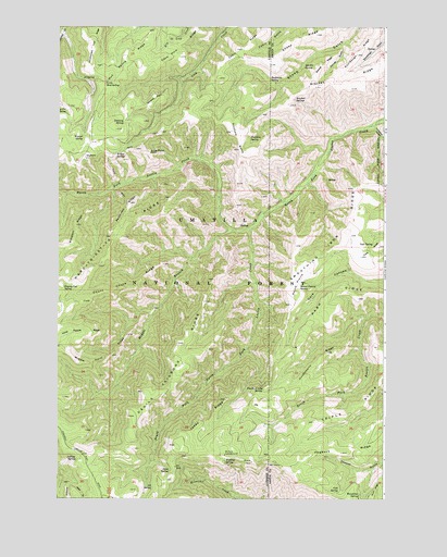
Pinkham Butte, WA USGS Topographic Map
Click on map above to begin viewing in our Map Viewer.

This topographic map contains these locations and features:
Feature Name Type Latitude Longitude GNIS ID View Map
Al SpringSpringN46.2360°W117.4865°1502956View Map
Big Fir SpringSpringN46.2278°W117.4969°1503344View Map
Bracken SpringsSpringN46.2308°W117.4105°1503525View Map
Buckhorn SpringSpringN46.2357°W117.4196°1503612View Map
Cabin RidgeRidgeN46.2440°W117.4313°1503699View Map
Cold SpringSpringN46.1269°W117.3931°1504062View Map
Cook SpringSpringN46.1925°W117.3801°1504117View Map
Count Chute RidgeRidgeN46.1871°W117.4596°1504199View Map
Devils Tailbone RidgeRidgeN46.1663°W117.4538°1504465View Map
Elk PointSummitN46.2154°W117.4899°1512185View Map
Fourth of July SpringSpringN46.1539°W117.4218°1505010View Map
Frying Pan SpringSpringN46.1805°W117.4984°1505063View Map
Getaway PointCapeN46.2307°W117.4630°1505117View Map
Getaway SpringSpringN46.2246°W117.4755°1505118View Map
Government Trail RidgeRidgeN46.2440°W117.4868°1511510View Map
Grouse GulchValleyN46.2449°W117.3916°1505312View Map
Grouse RidgeRidgeN46.2399°W117.3988°1505314View Map
Hard-to-get-to RidgeRidgeN46.1943°W117.4752°1505387View Map
Horak RanchLocaleN46.2002°W117.3868°1514007View Map
Horse Pasture RidgeRidgeN46.1690°W117.4905°1505611View Map
Horsethief CanyonValleyN46.2232°W117.3793°1505630View Map
Huckleberry RidgeRidgeN46.1638°W117.3974°1505646View Map
Jeffreys SpringSpringN46.1348°W117.4930°1505800View Map
Jones RidgeRidgeN46.1510°W117.4357°1505864View Map
Jump Off Joe PointCliffN46.2168°W117.4655°1505880View Map
Little Mud SpringSpringN46.2352°W117.4821°1506213View Map
Middle Branch North Fork Asotin CreekStreamN46.1960°W117.4327°1513165View Map
Middle Point RidgeRidgeN46.1629°W117.4796°1506666View Map
Mud Spring RidgeRidgeN46.2404°W117.4705°1513172View Map
North Fork Asotin Creek TrailTrailN46.1982°W117.4257°1510004View Map
Patterson RidgeRidgeN46.2029°W117.4727°1507329View Map
Pinkham ButteSummitN46.2224°W117.4335°1512564View Map
Pinkham RidgeRidgeN46.2177°W117.4705°1514006View Map
Pinkham SpringSpringN46.2209°W117.4277°1507451View Map
Red Fir SpringSpringN46.2396°W117.4068°1507753View Map
Round PrairieFlatN46.1846°W117.4055°1507937View Map
Round Prairie SpringSpringN46.1814°W117.4082°1507938View Map
Sheep RidgeRidgeN46.2479°W117.4013°1508278View Map
Simpson RidgeRidgeN46.1974°W117.4932°1508361View Map
Snow SpringSpringN46.1325°W117.4573°1508480View Map
South Fork North Fork Asotin CreekStreamN46.1965°W117.4266°1511557View Map
Three C SpringSpringN46.1280°W117.4638°1509008View Map
Triple RidgeRidgeN46.1493°W117.3863°1509083View Map
Warner SpringSpringN46.2207°W117.4906°1509293View Map
Wenatchee SpringSpringN46.1261°W117.3850°1509375View Map
WickiupLocaleN46.1368°W117.4385°1512890View Map
Wickiup CampgroundLocaleN46.1363°W117.4377°1509496View Map
Wickiup SpringSpringN46.1355°W117.4364°1509497View Map
Willow SpringsSpringN46.2152°W117.4782°1511571View Map

Note: Coordinates in the location and feature list above are referenced to NAD83 datum.


Copyright (C) 2008-2024 Ryan Niemi / Sunset Dynamics ... All Rights Reserved