TopoQuest Logo
Do you find TopoQuest useful?
Help keep TopoQuest running and adding new maps/features by donating!
Bitcoin:  19c7KJd3qBynnjoSw5npx9KScwjBe4ifkT
Litecoin:  LXs6TkuXGGXo1vDsWCkWVdjQX94eUKd6ui
Home View Maps Find Maps Find Places Resources & Links


Pepper Canyon, Arizona Topographic Map

USGS Map Title: Pepper Canyon, AZ
USGS Map MRC: 34110B5
DRG (GeoTIFF) Download: o34110b5.tif


Neighboring USGS Topographic Map Quads:


  Brookbank Point, AZ  
34110C6
 

  Outlaw Draw, AZ  
34110C5
 

  Day Spring, AZ  
34110C4
 

  Chediski Peak, AZ  
34110B6
 

  Pepper Canyon, AZ  
34110B5
 

  Bear Ridge, AZ  
34110B4
 

  Oak Creek Ranch, AZ  
34110A6
 

  Spotted Mountain, AZ  
34110A5
 

  Cibecue, AZ  
34110A4


Map MRC Location:

N35°
W111°
N35°
W110°
H8 H7 H6 H5 H4 H3 H2 H1
G8 G7 G6 G5 G4 G3 G2 G1
F8 F7 F6 F5 F4 F3 F2 F1
E8 E7 E6 E5 E4 E3 E2 E1
D8 D7 D6 D5 D4 D3 D2 D1
C8 C7 C6 C5 C4 C3 C2 C1
B8 B7 B6 B5 B4 B3 B2 B1
A8 A7 A6 A5 A4 A3 A2 A1
N34°
W111°
N34°
W110°

Pepper Canyon, AZ USGS 1:24K Topographic Map Preview:
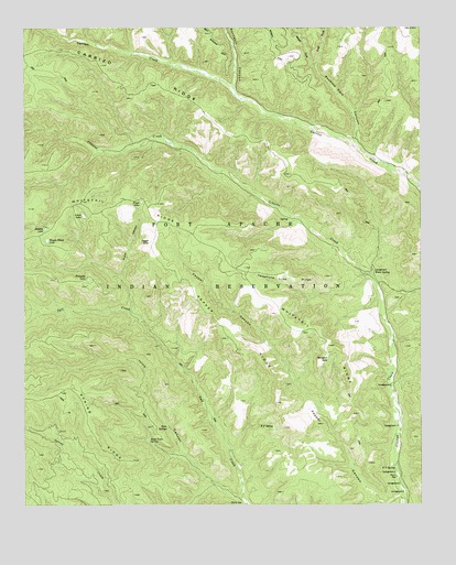
Pepper Canyon, AZ USGS Topographic Map
Click on map above to begin viewing in our Map Viewer.

This topographic map contains these locations and features:
Feature Name Type Latitude Longitude GNIS ID View Map
Buckskin CanyonValleyN34.2350°W110.5596°26933View Map
C T SpringSpringN34.1346°W110.5083°2328View Map
Carrizo RidgeRidgeN34.2392°W110.5932°27305View Map
Donkey LakeLakeN34.1972°W110.6192°4026View Map
East Fork Phoenix Park CanyonValleyN34.2406°W110.5332°28762View Map
Ivins CanyonValleyN34.1250°W110.5551°6297View Map
K P SpringSpringN34.1457°W110.5515°6569View Map
Louse LakeLakeN34.2009°W110.6069°7431View Map
Pepper CanyonValleyN34.1270°W110.5071°9322View Map
Pepper LakeLakeN34.1941°W110.5859°9323View Map
Pepper RidgeRidgeN34.1698°W110.5585°9324View Map
Phoenix Park CanyonValleyN34.2209°W110.5212°9381View Map
Pryce CanyonValleyN34.1839°W110.5948°9797View Map
Pryce LakeLakeN34.2045°W110.5886°9798View Map
Pumpkin LakeLakeN34.1841°W110.6055°9813View Map
Rock Point SpringSpringN34.1420°W110.5865°10417View Map
Telephone Line RidgeRidgeN34.1842°W110.5410°12230View Map
Twin SpringsSpringN34.1456°W110.5800°12960View Map
Wagon Wheel LakeLakeN34.1944°W110.6184°13272View Map
West Fork Phoenix Park CanyonValleyN34.2403°W110.5340°35992View Map
White SpringSpringN34.1859°W110.5161°13669View Map
Whitetail LakeLakeN34.1633°W110.5296°13709View Map
Whitetail RidgeRidgeN34.1948°W110.5718°13711View Map

Note: Coordinates in the location and feature list above are referenced to NAD83 datum.


Copyright (C) 2008-2024 Ryan Niemi / Sunset Dynamics ... All Rights Reserved