TopoQuest Logo
Do you find TopoQuest useful?
Help keep TopoQuest running and adding new maps/features by donating!
Bitcoin:  19c7KJd3qBynnjoSw5npx9KScwjBe4ifkT
Litecoin:  LXs6TkuXGGXo1vDsWCkWVdjQX94eUKd6ui
Home View Maps Find Maps Find Places Resources & Links


Perent Lake, Minnesota Topographic Map

USGS Map Title: Perent Lake, MN
USGS Map MRC: 47091G2
DRG (GeoTIFF) Download: o47091g2.tif


Neighboring USGS Topographic Map Quads:


  Lake Insula, MN  
47091H3
 

  Alice Lake, MN  
47091H2
 

  Lake Polly, MN  
47091H1
 

  Isabella Lake, MN  
47091G3
 

  Perent Lake, MN  
47091G2
 

  Kawishiwi Lake, MN  
47091G1
 

  Sawbill Landing, MN  
47091F3
 

  Silver Island Lake, MN  
47091F2
 

  Wilson Lake, MN  
47091F1


Map MRC Location:

N48°
W92°
N48°
W91°
H8 H7 H6 H5 H4 H3 H2 H1
G8 G7 G6 G5 G4 G3 G2 G1
F8 F7 F6 F5 F4 F3 F2 F1
E8 E7 E6 E5 E4 E3 E2 E1
D8 D7 D6 D5 D4 D3 D2 D1
C8 C7 C6 C5 C4 C3 C2 C1
B8 B7 B6 B5 B4 B3 B2 B1
A8 A7 A6 A5 A4 A3 A2 A1
N47°
W92°
N47°
W91°

Perent Lake, MN USGS 1:24K Topographic Map Preview:
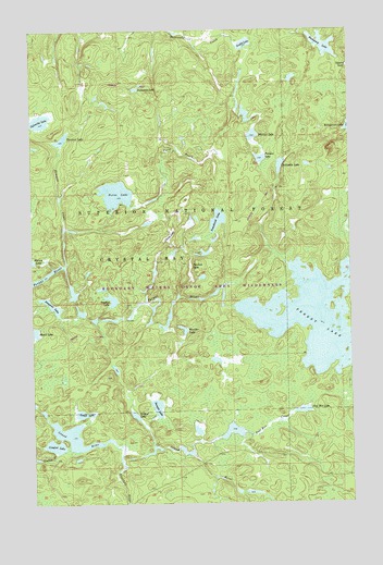
Perent Lake, MN USGS Topographic Map
Click on map above to begin viewing in our Map Viewer.

This topographic map contains these locations and features:
Feature Name Type Latitude Longitude GNIS ID View Map
Albino LakeLakeN47.8210°W91.1957°655096View Map
Andek LakeLakeN47.8713°W91.1655°655131View Map
Baskatong LakeLakeN47.8709°W91.1344°655238View Map
Calamity LakeLakeN47.8512°W91.2462°655591View Map
Chickadee LakeLakeN47.8391°W91.1521°655708View Map
Comfort CreekStreamN47.7638°W91.2412°655779View Map
Comfort LakeLakeN47.7654°W91.2419°655780View Map
Dumbbell RiverStreamN47.7621°W91.2160°656063View Map
Ferne CreekStreamN47.8227°W91.2371°656220View Map
Ferne LakeLakeN47.8318°W91.2166°656221View Map
Fool Hen CreekStreamN47.7638°W91.1882°656284View Map
Fool Hen LakeLakeN47.7744°W91.1439°656285View Map
Fungus LakeLakeN47.8410°W91.1600°656341View Map
Nuthatch LakeLakeN47.8595°W91.2083°657640View Map
Orchid LakeLakeN47.7733°W91.2102°657682View Map
Peerless LakeLakeN47.8097°W91.1877°657763View Map
Perent LakeLakeN47.7983°W91.1377°657779View Map
Placid LakeLakeN47.7956°W91.2495°657866View Map
Pompous LakeLakeN47.8024°W91.2422°657890View Map
Powwow CreekStreamN47.8132°W91.2368°657933View Map
Powwow LakeLakeN47.8462°W91.2377°657934View Map
Small LakeLakeN47.7738°W91.2305°658308View Map
Snusbox LakeLakeN47.8038°W91.2189°658339View Map
Sumpet LakeLakeN47.7754°W91.2013°658538View Map
Tomahawk LakeLakeN47.8248°W91.1768°658709View Map
Warbler LakeLakeN47.7965°W91.1916°658897View Map
Whittler LakeLakeN47.8471°W91.1628°658996View Map

Note: Coordinates in the location and feature list above are referenced to NAD83 datum.


Copyright (C) 2008-2025 Ryan Niemi / Sunset Dynamics ... All Rights Reserved