TopoQuest Logo
Do you find TopoQuest useful?
Help keep TopoQuest running and adding new maps/features by donating!
Bitcoin:  19c7KJd3qBynnjoSw5npx9KScwjBe4ifkT
Litecoin:  LXs6TkuXGGXo1vDsWCkWVdjQX94eUKd6ui
Home View Maps Find Maps Find Places Resources & Links


Isabella Lake, Minnesota Topographic Map

USGS Map Title: Isabella Lake, MN
USGS Map MRC: 47091G3
DRG (GeoTIFF) Download: o47091g3.tif


Neighboring USGS Topographic Map Quads:


  Snowbank Lake, MN  
47091H4
 

  Lake Insula, MN  
47091H3
 

  Alice Lake, MN  
47091H2
 

  Quadga Lake, MN  
47091G4
 

  Isabella Lake, MN  
47091G3
 

  Perent Lake, MN  
47091G2
 

  Mitawan Lake, MN  
47091F4
 

  Sawbill Landing, MN  
47091F3
 

  Silver Island Lake, MN  
47091F2


Map MRC Location:

N48°
W92°
N48°
W91°
H8 H7 H6 H5 H4 H3 H2 H1
G8 G7 G6 G5 G4 G3 G2 G1
F8 F7 F6 F5 F4 F3 F2 F1
E8 E7 E6 E5 E4 E3 E2 E1
D8 D7 D6 D5 D4 D3 D2 D1
C8 C7 C6 C5 C4 C3 C2 C1
B8 B7 B6 B5 B4 B3 B2 B1
A8 A7 A6 A5 A4 A3 A2 A1
N47°
W92°
N47°
W91°

Isabella Lake, MN USGS 1:24K Topographic Map Preview:
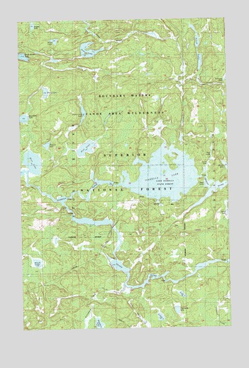
Isabella Lake, MN USGS Topographic Map
Click on map above to begin viewing in our Map Viewer.

This topographic map contains these locations and features:
Feature Name Type Latitude Longitude GNIS ID View Map
Arrow CreekStreamN47.8538°W91.2660°659268View Map
Arrow LakeLakeN47.8574°W91.2658°655157View Map
Arrow Lookout TowerTowerN47.8491°W91.3101°659775View Map
Arrowhead CreekStreamN47.7671°W91.3137°655158View Map
Azure LakeLakeN47.8157°W91.2626°659270View Map
Boga LakeLakeN47.8062°W91.2582°659267View Map
Briddle LakeLakeN47.8735°W91.3665°655515View Map
Brush LakeLakeN47.7770°W91.3658°655532View Map
Fallen Arch LakeLakeN47.8372°W91.3368°656195View Map
Flapper LakeLakeN47.8246°W91.3589°656263View Map
Forest CenterPopulated PlaceN47.7949°W91.3076°656294View Map
Forest Center Post Office (historical)Post OfficeN47.7950°W91.3075°2093270View Map
Harica LakeLakeN47.8152°W91.2514°656523View Map
Hump LakeLakeN47.8460°W91.3593°656678View Map
Hush LakeLakeN47.8669°W91.3534°656686View Map
Isabella LakeLakeN47.8112°W91.2891°656723View Map
Isabella Lake State ForestForestN47.8096°W91.2862°1814946View Map
Island RiverStreamN47.8013°W91.3499°656739View Map
Jack CreekStreamN47.7657°W91.3090°656746View Map
Lois LakeLakeN47.7634°W91.2790°657169View Map
Lynch LakeLakeN47.7542°W91.2924°657271View Map
Marathon LakeLakeN47.8356°W91.3729°657312View Map
Nine A M LakeLakeN47.7571°W91.2823°657600View Map
Pelt LakeLakeN47.8231°W91.3355°657768View Map
Perent RiverStreamN47.8096°W91.2682°657780View Map
Pose LakeLakeN47.8612°W91.3305°657919View Map
Powwoun TrailTrailN47.8221°W91.3215°659131View Map
Rap LakeReservoirN47.8177°W91.2612°659269View Map
Rice LakeLakeN47.8163°W91.3699°658039View Map
Sapphire LakeLakeN47.7518°W91.3296°658162View Map

Note: Coordinates in the location and feature list above are referenced to NAD83 datum.


Copyright (C) 2008-2025 Ryan Niemi / Sunset Dynamics ... All Rights Reserved