TopoQuest Logo
Do you find TopoQuest useful?
Help keep TopoQuest running and adding new maps/features by donating!
Bitcoin:  19c7KJd3qBynnjoSw5npx9KScwjBe4ifkT
Litecoin:  LXs6TkuXGGXo1vDsWCkWVdjQX94eUKd6ui
Home View Maps Find Maps Find Places Resources & Links


Sawbill Landing, Minnesota Topographic Map

USGS Map Title: Sawbill Landing, MN
USGS Map MRC: 47091F3
DRG (GeoTIFF) Download: o47091f3.tif


Neighboring USGS Topographic Map Quads:


  Quadga Lake, MN  
47091G4
 

  Isabella Lake, MN  
47091G3
 

  Perent Lake, MN  
47091G2
 

  Mitawan Lake, MN  
47091F4
 

  Sawbill Landing, MN  
47091F3
 

  Silver Island Lake, MN  
47091F2
 

  Isabella Station, MN  
47091E4
 

  Isabella, MN  
47091E3
 

  Cabin Lake, MN  
47091E2


Map MRC Location:

N48°
W92°
N48°
W91°
H8 H7 H6 H5 H4 H3 H2 H1
G8 G7 G6 G5 G4 G3 G2 G1
F8 F7 F6 F5 F4 F3 F2 F1
E8 E7 E6 E5 E4 E3 E2 E1
D8 D7 D6 D5 D4 D3 D2 D1
C8 C7 C6 C5 C4 C3 C2 C1
B8 B7 B6 B5 B4 B3 B2 B1
A8 A7 A6 A5 A4 A3 A2 A1
N47°
W92°
N47°
W91°

Sawbill Landing, MN USGS 1:24K Topographic Map Preview:
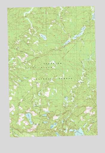
Sawbill Landing, MN USGS Topographic Map
Click on map above to begin viewing in our Map Viewer.

This topographic map contains these locations and features:
Feature Name Type Latitude Longitude GNIS ID View Map
Bine LakeLakeN47.6386°W91.3240°655391View Map
Bunny LakeLakeN47.7284°W91.2667°655565View Map
Byron LakeLakeN47.6385°W91.3000°655585View Map
Camp CreekStreamN47.7299°W91.3410°655608View Map
Doghouse LakeLakeN47.6792°W91.3598°659736View Map
Eighteen LakeLakeN47.6433°W91.3469°656128View Map
Ellen LakeLakeN47.6369°W91.3396°656147View Map
Finn PondLakeN47.6657°W91.3322°656237View Map
Frank LakeLakeN47.6614°W91.2935°656321View Map
Fred LakeLakeN47.6814°W91.3520°1814948View Map
Helen LakeLakeN47.7212°W91.3242°656568View Map
Jack LakeLakeN47.7156°W91.2901°656751View Map
Kelly LandingPopulated PlaceN47.6766°W91.3360°656871View Map
Long Lake CampLocaleN47.7249°W91.2571°657198View Map
Long Lake SchoolSchoolN47.7202°W91.2665°657200View Map
Martin LandingPopulated PlaceN47.7449°W91.3038°657332View Map
Odeima LakeLakeN47.6425°W91.3202°657656View Map
Redskin LakeLakeN47.6349°W91.3134°658008View Map
Sawbill LandingPopulated PlaceN47.7152°W91.2679°658170View Map
Sawbill Landing Post Office (historical)Post OfficeN47.7153°W91.2678°2093262View Map
Shoofly LakeLakeN47.6308°W91.2945°659136View Map
Spear LakeLakeN47.6489°W91.3212°658383View Map
Sylvania LakeLakeN47.7217°W91.2750°658586View Map
Tomlinson CreekStreamN47.6816°W91.2690°658611View Map
Tomlinson LakeLakeN47.6755°W91.2731°658712View Map
Trappers CreekStreamN47.6630°W91.3388°659744View Map
Trappers LakeLakeN47.6455°W91.3250°658737View Map
Weapon LakeLakeN47.6553°W91.3389°658914View Map
West Camp CreekStreamN47.7177°W91.3590°659174View Map
Wheeler LandingPopulated PlaceN47.7257°W91.2901°658970View Map

Note: Coordinates in the location and feature list above are referenced to NAD83 datum.


Copyright (C) 2008-2025 Ryan Niemi / Sunset Dynamics ... All Rights Reserved