TopoQuest Logo
Do you find TopoQuest useful?
Help keep TopoQuest running and adding new maps/features by donating!
Bitcoin:  19c7KJd3qBynnjoSw5npx9KScwjBe4ifkT
Litecoin:  LXs6TkuXGGXo1vDsWCkWVdjQX94eUKd6ui
Home View Maps Find Maps Find Places Resources & Links


Lathrop, Missouri Topographic Map

USGS Map Title: Lathrop, MO
USGS Map MRC: 39094E3
DRG (GeoTIFF) Download: o39094e3.tif


Neighboring USGS Topographic Map Quads:


  Perrin, MO  
39094F4
 

  Cameron West, MO  
39094F3
 

  Cameron East, MO  
39094F2
 

  Plattsburg, MO  
39094E4
 

  Lathrop, MO  
39094E3
 

  Elmira, MO  
39094E2
 

  Arley, MO  
39094D4
 

  Holt, MO  
39094D3
 

  Lawson, MO  
39094D2


Map MRC Location:

N40°
W95°
N40°
W94°
H8 H7 H6 H5 H4 H3 H2 H1
G8 G7 G6 G5 G4 G3 G2 G1
F8 F7 F6 F5 F4 F3 F2 F1
E8 E7 E6 E5 E4 E3 E2 E1
D8 D7 D6 D5 D4 D3 D2 D1
C8 C7 C6 C5 C4 C3 C2 C1
B8 B7 B6 B5 B4 B3 B2 B1
A8 A7 A6 A5 A4 A3 A2 A1
N39°
W95°
N39°
W94°

Lathrop, MO USGS 1:24K Topographic Map Preview:
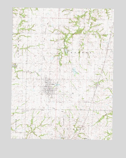
Lathrop, MO USGS Topographic Map
Click on map above to begin viewing in our Map Viewer.

This topographic map contains these locations and features:
Feature Name Type Latitude Longitude GNIS ID View Map
Bethel CemeteryCemeteryN39.5494°W94.2513°741994View Map
City of LathropCivilN39.5515°W94.3286°2395639View Map
Crouch Lake East DamDamN39.5767°W94.3169°762610View Map
Crouch Lake West DamDamN39.5783°W94.3252°762609View Map
Dale School (historical)SchoolN39.5072°W94.2649°716646View Map
GuytonPopulated PlaceN39.5144°W94.3238°740893View Map
Lake LenoreLakeN39.5833°W94.3086°758368View Map
Lake McGinnessReservoirN39.5648°W94.2974°758367View Map
LathropPopulated PlaceN39.5483°W94.3299°720826View Map
Lathrop CemeteryCemeteryN39.5475°W94.3206°2681455View Map
Lathrop Elementary SchoolSchoolN39.5422°W94.3302°2545445View Map
Lathrop Family Practice HeliportAirportN39.5561°W94.3322°758778View Map
Lathrop Fire and RescueBuildingN39.5562°W94.3318°2620761View Map
Lathrop High SchoolSchoolN39.5607°W94.3303°2545178View Map
Lathrop LakeReservoirN39.5841°W94.3088°760674View Map
Lathrop Lake and Forest Club DamDamN39.5867°W94.3102°760673View Map
Lathrop Middle SchoolSchoolN39.5448°W94.3296°2545275View Map
Lathrop Police DepartmentBuildingN39.5548°W94.3319°2752170View Map
Lathrop Post OfficePost OfficeN39.5485°W94.3295°2783101View Map
McGinness Lake DamDamN39.5683°W94.3002°760383View Map
Pleasant Grove School (historical)SchoolN39.5936°W94.2916°724506View Map
Prairie Dell School (historical)SchoolN39.5944°W94.3366°758442View Map
Prairie Hill School (historical)SchoolN39.5175°W94.3036°724857View Map
Township of LathropCivilN39.5861°W94.2819°766517View Map

Note: Coordinates in the location and feature list above are referenced to NAD83 datum.


Copyright (C) 2008-2024 Ryan Niemi / Sunset Dynamics ... All Rights Reserved