TopoQuest Logo
Do you find TopoQuest useful?
Help keep TopoQuest running and adding new maps/features by donating!
Bitcoin:  19c7KJd3qBynnjoSw5npx9KScwjBe4ifkT
Litecoin:  LXs6TkuXGGXo1vDsWCkWVdjQX94eUKd6ui
Home View Maps Find Maps Find Places Resources & Links


Berryville, Illinois Topographic Map

USGS Map Title: Berryville, IL
USGS Map MRC: 38087E8
DRG (GeoTIFF) Download: o38087e8.tif


Neighboring USGS Topographic Map Quads:


  Olney, IL  
38088F1
 

  Claremont, IL  
38087F8
 

  Sumner, IL  
38087F7
 

  West Salem, IL  
38088E1
 

  Berryville, IL  
38087E8
 

  Lancaster, IL  
38087E7
 

  Albion North, IL  
38088D1
 

  Bone Gap, IL  
38087D8
 

  Mount Carmel, IL  
38087D7


Map MRC Location:

N39°
W88°
N39°
W87°
H8 H7 H6 H5 H4 H3 H2 H1
G8 G7 G6 G5 G4 G3 G2 G1
F8 F7 F6 F5 F4 F3 F2 F1
E8 E7 E6 E5 E4 E3 E2 E1
D8 D7 D6 D5 D4 D3 D2 D1
C8 C7 C6 C5 C4 C3 C2 C1
B8 B7 B6 B5 B4 B3 B2 B1
A8 A7 A6 A5 A4 A3 A2 A1
N38°
W88°
N38°
W87°

Berryville, IL USGS 1:24K Topographic Map Preview:
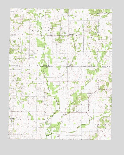
Berryville, IL USGS Topographic Map
Click on map above to begin viewing in our Map Viewer.

This topographic map contains these locations and features:
Feature Name Type Latitude Longitude GNIS ID View Map
Bell CemeteryCemeteryN38.6109°W87.8784°404117View Map
BerryvillePopulated PlaceN38.5995°W87.9286°404229View Map
Big BranchStreamN38.5412°W87.9434°404380View Map
Buck RunStreamN38.5964°W87.9570°405104View Map
Burton School (historical)SchoolN38.5587°W87.9295°1725669View Map
Claremont - Bonpas Fire Protection District Station 2BuildingN38.5997°W87.9326°2682525View Map
Crooked CreekStreamN38.5092°W87.9523°406808View Map
Cunningham CemeteryCemeteryN38.5439°W87.8989°406896View Map
Gates School (historical)SchoolN38.5406°W87.9664°1725214View Map
Higgins CreekStreamN38.6081°W87.9628°410207View Map
Jordan CreekStreamN38.5084°W87.9403°411243View Map
Jordan Creek CemeteryCemeteryN38.5287°W87.8811°411248View Map
Lancaster Election PrecinctCivilN38.5391°W87.8919°1928554View Map
Little Bonpas CreekStreamN38.5056°W87.9475°412290View Map
Long Prairie School (historical)SchoolN38.5403°W87.8917°1725672View Map
Mills Prairie (historical)Populated PlaceN38.5042°W87.9709°1808162View Map
Mills Prairie School (historical)SchoolN38.5039°W87.9711°1725216View Map
Mundy School (historical)SchoolN38.5153°W87.9111°1725675View Map
Paul CemeteryCemeteryN38.5637°W87.9325°415458View Map
Pinhook CemeteryCemeteryN38.5098°W87.9642°415713View Map
Pleasant Grove ChurchChurchN38.5148°W87.9111°415788View Map
Redhead School (historical)SchoolN38.5992°W87.9759°1736827View Map
Ridgely CemeteryCemeteryN38.5748°W87.9970°416649View Map
Salem Number 1 Election PrecinctCivilN38.5254°W87.9781°1928639View Map
Shiloh Number 1 CemeteryCemeteryN38.6145°W87.9470°418399View Map
Simmons CreekStreamN38.5764°W87.9603°418521View Map
Smith CemeteryCemeteryN38.5823°W87.9714°418520View Map
Township of BonpasCivilN38.6143°W87.9669°422235View Map
Victory School (historical)SchoolN38.5820°W87.9295°1736844View Map
Walnut Grove CemeteryCemeteryN38.5995°W87.9992°1820914View Map
Walnut Grove ChurchChurchN38.5995°W87.9995°420458View Map
Welser CemeteryCemeteryN38.5531°W87.9595°420742View Map
Whites School (historical)SchoolN38.5695°W87.9811°1725217View Map
Wright CemeteryCemeteryN38.6034°W87.9067°421519View Map

Note: Coordinates in the location and feature list above are referenced to NAD83 datum.


Copyright (C) 2008-2025 Ryan Niemi / Sunset Dynamics ... All Rights Reserved