TopoQuest Logo
Do you find TopoQuest useful?
Help keep TopoQuest running and adding new maps/features by donating!
Bitcoin:  19c7KJd3qBynnjoSw5npx9KScwjBe4ifkT
Litecoin:  LXs6TkuXGGXo1vDsWCkWVdjQX94eUKd6ui
Home View Maps Find Maps Find Places Resources & Links


Pfeiffer Point, California Topographic Map

USGS Map Title: Pfeiffer Point, CA
USGS Map MRC: 36121B7
DRG (GeoTIFF) Download: o36121b7.tif


Neighboring USGS Topographic Map Quads:


  Point Sur, CA  
36121C8
 

  Big Sur, CA  
36121C7
 

  Ventana Cones, CA  
36121C6


  Pfeiffer Point, CA  
36121B7
 

  Partington Ridge, CA  
36121B6


Map MRC Location:

N37°
W122°
N37°
W121°
H8 H7 H6 H5 H4 H3 H2 H1
G8 G7 G6 G5 G4 G3 G2 G1
F8 F7 F6 F5 F4 F3 F2 F1
E8 E7 E6 E5 E4 E3 E2 E1
D8 D7 D6 D5 D4 D3 D2 D1
C8 C7 C6 C5 C4 C3 C2 C1
B8 B7 B6 B5 B4 B3 B2 B1
A8 A7 A6 A5 A4 A3 A2 A1
N36°
W122°
N36°
W121°

Pfeiffer Point, CA USGS 1:24K Topographic Map Preview:
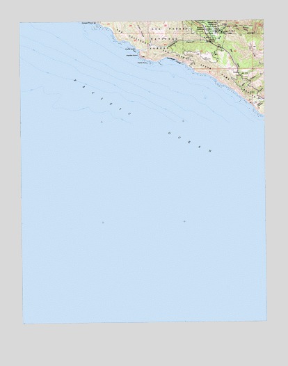
Pfeiffer Point, CA USGS Topographic Map
Click on map above to begin viewing in our Map Viewer.

This topographic map contains these locations and features:
Feature Name Type Latitude Longitude GNIS ID View Map
Bad GulchValleyN36.2497°W121.7511°269623View Map
Big Sur Guard StationLocaleN36.2480°W121.7822°269850View Map
Big Sur Post OfficePost OfficeN36.2368°W121.7704°2789127View Map
Big Sur Volunteer Fire Brigade Station 1 Post RanchBuildingN36.2331°W121.7697°2623995View Map
Buzzards RoostAreaN36.2494°W121.7886°1873478View Map
Castro CanyonValleyN36.2122°W121.7550°270344View Map
Cooper PointCapeN36.2497°W121.8380°270594View Map
Gorge TrailTrailN36.2458°W121.7744°1873486View Map
Graves CanyonValleyN36.2175°W121.7611°271416View Map
Majestic School (historical)SchoolN36.2422°W121.7850°1670898View Map
Mount Manuel TrailTrailN36.2491°W121.7741°1873514View Map
Mule Canyon CreekStreamN36.2222°W121.7622°272598View Map
P B S S P South CampgroundLocaleN36.2425°W121.7763°272826View Map
Pfeiffer BeachBeachN36.2386°W121.8175°272937View Map
Pfeiffer Beach Recreation SiteLocaleN36.2347°W121.8119°275334View Map
Pfeiffer Big Sur State ParkParkN36.2489°W121.7827°272938View Map
Pfeiffer GulchValleyN36.2411°W121.7750°272940View Map
Pfeiffer PointCapeN36.2355°W121.8147°272941View Map
Pfeiffer RockIslandN36.2327°W121.8116°272943View Map
Pfeiffer SchoolSchoolN36.2464°W121.7813°272944View Map
Post CreekStreamN36.2425°W121.7750°273092View Map
PostsPopulated PlaceN36.2283°W121.7644°1661256View Map
Sawmill Flat CampgroundLocaleN36.2486°W121.7805°273594View Map
Sycamore CanyonValleyN36.2383°W121.8158°273998View Map
Westmed Ambulance Unit 24BuildingN36.2285°W121.7651°2662267View Map
Weyland CampLocaleN36.2450°W121.7736°274454View Map
Wreck BeachBeachN36.2347°W121.7991°274575View Map

Note: Coordinates in the location and feature list above are referenced to NAD83 datum.


Copyright (C) 2008-2025 Ryan Niemi / Sunset Dynamics ... All Rights Reserved