TopoQuest Logo
Do you find TopoQuest useful?
Help keep TopoQuest running and adding new maps/features by donating!
Bitcoin:  19c7KJd3qBynnjoSw5npx9KScwjBe4ifkT
Litecoin:  LXs6TkuXGGXo1vDsWCkWVdjQX94eUKd6ui
Home View Maps Find Maps Find Places Resources & Links


Ventana Cones, California Topographic Map

USGS Map Title: Ventana Cones, CA
USGS Map MRC: 36121C6
DRG (GeoTIFF) Download: o36121c6.tif


Neighboring USGS Topographic Map Quads:


  Mount Carmel, CA  
36121D7
 

  Carmel Valley, CA  
36121D6
 

  Rana Creek, CA  
36121D5
 

  Big Sur, CA  
36121C7
 

  Ventana Cones, CA  
36121C6
 

  Chews Ridge, CA  
36121C5
 

  Pfeiffer Point, CA  
36121B7
 

  Partington Ridge, CA  
36121B6
 

  Zigzag Creek, CA  
36121B5


Map MRC Location:

N37°
W122°
N37°
W121°
H8 H7 H6 H5 H4 H3 H2 H1
G8 G7 G6 G5 G4 G3 G2 G1
F8 F7 F6 F5 F4 F3 F2 F1
E8 E7 E6 E5 E4 E3 E2 E1
D8 D7 D6 D5 D4 D3 D2 D1
C8 C7 C6 C5 C4 C3 C2 C1
B8 B7 B6 B5 B4 B3 B2 B1
A8 A7 A6 A5 A4 A3 A2 A1
N36°
W122°
N36°
W121°

Ventana Cones, CA USGS 1:24K Topographic Map Preview:
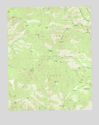
Ventana Cones, CA USGS Topographic Map
Click on map above to begin viewing in our Map Viewer.

This topographic map contains these locations and features:
Feature Name Type Latitude Longitude GNIS ID View Map
Bear BasinBasinN36.2864°W121.6391°239073View Map
Bear Basin CampLocaleN36.2830°W121.6444°239074View Map
Bear Basin CreekStreamN36.2975°W121.6497°239075View Map
Blue CreekStreamN36.3033°W121.6669°239496View Map
Bluff Camp Recreation SiteLocaleN36.3594°W121.6580°1655251View Map
Bruce ForkStreamN36.3486°W121.6511°239739View Map
Buckskin Flat CampLocaleN36.3327°W121.6730°239781View Map
Carmel River CampLocaleN36.3519°W121.6502°240249View Map
Carmel River TrailTrailN36.3691°W121.6594°240250View Map
Clover Basin CampLocaleN36.3433°W121.6302°240714View Map
Danish CreekStreamN36.3722°W121.6636°241256View Map
Dolores CreekStreamN36.2505°W121.6933°241540View Map
Doolans Hole CreekStreamN36.2652°W121.7447°241567View Map
Elephant MountainSummitN36.3497°W121.6891°1660611View Map
Hennicksons RidgeRidgeN36.3664°W121.6397°243363View Map
Hennicksons Ridge TrailTrailN36.3633°W121.6380°243364View Map
Hiding CanyonValleyN36.3136°W121.6777°243436View Map
Hiding Canyon CampLocaleN36.3214°W121.6855°243437View Map
Island MountainSummitN36.2650°W121.7238°243925View Map
Lion CreekStreamN36.2516°W121.6955°244886View Map
Little Bear TrapGapN36.3575°W121.6302°244897View Map
Little PinesSummitN36.3569°W121.7249°244941View Map
Little Pines CampLocaleN36.3527°W121.7238°244942View Map
Lone Pine CampLocaleN36.3214°W121.7169°245043View Map
Miller CanyonValleyN36.3539°W121.6511°245924View Map
Miller Canyon CampLocaleN36.3380°W121.6255°272476View Map
Miller Canyon Rustic CampsiteLocaleN36.3427°W121.6302°1655241View Map
Miller Fork Carmel RiverStreamN36.3536°W121.6511°245927View Map
Miller MountainSummitN36.3191°W121.6455°245928View Map
Pat Springs CampLocaleN36.3633°W121.7441°247300View Map
Pine FallsFallsN36.3008°W121.6452°247501View Map
Pine RidgeRidgeN36.2772°W121.6491°247512View Map
Pine Ridge CampLocaleN36.2736°W121.6505°247513View Map
Pine Ridge TrailTrailN36.2855°W121.6322°247514View Map
Pine ValleyBasinN36.3019°W121.6352°247522View Map
Pine Valley Rustic CampsiteLocaleN36.3011°W121.6355°1655240View Map
Puerto Suello CreekStreamN36.3297°W121.7461°247818View Map
Rattlesnake CampgroundLocaleN36.3686°W121.6933°275417View Map
Redwood Creek CampLocaleN36.2550°W121.6694°248102View Map
Round Rock CampLocaleN36.3097°W121.6772°248425View Map
South Ventana ConeSummitN36.2750°W121.6369°254285View Map
Sulpher Springs CampLocaleN36.3483°W121.6605°275418View Map
Sulphur SpringSpringN36.3480°W121.6605°1670915View Map
Sulphur Springs CampLocaleN36.3477°W121.6619°250065View Map
Uncle Sam MountainSummitN36.3411°W121.7063°250782View Map
Ventana CampLocaleN36.2597°W121.7427°250975View Map
Ventana ConeSummitN36.2841°W121.6783°255837View Map
Ventana CreekStreamN36.2586°W121.7455°250976View Map
Ventana Double ConeSummitN36.2969°W121.7147°255838View Map
Ventana Mesa CreekStreamN36.3147°W121.6822°250977View Map
Ventana TrailTrailN36.3552°W121.7249°250978View Map

Note: Coordinates in the location and feature list above are referenced to NAD83 datum.


Copyright (C) 2008-2025 Ryan Niemi / Sunset Dynamics ... All Rights Reserved