TopoQuest Logo
Do you find TopoQuest useful?
Help keep TopoQuest running and adding new maps/features by donating!
Bitcoin:  19c7KJd3qBynnjoSw5npx9KScwjBe4ifkT
Litecoin:  LXs6TkuXGGXo1vDsWCkWVdjQX94eUKd6ui
Home View Maps Find Maps Find Places Resources & Links


Big Sur, California Topographic Map

USGS Map Title: Big Sur, CA
USGS Map MRC: 36121C7
DRG (GeoTIFF) Download: o36121c7.tif


Neighboring USGS Topographic Map Quads:


  Soberanes Point, CA  
36121D8
 

  Mount Carmel, CA  
36121D7
 

  Carmel Valley, CA  
36121D6
 

  Point Sur, CA  
36121C8
 

  Big Sur, CA  
36121C7
 

  Ventana Cones, CA  
36121C6


  Pfeiffer Point, CA  
36121B7
 

  Partington Ridge, CA  
36121B6


Map MRC Location:

N37°
W122°
N37°
W121°
H8 H7 H6 H5 H4 H3 H2 H1
G8 G7 G6 G5 G4 G3 G2 G1
F8 F7 F6 F5 F4 F3 F2 F1
E8 E7 E6 E5 E4 E3 E2 E1
D8 D7 D6 D5 D4 D3 D2 D1
C8 C7 C6 C5 C4 C3 C2 C1
B8 B7 B6 B5 B4 B3 B2 B1
A8 A7 A6 A5 A4 A3 A2 A1
N36°
W122°
N36°
W121°

Big Sur, CA USGS 1:24K Topographic Map Preview:
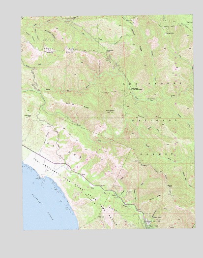
Big Sur, CA USGS Topographic Map
Click on map above to begin viewing in our Map Viewer.

This topographic map contains these locations and features:
Feature Name Type Latitude Longitude GNIS ID View Map
Andrew Molera State ParkParkN36.2833°W121.8344°274716View Map
Beartrap CanyonValleyN36.3689°W121.8613°269763View Map
Big PinesWoodsN36.3700°W121.7533°269838View Map
Big Pines Rustic CampsiteLocaleN36.3705°W121.7508°1655242View Map
Big Pines TrailTrailN36.3672°W121.7638°269840View Map
Big SurPopulated PlaceN36.2702°W121.8075°269849View Map
Big Sur RiverStreamN36.2805°W121.8600°269851View Map
Bixby MountainSummitN36.3550°W121.8408°269875View Map
Bluffs TrailTrailN36.2716°W121.8452°1873375View Map
Bobcat TrailTrailN36.2819°W121.8333°1873376View Map
Bonifacio HillSummitN36.3547°W121.8494°269959View Map
Bottchers GapGapN36.3539°W121.8136°269976View Map
Bottchers Recreation SiteLocaleN36.3552°W121.8133°1655243View Map
Boundary TrailTrailN36.2675°W121.8188°1873378View Map
Buzzards Roost TrailTrailN36.2539°W121.7908°1873380View Map
Cabezo PrietoRidgeN36.2861°W121.7819°270119View Map
Captain Cooper Elementary SchoolSchoolN36.2749°W121.8136°2504396View Map
Clear RidgeRidgeN36.2575°W121.8213°270752View Map
Comings CabinLocaleN36.3639°W121.7708°270574View Map
Comings CreekStreamN36.3316°W121.7558°270575View Map
Comings Rustic CampsiteLocaleN36.3633°W121.7705°1655246View Map
Cooper Cabin (historical)BuildingN36.2861°W121.8533°1873395View Map
Cooper Loop TrailTrailN36.2736°W121.8194°1873396View Map
Cooper RanchLocaleN36.3175°W121.8650°1670910View Map
Cooper School (historical)SchoolN36.3139°W121.8625°1670911View Map
Coyote FlatFlatN36.2758°W121.8261°1873400View Map
Creamery MeadowFlatN36.2839°W121.8480°1873401View Map
Cross CanyonValleyN36.3666°W121.8738°270688View Map
Dairy GulchValleyN36.3689°W121.8663°270742View Map
East Molera TrailTrailN36.2925°W121.8341°1873404View Map
El SurCivilN36.2972°W121.8466°271040View Map
Franciscan RocksIslandN36.2725°W121.8508°1873408View Map
Hopkins RidgeRidgeN36.2675°W121.7794°271622View Map
Jackson CampLocaleN36.3258°W121.7847°271754View Map
Jackson CreekStreamN36.3261°W121.7688°271755View Map
Juan Hiquera CreekStreamN36.2633°W121.7997°271833View Map
Launtz CreekStreamN36.3089°W121.7919°271991View Map
Launtz Creek CampgroundLocaleN36.3094°W121.7930°275421View Map
Launtz RidgeRidgeN36.3139°W121.7822°271992View Map
Liewald FlatFlatN36.2572°W121.7908°1873427View Map
Little River HillSummitN36.3166°W121.8713°272111View Map
Little Sur CampgroundLocaleN36.3416°W121.8083°275419View Map
Manuel PeakSummitN36.2741°W121.7708°1660988View Map
Manuel Peak TrailTrailN36.2702°W121.7688°272327View Map
Mescal RidgeRidgeN36.3547°W121.8494°272423View Map
Mill CreekStreamN36.3708°W121.8438°272465View Map
Molera PointCapeN36.2800°W121.8597°1873435View Map
Mulero RanchLocaleN36.2861°W121.8422°1670913View Map
Oak Grove TrailTrailN36.2505°W121.7777°1873441View Map
Panorama TrailTrailN36.2580°W121.8316°1873447View Map
Pfeffer-Redwood CreekStreamN36.2508°W121.7875°272936View Map
Pfeiffer FallsFallsN36.2569°W121.7816°272939View Map
Pfeiffer Falls TrailTrailN36.2547°W121.7830°1873449View Map
Pfeiffer RidgeRidgeN36.2622°W121.8222°272942View Map
Pheneger CreekStreamN36.2694°W121.8077°272946View Map
Pico BlancoSummitN36.3189°W121.8113°272952View Map
Pico Blanco Boy Scout CampLocaleN36.3319°W121.7972°272953View Map
Pico Blanco Rustic CampsiteLocaleN36.3061°W121.8069°1655244View Map
Post SummitSummitN36.2889°W121.7916°273093View Map
River TrailTrailN36.2786°W121.8325°1873451View Map
Skinner CreekStreamN36.3286°W121.7941°273731View Map
Skinner RidgeRidgeN36.3614°W121.7961°273733View Map
Skinner Ridge TrailTrailN36.3625°W121.8016°273734View Map
South Fork Little Sur RiverStreamN36.3302°W121.8630°273828View Map
Spaghetti Rustic CampsiteLocaleN36.3666°W121.7636°1655245View Map
Spring TrailTrailN36.2636°W121.8402°1873464View Map
Sur HillSummitN36.3114°W121.8477°1670916View Map
Swiss CanyonValleyN36.2869°W121.8675°273987View Map
Tin House CampgroundLocaleN36.2889°W121.7577°275431View Map
Turner CreekStreamN36.3750°W121.8327°274236View Map
Turner Creek TrailTrailN36.3697°W121.7944°274238View Map
Twin Cottonwoods TrailTrailN36.2750°W121.8263°1873471View Map
Vado CampgroundLocaleN36.3041°W121.7897°275422View Map
Valley View TrailTrailN36.2566°W121.7841°1873472View Map

Note: Coordinates in the location and feature list above are referenced to NAD83 datum.


Copyright (C) 2008-2024 Ryan Niemi / Sunset Dynamics ... All Rights Reserved