TopoQuest Logo
Do you find TopoQuest useful?
Help keep TopoQuest running and adding new maps/features by donating!
Bitcoin:  19c7KJd3qBynnjoSw5npx9KScwjBe4ifkT
Litecoin:  LXs6TkuXGGXo1vDsWCkWVdjQX94eUKd6ui
Home View Maps Find Maps Find Places Resources & Links


Phantom Lake, Wyoming Topographic Map

USGS Map Title: Phantom Lake, WY
USGS Map MRC: 41106C4
DRG (GeoTIFF) Download: o41106c4.tif


Neighboring USGS Topographic Map Quads:


  Kennaday Peak, WY  
41106D5
 

  Turpin Reservoir, WY  
41106D4
 

  Sand Lake, WY  
41106D3
 

  Ryan Park, WY  
41106C5
 

  Phantom Lake, WY  
41106C4
 

  Medicine Bow Peak, WY  
41106C3
 

  Barcus Peak, WY  
41106B5
 

  Overlook Hill, WY  
41106B4
 

  Keystone, WY  
41106B3


Map MRC Location:

N42°
W107°
N42°
W106°
H8 H7 H6 H5 H4 H3 H2 H1
G8 G7 G6 G5 G4 G3 G2 G1
F8 F7 F6 F5 F4 F3 F2 F1
E8 E7 E6 E5 E4 E3 E2 E1
D8 D7 D6 D5 D4 D3 D2 D1
C8 C7 C6 C5 C4 C3 C2 C1
B8 B7 B6 B5 B4 B3 B2 B1
A8 A7 A6 A5 A4 A3 A2 A1
N41°
W107°
N41°
W106°

Phantom Lake, WY USGS 1:24K Topographic Map Preview:
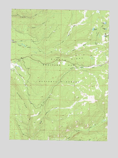
Phantom Lake, WY USGS Topographic Map
Click on map above to begin viewing in our Map Viewer.

This topographic map contains these locations and features:
Feature Name Type Latitude Longitude GNIS ID View Map
Araster DamDamN41.3600°W106.3822°1606180View Map
Araster ReservoirReservoirN41.3600°W106.3822°1606181View Map
Arrastre CreekStreamN41.3444°W106.3925°1597804View Map
Arrastre LakeLakeN41.3628°W106.3804°1597805View Map
Barrett RidgeRidgeN41.2897°W106.4875°1597940View Map
Gold HillSummitN41.3525°W106.3781°1599963View Map
Headquarters CreekStreamN41.2505°W106.4370°1600268View Map
Iron CreekStreamN41.2505°W106.4272°1600528View Map
Lily LakeLakeN41.3512°W106.3875°1704441View Map
Little Brush CreekStreamN41.3366°W106.4431°1604413View Map
Little Brush CreekStreamN41.3366°W106.4431°1604414View Map
Magnolia LakeLakeN41.3571°W106.3795°1604608View Map
Middle French CreekStreamN41.2508°W106.4711°1601416View Map
Mill CreekStreamN41.3436°W106.4964°1601445View Map
Phantom LakeLakeN41.3569°W106.3956°1602111View Map
Raven Group MineMineN41.2505°W106.4172°1726105View Map
Ryan Park Census Designated PlaceCensusN41.3132°W106.4896°2585084View Map
Slash RidgeRidgeN41.3264°W106.4320°1602963View Map
Slash Ridge LookoutLocaleN41.3291°W106.4411°1602964View Map
Stamp Mill LakeLakeN41.3504°W106.3812°1603325View Map

Note: Coordinates in the location and feature list above are referenced to NAD83 datum.


Copyright (C) 2008-2024 Ryan Niemi / Sunset Dynamics ... All Rights Reserved