TopoQuest Logo
Do you find TopoQuest useful?
Help keep TopoQuest running and adding new maps/features by donating!
Bitcoin:  19c7KJd3qBynnjoSw5npx9KScwjBe4ifkT
Litecoin:  LXs6TkuXGGXo1vDsWCkWVdjQX94eUKd6ui
Home View Maps Find Maps Find Places Resources & Links


Ryan Park, Wyoming Topographic Map

USGS Map Title: Ryan Park, WY
USGS Map MRC: 41106C5
DRG (GeoTIFF) Download: o41106c5.tif


Neighboring USGS Topographic Map Quads:


  Finley Reservoir, WY  
41106D6
 

  Kennaday Peak, WY  
41106D5
 

  Turpin Reservoir, WY  
41106D4
 

  Cow Creek, WY  
41106C6
 

  Ryan Park, WY  
41106C5
 

  Phantom Lake, WY  
41106C4
 

  Gunst Reservoir, WY  
41106B6
 

  Barcus Peak, WY  
41106B5
 

  Overlook Hill, WY  
41106B4


Map MRC Location:

N42°
W107°
N42°
W106°
H8 H7 H6 H5 H4 H3 H2 H1
G8 G7 G6 G5 G4 G3 G2 G1
F8 F7 F6 F5 F4 F3 F2 F1
E8 E7 E6 E5 E4 E3 E2 E1
D8 D7 D6 D5 D4 D3 D2 D1
C8 C7 C6 C5 C4 C3 C2 C1
B8 B7 B6 B5 B4 B3 B2 B1
A8 A7 A6 A5 A4 A3 A2 A1
N41°
W107°
N41°
W106°

Ryan Park, WY USGS 1:24K Topographic Map Preview:
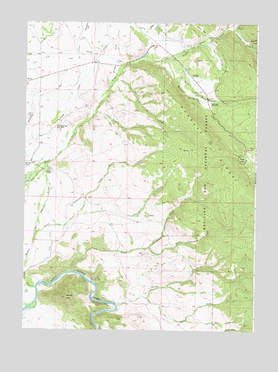
Ryan Park, WY USGS Topographic Map
Click on map above to begin viewing in our Map Viewer.

This topographic map contains these locations and features:
Feature Name Type Latitude Longitude GNIS ID View Map
Barrett CreekStreamN41.3597°W106.5522°1597938View Map
Beaver CreekStreamN41.2727°W106.6236°1598048View Map
Bennett PeakSummitN41.2630°W106.6017°1598112View Map
Brush CreekStreamN41.2669°W106.6184°1598419View Map
Brush Creek RanchLocaleN41.3316°W106.6064°1598423View Map
Brush Creek Ranger StationLocaleN41.3427°W106.5250°1598424View Map
Brush Creek SchoolSchoolN41.3164°W106.6228°1598425View Map
Buffalo GulchValleyN41.3569°W106.5764°1598468View Map
Cabin CampLocaleN41.3561°W106.5389°1598548View Map
Chimney ParkFlatN41.3728°W106.5305°1604611View Map
Condict RanchLocaleN41.3147°W106.6111°1598875View Map
Condict SloughStreamN41.2886°W106.6189°1598876View Map
Cook DitchCanalN41.2861°W106.6103°1598885View Map
Corral CreekStreamN41.2600°W106.5742°1598909View Map
Dewey MineMineN41.3625°W106.5906°1599238View Map
Francis DrawValleyN41.3380°W106.5870°1599839View Map
Jim DrawValleyN41.3514°W106.5750°1600620View Map
Lincoln CreekStreamN41.3727°W106.5131°1600923View Map
Lincoln ParkLocaleN41.3719°W106.5220°1704443View Map
Little Beaver CreekStreamN41.2966°W106.5964°1600945View Map
Medicine Bow LodgeLocaleN41.3441°W106.5328°1601335View Map
Moores CreekStreamN41.2502°W106.5156°1601531View Map
Mullison CreekStreamN41.3647°W106.5009°1601636View Map
North Brush CreekStreamN41.3605°W106.5456°1601722View Map
North Cottonwood CreekStreamN41.2736°W106.5989°1601730View Map
Ryan ParkPopulated PlaceN41.3214°W106.5089°1602659View Map
Ryan Park Ski CourseLocaleN41.3305°W106.5234°1602660View Map
Ryan Park Volunteer Fire DepartmentBuildingN41.3234°W106.5057°2673576View Map
South Brush CreekStreamN41.3602°W106.5456°1603098View Map
South Cottonwood CreekStreamN41.2833°W106.5581°1603103View Map
South Fork Corral CreekStreamN41.2630°W106.5586°1603126View Map
Stewart DitchCanalN41.3552°W106.5214°1603360View Map
Stump HollowValleyN41.3750°W106.5131°1604609View Map
TenmilePopulated PlaceN41.3527°W106.5350°1603556View Map
Uihlein CreekStreamN41.3172°W106.6170°1603853View Map
Wiant and Highline DitchCanalN41.3619°W106.5970°1604537View Map
Wiant DitchCanalN41.3483°W106.6206°1604158View Map

Note: Coordinates in the location and feature list above are referenced to NAD83 datum.


Copyright (C) 2008-2025 Ryan Niemi / Sunset Dynamics ... All Rights Reserved