TopoQuest Logo
Do you find TopoQuest useful?
Help keep TopoQuest running and adding new maps/features by donating!
Bitcoin:  19c7KJd3qBynnjoSw5npx9KScwjBe4ifkT
Litecoin:  LXs6TkuXGGXo1vDsWCkWVdjQX94eUKd6ui
Home View Maps Find Maps Find Places Resources & Links


Philadelphia, New York Topographic Map

USGS Map Title: Philadelphia, NY
USGS Map MRC: 44075B6
DRG (GeoTIFF) Download: o44075b6.tif


Neighboring USGS Topographic Map Quads:


  Redwood, NY  
44075C7
 

  Muskellunge Lake, NY  
44075C6
 

  Natural Dam, NY  
44075C5
 

  Theresa, NY  
44075B7
 

  Philadelphia, NY  
44075B6
 

  Antwerp, NY  
44075B5
 

  Black River, NY  
44075A7
 

  Deferiet, NY  
44075A6
 

  North Wilna, NY  
44075A5


Map MRC Location:

N45°
W76°
N45°
W75°
H8 H7 H6 H5 H4 H3 H2 H1
G8 G7 G6 G5 G4 G3 G2 G1
F8 F7 F6 F5 F4 F3 F2 F1
E8 E7 E6 E5 E4 E3 E2 E1
D8 D7 D6 D5 D4 D3 D2 D1
C8 C7 C6 C5 C4 C3 C2 C1
B8 B7 B6 B5 B4 B3 B2 B1
A8 A7 A6 A5 A4 A3 A2 A1
N44°
W76°
N44°
W75°

Philadelphia, NY USGS 1:24K Topographic Map Preview:
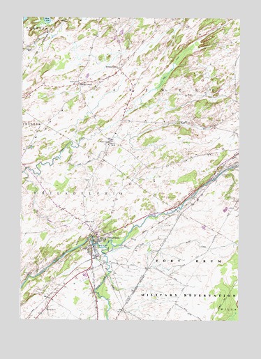
Philadelphia, NY USGS Topographic Map
Click on map above to begin viewing in our Map Viewer.

This topographic map contains these locations and features:
Feature Name Type Latitude Longitude GNIS ID View Map
Bentleys CornersPopulated PlaceN44.2289°W75.6938°943706View Map
Bishops CornersLocaleN44.2226°W75.7172°944054View Map
Black CreekStreamN44.1551°W75.7013°944123View Map
Bodman Memorial LibraryBuildingN44.1574°W75.7044°2617227View Map
Childs FallsFallsN44.1361°W75.7052°2788104View Map
Halls CornerPopulated PlaceN44.1998°W75.6988°972586View Map
Halls CreekStreamN44.1967°W75.7236°952070View Map
Hunter CreekStreamN44.1556°W75.6963°953472View Map
Indian River Baptist ChurchChurchN44.1566°W75.7074°2616530View Map
Indian River High SchoolSchoolN44.1434°W75.7139°2669224View Map
Indian River Intermediate SchoolSchoolN44.1341°W75.7219°2669164View Map
Indian River Middle SchoolSchoolN44.1404°W75.7117°2669165View Map
PhiladelphiaPopulated PlaceN44.1545°W75.7088°960294View Map
Philadelphia Fire DepartmentBuildingN44.1589°W75.7056°2718439View Map
Philadelphia United Methodist ChurchChurchN44.1544°W75.7099°2616227View Map
Philadelphia United Methodist ChurchChurchN44.1544°W75.7099°2616228View Map
Philadelphia Village Wastewater Treatment PlantLocaleN44.1583°W75.7107°2617748View Map
Quaker CemeteryCemeteryN44.1553°W75.7061°962042View Map
Sandy Hollow CemeteryCemeteryN44.1446°W75.7421°964431View Map
School Number 4 (historical)SchoolN44.2376°W75.7463°975381View Map
School Number 5 (historical)SchoolN44.1553°W75.7083°2353016View Map
School Number 6 (historical)SchoolN44.2228°W75.7174°975514View Map
School Number 8 (historical)SchoolN44.1295°W75.7344°975615View Map
School Number 8 (historical)SchoolN44.1987°W75.6983°975616View Map
School Number 9 (historical)SchoolN44.1653°W75.7130°975667View Map
Town of PhiladelphiaCivilN44.1464°W75.7053°979362View Map
Village of PhiladelphiaCivilN44.1540°W75.7098°2391061View Map

Note: Coordinates in the location and feature list above are referenced to NAD83 datum.


Copyright (C) 2008-2024 Ryan Niemi / Sunset Dynamics ... All Rights Reserved