TopoQuest Logo
Do you find TopoQuest useful?
Help keep TopoQuest running and adding new maps/features by donating!
Bitcoin:  19c7KJd3qBynnjoSw5npx9KScwjBe4ifkT
Litecoin:  LXs6TkuXGGXo1vDsWCkWVdjQX94eUKd6ui
Home View Maps Find Maps Find Places Resources & Links


Natural Dam, New York Topographic Map

USGS Map Title: Natural Dam, NY
USGS Map MRC: 44075C5
DRG (GeoTIFF) Download: o44075c5.tif


Neighboring USGS Topographic Map Quads:


  Hammond, NY  
44075D6
 

  Pope Mills, NY  
44075D5
 

  Richville, NY  
44075D4
 

  Muskellunge Lake, NY  
44075C6
 

  Natural Dam, NY  
44075C5
 

  Gouverneur, NY  
44075C4
 

  Philadelphia, NY  
44075B6
 

  Antwerp, NY  
44075B5
 

  Lake Bonaparte, NY  
44075B4


Map MRC Location:

N45°
W76°
N45°
W75°
H8 H7 H6 H5 H4 H3 H2 H1
G8 G7 G6 G5 G4 G3 G2 G1
F8 F7 F6 F5 F4 F3 F2 F1
E8 E7 E6 E5 E4 E3 E2 E1
D8 D7 D6 D5 D4 D3 D2 D1
C8 C7 C6 C5 C4 C3 C2 C1
B8 B7 B6 B5 B4 B3 B2 B1
A8 A7 A6 A5 A4 A3 A2 A1
N44°
W76°
N44°
W75°

Natural Dam, NY USGS 1:24K Topographic Map Preview:
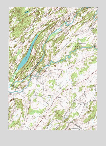
Natural Dam, NY USGS Topographic Map
Click on map above to begin viewing in our Map Viewer.

This topographic map contains these locations and features:
Feature Name Type Latitude Longitude GNIS ID View Map
ElmdalePopulated PlaceN44.3603°W75.5433°976295View Map
KeenesPopulated PlaceN44.2628°W75.5416°976511View Map
Laidlow School (historical)SchoolN44.3664°W75.5781°2120413View Map
Little BowPopulated PlaceN44.3537°W75.5102°976557View Map
Malterna CreekStreamN44.3217°W75.5447°976619View Map
Mud LakeLakeN44.3694°W75.6011°976695View Map
Natural DamPopulated PlaceN44.3373°W75.5030°976712View Map
Oswegatchie River BridgeBridgeN44.3596°W75.5459°2614968View Map
OxbowPopulated PlaceN44.2873°W75.6230°959708View Map
Oxbow Census Designated PlaceCensusN44.2871°W75.6227°2584281View Map
Oxbow Volunteer Fire DepartmentBuildingN44.2872°W75.6203°2734737View Map
Pikes CornerPopulated PlaceN44.2773°W75.5174°976814View Map
School Number 12 (historical)SchoolN44.2864°W75.6206°2353010View Map
School Number 2 (historical)SchoolN44.2517°W75.5872°2353009View Map
Scotch Settlement School (historical)SchoolN44.3386°W75.6064°2120414View Map
SomervillePopulated PlaceN44.2831°W75.5566°977022View Map
SpraguevillePopulated PlaceN44.2589°W75.5363°977044View Map
Vrooman CreekStreamN44.2942°W75.6222°968613View Map
WegatchiePopulated PlaceN44.3042°W75.5855°977192View Map
Wilhome Dairy FarmsLocaleN44.3092°W75.5058°2702625View Map
Yellow LakeLakeN44.3258°W75.5990°977307View Map

Note: Coordinates in the location and feature list above are referenced to NAD83 datum.


Copyright (C) 2008-2025 Ryan Niemi / Sunset Dynamics ... All Rights Reserved