TopoQuest Logo
Do you find TopoQuest useful?
Help keep TopoQuest running and adding new maps/features by donating!
Bitcoin:  19c7KJd3qBynnjoSw5npx9KScwjBe4ifkT
Litecoin:  LXs6TkuXGGXo1vDsWCkWVdjQX94eUKd6ui
Home View Maps Find Maps Find Places Resources & Links


Shandaken, New York Topographic Map

USGS Map Title: Shandaken, NY
USGS Map MRC: 42074A4
DRG (GeoTIFF) Download: o42074a4.tif


Neighboring USGS Topographic Map Quads:


  Fleischmanns, NY  
42074B5
 

  West Kill, NY  
42074B4
 

  Lexington, NY  
42074B3
 

  Seager, NY  
42074A5
 

  Shandaken, NY  
42074A4
 

  Phoenicia, NY  
42074A3
 

  Claryville, NY  
41074H5
 

  Peekamoose Mountain, NY  
41074H4
 

  West Shokan, NY  
41074H3


Map MRC Location:

N43°
W75°
N43°
W74°
H8 H7 H6 H5 H4 H3 H2 H1
G8 G7 G6 G5 G4 G3 G2 G1
F8 F7 F6 F5 F4 F3 F2 F1
E8 E7 E6 E5 E4 E3 E2 E1
D8 D7 D6 D5 D4 D3 D2 D1
C8 C7 C6 C5 C4 C3 C2 C1
B8 B7 B6 B5 B4 B3 B2 B1
A8 A7 A6 A5 A4 A3 A2 A1
N42°
W75°
N42°
W74°

Shandaken, NY USGS 1:24K Topographic Map Preview:
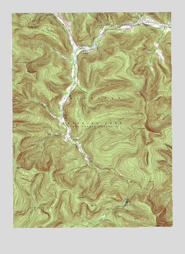
Shandaken, NY USGS Topographic Map
Click on map above to begin viewing in our Map Viewer.

This topographic map contains these locations and features:
Feature Name Type Latitude Longitude GNIS ID View Map
Balsam MountainSummitN42.0909°W74.4882°942953View Map
Belle Ayr MountainSummitN42.1159°W74.4979°969873View Map
Big IndianPopulated PlaceN42.1026°W74.4438°943904View Map
Big Indian and Oliverea Fire DistrictBuildingN42.1027°W74.4422°2735444View Map
Big Indian HollowValleyN42.1031°W74.4496°943906View Map
Big Indian MountainSummitN42.0351°W74.4965°943907View Map
Big Indian Post OfficePost OfficeN42.1031°W74.4447°2599314View Map
Birch CreekStreamN42.1051°W74.4424°943995View Map
Bushnellsville CreekStreamN42.1204°W74.3993°969938View Map
Catskill State ParkParkN42.0629°W74.4357°973633View Map
Elk BushkillStreamN42.0540°W74.4577°949486View Map
Fir MountainSummitN42.0276°W74.4690°950082View Map
Fox HollowValleyN42.1151°W74.3808°950570View Map
Giant LedgeCliffN42.0401°W74.3946°951058View Map
Giant Ledge StreamStreamN42.0328°W74.4211°2090265View Map
Giggle HollowValleyN42.1248°W74.4724°951087View Map
Hanging Birds NestValleyN42.0320°W74.4326°952159View Map
Hatchery HollowValleyN42.0837°W74.4490°952369View Map
Hemlock MountainSummitN42.0129°W74.4390°952565View Map
Little Peck HollowValleyN42.0491°W74.4484°955621View Map
Lost CloveValleyN42.0965°W74.4526°956007View Map
McKenley HollowValleyN42.0640°W74.4635°956793View Map
Millbrook HollowValleyN42.1176°W74.4271°957290View Map
OlivereaPopulated PlaceN42.0654°W74.4602°959347View Map
Panther MountainSummitN42.0565°W74.3946°959820View Map
Peck HollowValleyN42.1181°W74.3779°960083View Map
Phoenicia Volunteer Fire Company Shandaken - Allaben Hose Company 2BuildingN42.1198°W74.3917°2735450View Map
Rochester HollowValleyN42.1151°W74.4546°962689View Map
School Number 2 (historical)SchoolN42.1194°W74.3917°2371407View Map
School Number 4 (historical)SchoolN42.1133°W74.4539°2371408View Map
Seager West Branch TrailTrailN42.0187°W74.4860°964731View Map
Seneca HollowValleyN42.1173°W74.4202°964830View Map
ShandakenPopulated PlaceN42.1201°W74.3954°964927View Map
Shandaken - Allaben Hose CompanyBuildingN42.1198°W74.3917°2718606View Map
Shandaken Ambulance ServiceBuildingN42.1230°W74.3996°2720189View Map
Spruce MountainSummitN42.0176°W74.4499°966132View Map
Town of ShandakenCivilN42.0690°W74.3896°979484View Map
Winnisook ClubLocaleN42.0126°W74.4129°971502View Map
Winnisook LakeReservoirN42.0144°W74.4126°971503View Map

Note: Coordinates in the location and feature list above are referenced to NAD83 datum.


Copyright (C) 2008-2024 Ryan Niemi / Sunset Dynamics ... All Rights Reserved