TopoQuest Logo
Do you find TopoQuest useful?
Help keep TopoQuest running and adding new maps/features by donating!
Bitcoin:  19c7KJd3qBynnjoSw5npx9KScwjBe4ifkT
Litecoin:  LXs6TkuXGGXo1vDsWCkWVdjQX94eUKd6ui
Home View Maps Find Maps Find Places Resources & Links


Phoenix, Maryland Topographic Map

USGS Map Title: Phoenix, MD
USGS Map MRC: 39076E5
DRG (GeoTIFF) Download: o39076e5.tif


Neighboring USGS Topographic Map Quads:


  New Freedom, PA  
39076F6
 

  Norrisville, MD  
39076F5
 

  Fawn Grove, PA  
39076F4
 

  Hereford, MD  
39076E6
 

  Phoenix, MD  
39076E5
 

  Jarrettsville, MD  
39076E4
 

  Cockeysville, MD  
39076D6
 

  Towson, MD  
39076D5
 

  White Marsh, MD  
39076D4


Map MRC Location:

N40°
W77°
N40°
W76°
H8 H7 H6 H5 H4 H3 H2 H1
G8 G7 G6 G5 G4 G3 G2 G1
F8 F7 F6 F5 F4 F3 F2 F1
E8 E7 E6 E5 E4 E3 E2 E1
D8 D7 D6 D5 D4 D3 D2 D1
C8 C7 C6 C5 C4 C3 C2 C1
B8 B7 B6 B5 B4 B3 B2 B1
A8 A7 A6 A5 A4 A3 A2 A1
N39°
W77°
N39°
W76°

Phoenix, MD USGS 1:24K Topographic Map Preview:
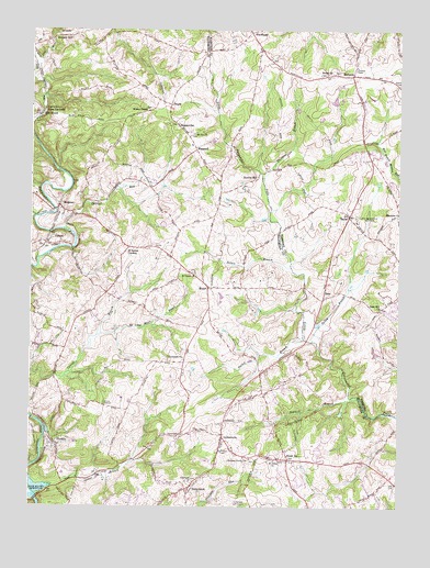
Phoenix, MD USGS Topographic Map
Click on map above to begin viewing in our Map Viewer.

This topographic map contains these locations and features:
Feature Name Type Latitude Longitude GNIS ID View Map
Albright FarmsLocaleN39.5144°W76.5569°2705139View Map
Ascot EstatesPopulated PlaceN39.5207°W76.5644°593525View Map
Beckley EstatesPopulated PlaceN39.5979°W76.5386°1698053View Map
Bethel Presbyterian ChurchChurchN39.6137°W76.5230°583182View Map
Bethel Presbyterian Church CemeteryCemeteryN39.6143°W76.5229°1698071View Map
BlackhorsePopulated PlaceN39.6240°W76.5511°589764View Map
Blenheim ForestPopulated PlaceN39.5046°W76.5522°593543View Map
Blue MountPopulated PlaceN39.6023°W76.6216°589777View Map
Briar Ridge Farm Pond DamDamN39.6068°W76.5214°594541View Map
BrookfieldPopulated PlaceN39.5290°W76.5730°593557View Map
Camp BonkirchenLocaleN39.5723°W76.5955°593563View Map
Camp-Tuc-HolkaLocaleN39.6037°W76.6200°583577View Map
Carroll Manor RidgePopulated PlaceN39.5098°W76.5027°593567View Map
CharbonnetPopulated PlaceN39.6179°W76.5172°1698094View Map
Charles RunStreamN39.5723°W76.6141°583701View Map
Chestnut Grove ChurchChurchN39.5126°W76.5502°583738View Map
Clynmalira ChurchChurchN39.5390°W76.5727°583821View Map
Cool Meadows FarmsPopulated PlaceN39.6057°W76.5116°1698103View Map
CooperfieldPopulated PlaceN39.5221°W76.5922°593592View Map
CorbettPopulated PlaceN39.5701°W76.6180°590021View Map
Corbett Hill FarmsPopulated PlaceN39.5559°W76.5994°593594View Map
Cross CreekPopulated PlaceN39.5307°W76.6233°593596View Map
District 10CivilN39.5411°W76.5752°1929432View Map
Dulaney Valley EstatesPopulated PlaceN39.5015°W76.5058°593601View Map
Elkridge-Harford Hunt ClubLocaleN39.5759°W76.5133°592422View Map
Fairview ChurchChurchN39.5068°W76.5691°584332View Map
Fairwood of Hunt ValleyPopulated PlaceN39.5134°W76.5975°593605View Map
Farmington NurseriesBuildingN39.6136°W76.5189°2651579View Map
Fern ValleyPopulated PlaceN39.6015°W76.6052°593609View Map
First Mine BranchStreamN39.6137°W76.6230°584379View Map
Fox Hill FarmLocaleN39.5973°W76.5933°593617View Map
Fox MeadowsPopulated PlaceN39.5932°W76.5083°1698146View Map
Fox Meadows PurchasePopulated PlaceN39.5890°W76.5139°1698147View Map
Fox Meadows WoodsPopulated PlaceN39.5921°W76.5155°1698148View Map
Fox RunPopulated PlaceN39.5118°W76.5522°593619View Map
FoxwoodPopulated PlaceN39.5532°W76.5066°1698150View Map
Glen ElynPopulated PlaceN39.5432°W76.5086°1698160View Map
Good Will CemeteryCemeteryN39.5525°W76.5058°1698166View Map
Good Will ChurchChurchN39.5521°W76.5061°584640View Map
Greene BranchStreamN39.5051°W76.6200°584758View Map
GreenfieldPopulated PlaceN39.5359°W76.5352°593635View Map
HampshirePopulated PlaceN39.5162°W76.5555°593641View Map
Henrys BridgePopulated PlaceN39.5312°W76.5683°593648View Map
HessPopulated PlaceN39.5559°W76.5255°590453View Map
Hillendale Golf CourseLocaleN39.5009°W76.5558°592437View Map
Hillendale HeightsPopulated PlaceN39.5115°W76.5600°593656View Map
Houcks MillPopulated PlaceN39.5862°W76.5480°590506View Map
Hunt CrestPopulated PlaceN39.6109°W76.5119°1698212View Map
Hunt Valley Inn Golf CourseLocaleN39.5093°W76.6100°593668View Map
Hunters MillPopulated PlaceN39.6223°W76.6175°590515View Map
Hurline FarmsPopulated PlaceN39.5057°W76.5033°593676View Map
Jackson Minilibrary Baltimore County Public LibraryBuildingN39.5179°W76.5591°1952162View Map
Jackson RidgePopulated PlaceN39.5223°W76.5708°593691View Map
JacksonvillePopulated PlaceN39.5182°W76.5594°590549View Map
Jacksonville Elementary SchoolSchoolN39.5124°W76.5596°593692View Map
Jacksonville Volunteer Fire Company Station 47BuildingN39.5153°W76.5561°2087019View Map
Jarrettsville ParkParkN39.5890°W76.5058°1698215View Map
Jarrettsville Volunteer Fire Company Black Horse StationBuildingN39.6183°W76.5472°2131729View Map
Kinhart ManorPopulated PlaceN39.6023°W76.5150°1698220View Map
Ladew Topiary GardensLocaleN39.5846°W76.5111°1698222View Map
Little Deer Creek Reservoir Number 3ReservoirN39.6168°W76.5330°594292View Map
Little Deer Creek Watershed Site Number 3 DamDamN39.6168°W76.5330°594291View Map
LocksleyPopulated PlaceN39.5318°W76.5386°593707View Map
Locust HillPopulated PlaceN39.5021°W76.5183°593708View Map
MadonnaPopulated PlaceN39.6132°W76.5164°590719View Map
Madonna Heritage Assisted Living CenterBuildingN39.6116°W76.5050°2503452View Map
Madonna Ranger StationLocaleN39.6145°W76.5152°1698230View Map
ManorPopulated PlaceN39.5573°W76.5647°590729View Map
Manor BrookPopulated PlaceN39.5743°W76.6041°593714View Map
Manor FieldsPopulated PlaceN39.5098°W76.5269°593715View Map
Manor GladePopulated PlaceN39.5232°W76.5344°593716View Map
Manor GlenPopulated PlaceN39.5279°W76.5422°593717View Map
Manor RidgePopulated PlaceN39.5084°W76.5405°593718View Map
Manor View FarmsPopulated PlaceN39.5523°W76.5636°593719View Map
Maryland Polo ClubLocaleN39.5870°W76.5072°1698237View Map
Merryman ParkParkN39.5682°W76.6108°593730View Map
Merrymans MillPopulated PlaceN39.5079°W76.5747°593731View Map
Mill Run EstatesPopulated PlaceN39.5182°W76.5650°593737View Map
MillgatePopulated PlaceN39.5154°W76.5472°593738View Map
Mission RidgePopulated PlaceN39.5371°W76.6158°593739View Map
MonktonPopulated PlaceN39.5787°W76.6155°590815View Map
Monkton FarmsPopulated PlaceN39.5570°W76.6080°593740View Map
Monkton United Methodist ChurchChurchN39.5779°W76.6130°593741View Map
Mount Joy ChurchChurchN39.5976°W76.5702°586007View Map
Moy BurnStreamN39.5773°W76.5436°591732View Map
Mrs Bozman HeliportAirportN39.5496°W76.5627°595305View Map
My Ladys Manor BranchStreamN39.5443°W76.6027°586125View Map
My Ladys Manor EstatesPopulated PlaceN39.5695°W76.5741°593747View Map
Nelson BranchStreamN39.5626°W76.5366°586163View Map
Nike Site BA-03C (historical)MilitaryN39.5069°W76.5789°2355049View Map
Nike Site BA-03L (historical)MilitaryN39.5161°W76.5700°2355050View Map
Old York ManorPopulated PlaceN39.5159°W76.5766°593752View Map
Paper Mill Village Shopping CenterLocaleN39.5197°W76.5603°2087842View Map
Parker BranchStreamN39.5443°W76.5325°586409View Map
Patchwork FarmsPopulated PlaceN39.5707°W76.5927°593760View Map
PhoenixPopulated PlaceN39.5165°W76.6161°591002View Map
Phoenix Post OfficePost OfficeN39.5197°W76.5595°595551View Map
Pleasant Prospect at Glen ElynPopulated PlaceN39.5404°W76.5016°1698266View Map
Queen Anne Hillsboro Volunteer Fire CompanyBuildingN39.5425°W76.5956°2087303View Map
QuinnPopulated PlaceN39.5071°W76.5330°593776View Map
Saint James AcademySchoolN39.5618°W76.5705°593793View Map
Saint James ChurchChurchN39.5612°W76.5697°587021View Map
Saint James CornersLocaleN39.5679°W76.5916°587025View Map
Saint Johns ChurchChurchN39.5121°W76.5419°587049View Map
Salem United Methodist CemeteryCemeteryN39.6111°W76.5001°587166View Map
Sawmill BranchStreamN39.5293°W76.5136°587232View Map
ShepperdPopulated PlaceN39.5934°W76.5691°591270View Map
Shepperd SchoolSchoolN39.6001°W76.5755°587326View Map
StocktonPopulated PlaceN39.5332°W76.5736°593817View Map
Stockton WoodsPopulated PlaceN39.5309°W76.6025°593818View Map
SunnybrookPopulated PlaceN39.5043°W76.5714°591379View Map
Sutton ManorPopulated PlaceN39.6057°W76.5536°1698302View Map
Sweet AirPopulated PlaceN39.5123°W76.5372°587671View Map
Sweet Air ManorPopulated PlaceN39.5176°W76.5252°593824View Map
TaylorPopulated PlaceN39.5762°W76.5172°588730View Map
Taylor School (historical)SchoolN39.5643°W76.5239°1698304View Map
The Fields of Four CornersPopulated PlaceN39.5154°W76.5525°593828View Map
The Highlands of Hunt ValleyPopulated PlaceN39.5168°W76.6041°593829View Map
The Manor Shopping CenterLocaleN39.5164°W76.5592°2087853View Map
Thornton BranchStreamN39.5851°W76.5469°587778View Map
TroyerPopulated PlaceN39.6051°W76.5780°591433View Map
Union ChapelChurchN39.6004°W76.5758°593851View Map
Vance ValleyPopulated PlaceN39.5987°W76.5680°593858View Map
Verdant ValleyValleyN39.5506°W76.5289°1698316View Map
Wesley ChapelChurchN39.6037°W76.5855°588121View Map
WetherbeePopulated PlaceN39.5115°W76.5816°593871View Map
Wooddale FarmsPopulated PlaceN39.5584°W76.5986°593874View Map
Yellow BranchStreamN39.5434°W76.5291°588365View Map

Note: Coordinates in the location and feature list above are referenced to NAD83 datum.


Copyright (C) 2008-2024 Ryan Niemi / Sunset Dynamics ... All Rights Reserved