TopoQuest Logo
Do you find TopoQuest useful?
Help keep TopoQuest running and adding new maps/features by donating!
Bitcoin:  19c7KJd3qBynnjoSw5npx9KScwjBe4ifkT
Litecoin:  LXs6TkuXGGXo1vDsWCkWVdjQX94eUKd6ui
Home View Maps Find Maps Find Places Resources & Links


Hereford, Maryland Topographic Map

USGS Map Title: Hereford, MD
USGS Map MRC: 39076E6
DRG (GeoTIFF) Download: o39076e6.tif


Neighboring USGS Topographic Map Quads:


  Lineboro, MD  
39076F7
 

  New Freedom, PA  
39076F6
 

  Norrisville, MD  
39076F5
 

  Hampstead, MD  
39076E7
 

  Hereford, MD  
39076E6
 

  Phoenix, MD  
39076E5
 

  Reisterstown, MD  
39076D7
 

  Cockeysville, MD  
39076D6
 

  Towson, MD  
39076D5


Map MRC Location:

N40°
W77°
N40°
W76°
H8 H7 H6 H5 H4 H3 H2 H1
G8 G7 G6 G5 G4 G3 G2 G1
F8 F7 F6 F5 F4 F3 F2 F1
E8 E7 E6 E5 E4 E3 E2 E1
D8 D7 D6 D5 D4 D3 D2 D1
C8 C7 C6 C5 C4 C3 C2 C1
B8 B7 B6 B5 B4 B3 B2 B1
A8 A7 A6 A5 A4 A3 A2 A1
N39°
W77°
N39°
W76°

Hereford, MD USGS 1:24K Topographic Map Preview:
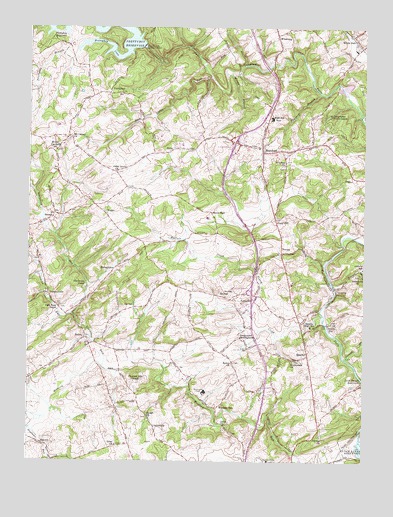
Hereford, MD USGS Topographic Map
Click on map above to begin viewing in our Map Viewer.

This topographic map contains these locations and features:
Feature Name Type Latitude Longitude GNIS ID View Map
Arden ValleyPopulated PlaceN39.5737°W76.6886°593524View Map
Armacost Farms Airport (historical)AirportN39.6034°W76.7444°595298View Map
Bacon HallPopulated PlaceN39.5715°W76.6819°589678View Map
Basignani WineryBuildingN39.5564°W76.7481°2704593View Map
BelfastPopulated PlaceN39.5479°W76.6786°589726View Map
BereanPopulated PlaceN39.5712°W76.7403°588615View Map
Black Rock ChurchChurchN39.5357°W76.7286°593542View Map
Blackrock CampLocaleN39.5512°W76.7286°583273View Map
Blackrock RunStreamN39.5273°W76.7222°583274View Map
Bluemount QuarryMineN39.6083°W76.6314°2635691View Map
Bosley ChurchChurchN39.5279°W76.6741°583331View Map
Brandy SpringsPopulated PlaceN39.5945°W76.6858°593548View Map
Broadmead Assisted Living CenterBuildingN39.5024°W76.6463°2503133View Map
Buffalo CreekStreamN39.5551°W76.6652°583467View Map
Bush Cabin RunStreamN39.6104°W76.6822°583501View Map
ButlerPopulated PlaceN39.5354°W76.7280°589866View Map
Butler Post OfficePost OfficeN39.5353°W76.7275°595543View Map
Butler Stone QuarryMineN39.5417°W76.7281°2709866View Map
Butler Volunteer Fire Company Station 49BuildingN39.5366°W76.7283°2087011View Map
Cambridge School Elementary SchoolSchoolN39.5226°W76.7106°2132598View Map
Camp AlkorLocaleN39.5993°W76.6372°593561View Map
Camp Alkor SpringSpringN39.5937°W76.6375°593562View Map
Camp KalorLocaleN39.5993°W76.6333°593564View Map
Camp Puh TokLocaleN39.5965°W76.6394°593565View Map
Carroll BranchStreamN39.5296°W76.6314°583600View Map
Cedar GrovePopulated PlaceN39.5837°W76.7166°593574View Map
Cedar Grove ChurchChurchN39.5832°W76.7178°583647View Map
ChesterfieldPopulated PlaceN39.5682°W76.6502°593580View Map
Childrens Rehabilitation Institute (historical)BuildingN39.5101°W76.7108°593582View Map
Church of GodChurchN39.5898°W76.6894°593583View Map
CloverfieldPopulated PlaceN39.5695°W76.6283°593586View Map
CoopersvillePopulated PlaceN39.5476°W76.7419°590016View Map
Deadman RunStreamN39.5095°W76.7491°584039View Map
EvnaPopulated PlaceN39.5898°W76.6966°590176View Map
Fairgrounds Plaza Shopping CenterLocaleN39.5217°W76.6283°2087824View Map
FlickerwoodPopulated PlaceN39.5890°W76.6955°593614View Map
Friends ViewPopulated PlaceN39.5312°W76.6677°593621View Map
Geist ChurchChurchN39.5048°W76.7169°584567View Map
GentsvillePopulated PlaceN39.5101°W76.7025°590287View Map
GillcrestPopulated PlaceN39.6209°W76.6614°593623View Map
GlencoePopulated PlaceN39.5490°W76.6352°590324View Map
Glencoe ManorPopulated PlaceN39.5434°W76.6458°593624View Map
Gough ChurchChurchN39.5129°W76.7053°584670View Map
GreencroftPopulated PlaceN39.5132°W76.6861°593633View Map
Gunpowder MeetinghouseLocaleN39.5359°W76.6716°584808View Map
Gunpowder Youth CampsLocaleN39.5995°W76.6377°584811View Map
HerefordPopulated PlaceN39.5890°W76.6633°590449View Map
Hereford Baptist ChurchChurchN39.5904°W76.6647°593649View Map
Hereford Branch Baltimore County Public LibraryBuildingN39.5890°W76.6633°1952161View Map
Hereford High SchoolSchoolN39.5995°W76.6594°593650View Map
Hereford Medical CenterHospitalN39.5954°W76.6619°595700View Map
Hereford Middle SchoolSchoolN39.5728°W76.6531°593651View Map
Hereford Plaza Shopping CenterLocaleN39.5900°W76.6647°2087830View Map
Hereford Shopping CenterLocaleN39.5918°W76.6700°593652View Map
Hereford United Methodist ChurchChurchN39.5893°W76.6627°593653View Map
Hereford Volunteer Ambulance Association Station 53BuildingN39.5902°W76.6481°2087016View Map
Hereford Volunteer Fire Company Station 44BuildingN39.5894°W76.6620°2087017View Map
Highlands Corporate Office ParkLocaleN39.5251°W76.6480°593655View Map
Hope MeadowsPopulated PlaceN39.5873°W76.6658°593664View Map
Hunters RunPopulated PlaceN39.5029°W76.6364°593672View Map
Immanuel ChurchChurchN39.5543°W76.6264°585129View Map
Indian RunStreamN39.5423°W76.7339°585138View Map
Jessops Methodist ChurchChurchN39.5071°W76.6405°585230View Map
Lambourne DownsPopulated PlaceN39.5190°W76.6844°593704View Map
Little FallsStreamN39.5984°W76.6258°585461View Map
Longview Executive Business ParkLocaleN39.5003°W76.6664°2087834View Map
Loveton Business CenterLocaleN39.5182°W76.6469°593711View Map
Loveton FarmsPopulated PlaceN39.5187°W76.6400°593712View Map
MantuaPopulated PlaceN39.5051°W76.7441°590733View Map
Maplehurst WoodsPopulated PlaceN39.5845°W76.6491°593720View Map
Masonic Home of MarylandLocaleN39.5004°W76.6602°593724View Map
Mingo BranchStreamN39.6120°W76.6775°585905View Map
Monkton Post OfficePost OfficeN39.5900°W76.6640°595549View Map
Morgan ManorPopulated PlaceN39.5557°W76.6561°593742View Map
Mount CarmelPopulated PlaceN39.5887°W76.7405°585984View Map
Mount Carmel ChurchChurchN39.5932°W76.7350°585989View Map
Mount Carmel FarmsPopulated PlaceN39.5807°W76.7203°593744View Map
Oldfield SchoolSchoolN39.5554°W76.6252°586329View Map
Oldfields Childrens CenterSchoolN39.5553°W76.6252°2132189View Map
Panther BranchStreamN39.6062°W76.6414°586393View Map
Pine Hill FarmsPopulated PlaceN39.5148°W76.7228°593767View Map
Piney CreekPopulated PlaceN39.5820°W76.6436°593770View Map
Piney CreekStreamN39.5407°W76.6400°586540View Map
Piney HillPopulated PlaceN39.5698°W76.6583°591019View Map
Pleasant Hill ChapelChurchN39.5232°W76.7103°586590View Map
PrettyboyPopulated PlaceN39.6059°W76.7203°591070View Map
Prettyboy BranchStreamN39.6179°W76.7319°586700View Map
Prettyboy CoveBayN39.6195°W76.7191°586701View Map
Prettyboy DamDamN39.6201°W76.7080°594218View Map
Prettyboy DamDamN39.6196°W76.7075°586702View Map
Prettyboy GarthPopulated PlaceN39.6048°W76.7150°593774View Map
Prettyboy ReservoirReservoirN39.6235°W76.7429°586703View Map
PricevillePopulated PlaceN39.5451°W76.6691°591071View Map
Retreat FarmsPopulated PlaceN39.5562°W76.6630°593778View Map
Ross Valley FarmsPopulated PlaceN39.5723°W76.6580°593788View Map
Saint Lukes ChurchChurchN39.5857°W76.6547°587072View Map
Second Mine BranchStreamN39.6220°W76.6305°587260View Map
Sharretts RidgePopulated PlaceN39.5432°W76.6294°593803View Map
SparksPopulated PlaceN39.5309°W76.6458°591324View Map
Sparks Elementary SchoolSchoolN39.5418°W76.6622°587480View Map
Sparks Glencoe Post OfficePost OfficeN39.5295°W76.6458°2503664View Map
Sparks ParkParkN39.5412°W76.6436°593810View Map
Sparks StationLocaleN39.5390°W76.6380°587481View Map
Springfield FarmLocaleN39.5811°W76.7364°2705141View Map
Stephenson ChurchChurchN39.5296°W76.6514°587549View Map
StoddardPopulated PlaceN39.5329°W76.6480°593819View Map
StringtownPopulated PlaceN39.5545°W76.7189°591364View Map
Thompson EstatesPopulated PlaceN39.5998°W76.7478°593837View Map
Tinsley Airstrip (historical)AirportN39.5168°W76.7330°595245View Map
Top Bar RanchLocaleN39.5951°W76.6416°593845View Map
Towson Nurseries (historical)LocaleN39.5009°W76.6414°593846View Map
VeronaPopulated PlaceN39.5601°W76.6558°591471View Map
Weisburg United Methodist ChurchChurchN39.6248°W76.6514°593866View Map
Western RunPopulated PlaceN39.5151°W76.6794°591531View Map
White HallPopulated PlaceN39.6218°W76.6286°591541View Map
White Hall Post OfficePost OfficeN39.6214°W76.6292°595556View Map
WiseburgPopulated PlaceN39.6220°W76.6577°591578View Map
Woodhall Wine CellarsBuildingN39.6167°W76.6608°2704694View Map
Worthington ManorPopulated PlaceN39.5226°W76.7078°593879View Map
YeohoPopulated PlaceN39.5715°W76.7216°591618View Map

Note: Coordinates in the location and feature list above are referenced to NAD83 datum.


Copyright (C) 2008-2024 Ryan Niemi / Sunset Dynamics ... All Rights Reserved