TopoQuest Logo
Do you find TopoQuest useful?
Help keep TopoQuest running and adding new maps/features by donating!
Bitcoin:  19c7KJd3qBynnjoSw5npx9KScwjBe4ifkT
Litecoin:  LXs6TkuXGGXo1vDsWCkWVdjQX94eUKd6ui
Home View Maps Find Maps Find Places Resources & Links


Norrisville, Maryland Topographic Map

USGS Map Title: Norrisville, MD
USGS Map MRC: 39076F5
DRG (GeoTIFF) Download: o39076f5.tif


Neighboring USGS Topographic Map Quads:


  Glen Rock, PA  
39076G6
 

  Stewartstown, PA  
39076G5
 

  Airville, PA  
39076G4
 

  New Freedom, PA  
39076F6
 

  Norrisville, MD  
39076F5
 

  Fawn Grove, PA  
39076F4
 

  Hereford, MD  
39076E6
 

  Phoenix, MD  
39076E5
 

  Jarrettsville, MD  
39076E4


Map MRC Location:

N40°
W77°
N40°
W76°
H8 H7 H6 H5 H4 H3 H2 H1
G8 G7 G6 G5 G4 G3 G2 G1
F8 F7 F6 F5 F4 F3 F2 F1
E8 E7 E6 E5 E4 E3 E2 E1
D8 D7 D6 D5 D4 D3 D2 D1
C8 C7 C6 C5 C4 C3 C2 C1
B8 B7 B6 B5 B4 B3 B2 B1
A8 A7 A6 A5 A4 A3 A2 A1
N39°
W77°
N39°
W76°

Norrisville, MD USGS 1:24K Topographic Map Preview:
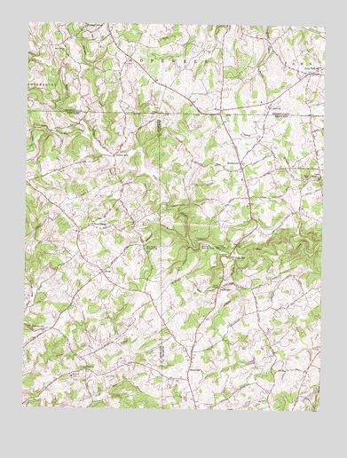
Norrisville, MD USGS Topographic Map
Click on map above to begin viewing in our Map Viewer.

This topographic map contains these locations and features:
Feature Name Type Latitude Longitude GNIS ID View Map
Amos MillPopulated PlaceN39.7004°W76.5011°589642View Map
Ayers ChapelChurchN39.6648°W76.5425°582961View Map
BradenbaughPopulated PlaceN39.6498°W76.5230°1697880View Map
Bradenbaugh ManorPopulated PlaceN39.6518°W76.5366°1697881View Map
Camp Deer CreekLocaleN39.6770°W76.5425°583561View Map
CareaPopulated PlaceN39.7015°W76.5061°588631View Map
Cattail ReservoirReservoirN39.6319°W76.5010°594277View Map
Centre ChurchChurchN39.7234°W76.5219°1171511View Map
Church Lane SpringSpringN39.6979°W76.5511°1698651View Map
Circadian FarmsLocaleN39.6481°W76.6217°2663549View Map
DrybranchPopulated PlaceN39.6637°W76.5433°590114View Map
Ebaughs CreekStreamN39.7073°W76.5902°584239View Map
Falling Rocks BranchStreamN39.6810°W76.5173°2680021View Map
FarmingtonPopulated PlaceN39.6320°W76.5394°1697897View Map
Gorsuch MillsPopulated PlaceN39.7070°W76.5880°593626View Map
Greystone Golf CourseLocaleN39.6340°W76.6061°2503334View Map
Harford County Public Library - Norrisville BranchBuildingN39.7018°W76.5344°2503356View Map
Harford Manor FarmsLocaleN39.6601°W76.5052°1697905View Map
Harris Mill CreekStreamN39.7132°W76.5977°584883View Map
Holiday HillsPopulated PlaceN39.6945°W76.5633°1697912View Map
Hopewell CemeteryCemeteryN39.7373°W76.5843°1177391View Map
Indian HillsPopulated PlaceN39.6801°W76.5105°1697914View Map
Indian MeadowsPopulated PlaceN39.6993°W76.5769°593677View Map
Ivory MillPopulated PlaceN39.6743°W76.5364°590545View Map
Jackson BranchStreamN39.6729°W76.5352°585182View Map
Jolly Acres Summer CampLocaleN39.6784°W76.5472°585262View Map
Jordan Mill FarmsPopulated PlaceN39.6870°W76.6086°593696View Map
Little Deer CreekStreamN39.7154°W76.6241°585458View Map
Little Deer CreekStreamN39.7151°W76.6247°1192801View Map
Little Deer Creek Reservoir SiteReservoirN39.6410°W76.5284°594283View Map
Madonna ManorPopulated PlaceN39.6295°W76.5052°1697917View Map
Manor Hill FarmLocaleN39.6409°W76.5447°1697918View Map
Marsteller Airport (historical)AirportN39.7334°W76.5330°1193726View Map
McKendree Church (historical)ChurchN39.6265°W76.5441°1697919View Map
McKendree Methodist Episcopal Church CemeteryCemeteryN39.6268°W76.5442°585765View Map
Meadow StreamPopulated PlaceN39.6904°W76.5241°1697920View Map
Nestling WindPopulated PlaceN39.7076°W76.5080°1697926View Map
New Bethel ChurchChurchN39.7412°W76.6091°1182286View Map
New ParkPopulated PlaceN39.7348°W76.5055°1182356View Map
New Park Post OfficePost OfficeN39.7337°W76.5062°2756689View Map
NorrisvillePopulated PlaceN39.7048°W76.5347°586209View Map
Norrisville Elementary SchoolSchoolN39.7001°W76.5338°1697927View Map
Norrisville Reading CenterBuildingN39.7029°W76.5330°1697929View Map
Norrisville Recreation ComplexParkN39.6998°W76.5350°1697930View Map
North Green RidgePopulated PlaceN39.6915°W76.5655°1697934View Map
Nottinghamshire FarmsPopulated PlaceN39.6518°W76.5816°593771View Map
Oak ValleyPopulated PlaceN39.6626°W76.5889°593750View Map
Old York ManorPopulated PlaceN39.6487°W76.5622°1697941View Map
Parker Conservation AreaParkN39.6820°W76.5525°1697943View Map
Pine Grove Memorial ChurchChurchN39.6765°W76.5727°586518View Map
Plumtree BranchStreamN39.6807°W76.5566°586614View Map
Rolling KnollsPopulated PlaceN39.6395°W76.5011°1697948View Map
ShanePopulated PlaceN39.6693°W76.5919°591261View Map
Shane ValleyPopulated PlaceN39.6968°W76.5805°593802View Map
ShawsvillePopulated PlaceN39.6379°W76.5550°591268View Map
Shawsville AcresPopulated PlaceN39.6315°W76.5519°1697953View Map
StablersvillePopulated PlaceN39.6507°W76.6158°591341View Map
Township of HopewellCivilN39.7455°W76.5555°1217292View Map
TrumpPopulated PlaceN39.6823°W76.6022°593847View Map
VernonPopulated PlaceN39.6373°W76.5977°588738View Map
Vernon ChurchChurchN39.6343°W76.5986°593861View Map
Walnut SpringsPopulated PlaceN39.6626°W76.5811°593864View Map
West LibertyPopulated PlaceN39.6845°W76.5972°591522View Map
West Liberty United Methodist ChurchChurchN39.6851°W76.5972°593868View Map
WileyPopulated PlaceN39.7223°W76.5433°1204951View Map
Wiley FallsFallsN39.6830°W76.5189°2680020View Map
Wileys CornerLocaleN39.7209°W76.5436°1697959View Map

Note: Coordinates in the location and feature list above are referenced to NAD83 datum.


Copyright (C) 2008-2025 Ryan Niemi / Sunset Dynamics ... All Rights Reserved