TopoQuest Logo
Do you find TopoQuest useful?
Help keep TopoQuest running and adding new maps/features by donating!
Bitcoin:  19c7KJd3qBynnjoSw5npx9KScwjBe4ifkT
Litecoin:  LXs6TkuXGGXo1vDsWCkWVdjQX94eUKd6ui
Home View Maps Find Maps Find Places Resources & Links


Gannett, Idaho Topographic Map

USGS Map Title: Gannett, ID
USGS Map MRC: 43114C2
DRG (GeoTIFF) Download: o43114c2.tif


Neighboring USGS Topographic Map Quads:


  Bellevue, ID  
43114D3
 

  Seamans Creek, ID  
43114D2
 

  Little Wood River Reservoir, ID  
43114D1
 

  Magic Reservoir East, ID  
43114C3
 

  Gannett, ID  
43114C2
 

  Picabo, ID  
43114C1
 

  Shoshone Ice Cave, ID  
43114B3
 

  Tapper Lake, ID  
43114B2
 

  Tikura, ID  
43114B1


Map MRC Location:

N44°
W115°
N44°
W114°
H8 H7 H6 H5 H4 H3 H2 H1
G8 G7 G6 G5 G4 G3 G2 G1
F8 F7 F6 F5 F4 F3 F2 F1
E8 E7 E6 E5 E4 E3 E2 E1
D8 D7 D6 D5 D4 D3 D2 D1
C8 C7 C6 C5 C4 C3 C2 C1
B8 B7 B6 B5 B4 B3 B2 B1
A8 A7 A6 A5 A4 A3 A2 A1
N43°
W115°
N43°
W114°

Gannett, ID USGS 1:24K Topographic Map Preview:
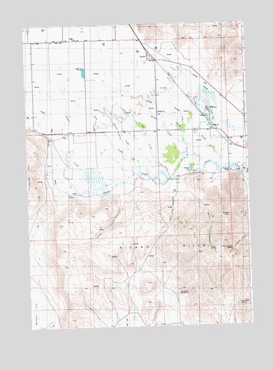
Gannett, ID USGS Topographic Map
Click on map above to begin viewing in our Map Viewer.

This topographic map contains these locations and features:
Feature Name Type Latitude Longitude GNIS ID View Map
Albrethsen DamDamN43.3149°W114.2092°398787View Map
Arrowhead SpringSpringN43.2599°W114.1314°395059View Map
Arrowhead Spring Number TwoSpringN43.2641°W114.1657°395061View Map
Buhler DrainCanalN43.3191°W114.2342°395144View Map
Butte CreekCanalN43.3360°W114.1442°395155View Map
Cain CreekStreamN43.3191°W114.1903°395169View Map
Chaney CreekStreamN43.3130°W114.1853°395197View Map
GannettPopulated PlaceN43.3599°W114.1759°397729View Map
Grove CreekStreamN43.3193°W114.1620°376071View Map
Hailey CanyonValleyN43.3057°W114.1609°395444View Map
Hayspur Fish HatcheryLocaleN43.3391°W114.1467°395455View Map
Highline DitchCanalN43.3410°W114.1336°395470View Map
Kilpatrick BridgeBridgeN43.3146°W114.1359°395551View Map
Leduck Canyon SpringSpringN43.2820°W114.1354°395617View Map
Loving CreekStreamN43.3166°W114.1431°395658View Map
Mud CreekStreamN43.3107°W114.1709°394798View Map
Pasco SpringSpringN43.2826°W114.1474°394895View Map
Patton CreekStreamN43.3041°W114.2092°376066View Map
Picabo HillsRangeN43.2746°W114.1431°374386View Map
Pole Line CanyonValleyN43.3063°W114.1695°394931View Map
Skeeter PointSummitN43.2955°W114.1361°395953View Map
Stalker CreekStreamN43.3193°W114.1603°376076View Map
Stanfield DitchCanalN43.3513°W114.1509°395989View Map
Sullivan LakeLakeN43.3144°W114.1566°396007View Map
Thompson CreekStreamN43.3296°W114.1606°399302View Map
Tieter CanyonValleyN43.3032°W114.1975°399309View Map
Wilson CreekStreamN43.3260°W114.1614°399658View Map

Note: Coordinates in the location and feature list above are referenced to NAD83 datum.


Copyright (C) 2008-2025 Ryan Niemi / Sunset Dynamics ... All Rights Reserved