TopoQuest Logo
Do you find TopoQuest useful?
Help keep TopoQuest running and adding new maps/features by donating!
Bitcoin:  19c7KJd3qBynnjoSw5npx9KScwjBe4ifkT
Litecoin:  LXs6TkuXGGXo1vDsWCkWVdjQX94eUKd6ui
Home View Maps Find Maps Find Places Resources & Links


Pierceton, Indiana Topographic Map

USGS Map Title: Pierceton, IN
USGS Map MRC: 41085B6
DRG (GeoTIFF) Download: o41085b6.tif


Neighboring USGS Topographic Map Quads:


  Leesburg, IN  
41085C7
 

  North Webster, IN  
41085C6
 

  Ormas, IN  
41085C5
 

  Warsaw, IN  
41085B7
 

  Pierceton, IN  
41085B6
 

  Lorane, IN  
41085B5
 

  North Manchester North, IN  
41085A7
 

  South Whitley West, IN  
41085A6
 

  South Whitley East, IN  
41085A5


Map MRC Location:

N42°
W86°
N42°
W85°
H8 H7 H6 H5 H4 H3 H2 H1
G8 G7 G6 G5 G4 G3 G2 G1
F8 F7 F6 F5 F4 F3 F2 F1
E8 E7 E6 E5 E4 E3 E2 E1
D8 D7 D6 D5 D4 D3 D2 D1
C8 C7 C6 C5 C4 C3 C2 C1
B8 B7 B6 B5 B4 B3 B2 B1
A8 A7 A6 A5 A4 A3 A2 A1
N41°
W86°
N41°
W85°

Pierceton, IN USGS 1:24K Topographic Map Preview:
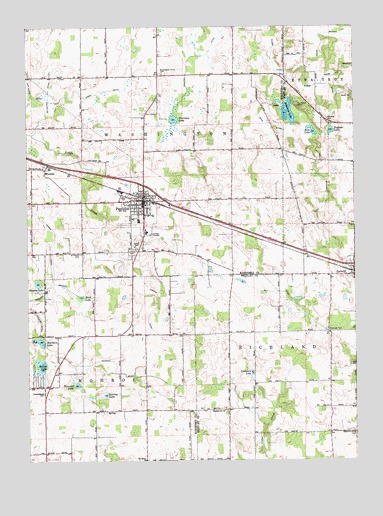
Pierceton, IN USGS Topographic Map
Click on map above to begin viewing in our Map Viewer.

This topographic map contains these locations and features:
Feature Name Type Latitude Longitude GNIS ID View Map
Boonesville ChurchChurchN41.1398°W85.6753°431341View Map
Cedar Lake BranchStreamN41.2334°W85.6375°432284View Map
Compton LakeLakeN41.1505°W85.6647°432843View Map
Doke DitchCanalN41.2209°W85.6561°433611View Map
Eel River ChurchChurchN41.1253°W85.7055°434041View Map
Elder DitchCanalN41.2367°W85.6436°434062View Map
French DitchCanalN41.1689°W85.7000°434831View Map
Guy DitchCanalN41.1717°W85.6500°435565View Map
Hillcrest CemeteryCemeteryN41.1856°W85.7103°436203View Map
Larrew LakeLakeN41.1440°W85.7209°437634View Map
LarwillPopulated PlaceN41.1806°W85.6255°437635View Map
Leedy DitchCanalN41.2317°W85.7225°437742View Map
Mathias DitchCanalN41.2039°W85.6358°438719View Map
McCarter DitchCanalN41.2275°W85.7414°438784View Map
PiercetonPopulated PlaceN41.2003°W85.7055°441110View Map
Pierceton Elementary SchoolSchoolN41.1942°W85.7078°447460View Map
Pierceton Fire DepartmentBuildingN41.1968°W85.7055°2625664View Map
Pierceton LakeLakeN41.2234°W85.6937°441111View Map
Pierceton Police DepartmentBuildingN41.1968°W85.7058°2758342View Map
Pierceton United Methodist ChurchChurchN41.2023°W85.7050°2677375View Map
Reed LakeLakeN41.1720°W85.7295°441854View Map
Richland Center CemeteryCemeteryN41.1328°W85.6253°441961View Map
Rine LakeLakeN41.2202°W85.6410°442046View Map
Robinson LakeLakeN41.2255°W85.6501°442182View Map
Saint Francis CemeteryCemeteryN41.1850°W85.7294°442534View Map
Sellers LakeLakeN41.1526°W85.7454°443210View Map
Shanton DitchCanalN41.2420°W85.6828°443288View Map
Sherburn LakeLakeN41.1597°W85.7455°443360View Map
Stevens LakeLakeN41.1762°W85.7464°444138View Map
Tadpole LakeLakeN41.2199°W85.6340°444542View Map
Tennant DitchCanalN41.1506°W85.7153°444638View Map
Tennant LakeLakeN41.1471°W85.7319°444639View Map
Town of PiercetonCivilN41.1992°W85.7032°2396856View Map
Township of MonroeCivilN41.1475°W85.7422°453641View Map
Township of WashingtonCivilN41.2217°W85.7085°454003View Map
Unrah DitchCanalN41.1873°W85.7411°445153View Map
White BranchCanalN41.2481°W85.6372°445919View Map
Whitko Middle SchoolSchoolN41.1781°W85.6344°447459View Map
WoosterPopulated PlaceN41.2092°W85.7428°446328View Map

Note: Coordinates in the location and feature list above are referenced to NAD83 datum.


Copyright (C) 2008-2025 Ryan Niemi / Sunset Dynamics ... All Rights Reserved