TopoQuest Logo
Do you find TopoQuest useful?
Help keep TopoQuest running and adding new maps/features by donating!
Bitcoin:  19c7KJd3qBynnjoSw5npx9KScwjBe4ifkT
Litecoin:  LXs6TkuXGGXo1vDsWCkWVdjQX94eUKd6ui
Home View Maps Find Maps Find Places Resources & Links


South Whitley East, Indiana Topographic Map

USGS Map Title: South Whitley East, IN
USGS Map MRC: 41085A5
DRG (GeoTIFF) Download: o41085a5.tif


Neighboring USGS Topographic Map Quads:


  Pierceton, IN  
41085B6
 

  Lorane, IN  
41085B5
 

  Columbia City, IN  
41085B4
 

  South Whitley West, IN  
41085A6
 

  South Whitley East, IN  
41085A5
 

  Laud, IN  
41085A4
 

  Servia, IN  
40085H6
 

  Bippus, IN  
40085H5
 

  Huntington, IN  
40085H4


Map MRC Location:

N42°
W86°
N42°
W85°
H8 H7 H6 H5 H4 H3 H2 H1
G8 G7 G6 G5 G4 G3 G2 G1
F8 F7 F6 F5 F4 F3 F2 F1
E8 E7 E6 E5 E4 E3 E2 E1
D8 D7 D6 D5 D4 D3 D2 D1
C8 C7 C6 C5 C4 C3 C2 C1
B8 B7 B6 B5 B4 B3 B2 B1
A8 A7 A6 A5 A4 A3 A2 A1
N41°
W86°
N41°
W85°

South Whitley East, IN USGS 1:24K Topographic Map Preview:
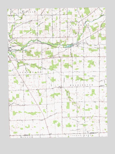
South Whitley East, IN USGS Topographic Map
Click on map above to begin viewing in our Map Viewer.

This topographic map contains these locations and features:
Feature Name Type Latitude Longitude GNIS ID View Map
Centenary ChurchChurchN41.0170°W85.5853°432303View Map
Clear CreekStreamN41.0942°W85.6222°432612View Map
Cleveland CemeteryCemeteryN41.0711°W85.6019°432646View Map
County Farm DitchCanalN41.1220°W85.5058°433035View Map
Cox BranchStreamN41.0595°W85.5375°433059View Map
Eberhard ChurchChurchN41.0909°W85.5358°433985View Map
Fairview ChurchChurchN41.0539°W85.6055°434344View Map
Gable DitchCanalN41.0523°W85.5705°434910View Map
Huffman BranchStreamN41.0592°W85.5528°436584View Map
Lee DitchCanalN41.0064°W85.5469°437736View Map
Lehman DitchCanalN41.0145°W85.5364°437755View Map
LutherPopulated PlaceN41.0028°W85.5739°438413View Map
Saint Johns ChurchChurchN41.0889°W85.5378°442595View Map
Saint Peters CemeteryCemeteryN41.0906°W85.5294°442802View Map
Schoenauer DitchCanalN41.1145°W85.5872°443088View Map
South Whitley PitMineN41.0772°W85.6211°2649688View Map
Spring CreekStreamN41.0870°W85.6066°443975View Map
Stony CreekStreamN41.0906°W85.5380°444226View Map
Sugar CreekStreamN41.0809°W85.6205°444317View Map
Sugar Creek ChurchChurchN41.0481°W85.5580°444333View Map
Township of WashingtonCivilN41.0468°W85.5099°454025View Map
TunkerPopulated PlaceN41.0487°W85.5575°444950View Map
Washington CenterPopulated PlaceN41.0484°W85.5094°445498View Map
Washington Township SchoolSchoolN41.0492°W85.5089°447498View Map
Washington Township Volunteer Fire Department Columbia CityBuildingN41.0505°W85.5089°2626266View Map
Williamson DitchCanalN41.0620°W85.6019°446085View Map

Note: Coordinates in the location and feature list above are referenced to NAD83 datum.


Copyright (C) 2008-2024 Ryan Niemi / Sunset Dynamics ... All Rights Reserved