TopoQuest Logo
Do you find TopoQuest useful?
Help keep TopoQuest running and adding new maps/features by donating!
Bitcoin:  19c7KJd3qBynnjoSw5npx9KScwjBe4ifkT
Litecoin:  LXs6TkuXGGXo1vDsWCkWVdjQX94eUKd6ui
Home View Maps Find Maps Find Places Resources & Links


Bessemer Mountain, Wyoming Topographic Map

USGS Map Title: Bessemer Mountain, WY
USGS Map MRC: 42106F5
DRG (GeoTIFF) Download: o42106f5.tif


Neighboring USGS Topographic Map Quads:


  Oil Mountain, WY  
42106G6
 

  Emigrant Gap, WY  
42106G5
 

  Goose Egg, WY  
42106G4
 

  Clarkson Hill, WY  
42106F6
 

  Bessemer Mountain, WY  
42106F5
 

  Freeland, WY  
42106F4
 

  Alcova, WY  
42106E6
 

  Alcova SE, WY  
42106E5
 

  Twin Buttes, WY  
42106E4


Map MRC Location:

N43°
W107°
N43°
W106°
H8 H7 H6 H5 H4 H3 H2 H1
G8 G7 G6 G5 G4 G3 G2 G1
F8 F7 F6 F5 F4 F3 F2 F1
E8 E7 E6 E5 E4 E3 E2 E1
D8 D7 D6 D5 D4 D3 D2 D1
C8 C7 C6 C5 C4 C3 C2 C1
B8 B7 B6 B5 B4 B3 B2 B1
A8 A7 A6 A5 A4 A3 A2 A1
N42°
W107°
N42°
W106°

Bessemer Mountain, WY USGS 1:24K Topographic Map Preview:
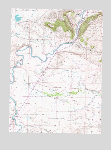
Bessemer Mountain, WY USGS Topographic Map
Click on map above to begin viewing in our Map Viewer.

This topographic map contains these locations and features:
Feature Name Type Latitude Longitude GNIS ID View Map
Bates CreekStreamN42.6922°W106.6150°1597959View Map
Bates Creek SchoolSchoolN42.6708°W106.5939°1585195View Map
Bear CreekStreamN42.6252°W106.6136°1585250View Map
Bessemer MountainSummitN42.7383°W106.5542°1585407View Map
Bessemer NarrowsValleyN42.7339°W106.5350°1585408View Map
Bolton CreekStreamN42.6325°W106.6117°1585758View Map
Clark RanchLocaleN42.6602°W106.5625°1586739View Map
Coal CreekStreamN42.7155°W106.5453°1586809View Map
Cottonwood CreekStreamN42.7172°W106.5392°1587039View Map
Goose Egg Number Two MineMineN42.7405°W106.5311°1746847View Map
Goose Egg SpringSpringN42.7438°W106.5315°1588973View Map
Government BridgeBridgeN42.6380°W106.6178°1588996View Map
Haygood DamDamN42.6400°W106.5973°1605951View Map
Haygood ReservoirReservoirN42.6398°W106.5994°1605952View Map
O'Brien DamDamN42.6683°W106.5589°1605917View Map
O'Brien ReservoirReservoirN42.6683°W106.5589°1605918View Map
Oregon Trail Historical MarkerParkN42.7411°W106.5248°1592469View Map
Rasmus Lee LakeLakeN42.7403°W106.6161°1593172View Map
Red ButtesSummitN42.7439°W106.5048°1593246View Map
Speas RanchLocaleN42.7441°W106.5311°1594770View Map
Stinking CreekStreamN42.6619°W106.5550°1596942View Map
Two Bar RanchLocaleN42.6655°W106.5120°1595818View Map
Willow CreekStreamN42.7252°W106.6125°1596444View Map
Winter CrossingCrossingN42.7094°W106.5636°1597545View Map

Note: Coordinates in the location and feature list above are referenced to NAD83 datum.


Copyright (C) 2008-2025 Ryan Niemi / Sunset Dynamics ... All Rights Reserved