TopoQuest Logo
Do you find TopoQuest useful?
Help keep TopoQuest running and adding new maps/features by donating!
Bitcoin:  19c7KJd3qBynnjoSw5npx9KScwjBe4ifkT
Litecoin:  LXs6TkuXGGXo1vDsWCkWVdjQX94eUKd6ui
Home View Maps Find Maps Find Places Resources & Links


Goose Egg, Wyoming Topographic Map

USGS Map Title: Goose Egg, WY
USGS Map MRC: 42106G4
DRG (GeoTIFF) Download: o42106g4.tif


Neighboring USGS Topographic Map Quads:


  Emigrant Gap NE, WY  
42106H5
 

  Bishop, WY  
42106H4
 

  The Reefs, WY  
42106H3
 

  Emigrant Gap, WY  
42106G5
 

  Goose Egg, WY  
42106G4
 

  Casper, WY  
42106G3
 

  Bessemer Mountain, WY  
42106F5
 

  Freeland, WY  
42106F4
 

  Crimson Dawn, WY  
42106F3


Map MRC Location:

N43°
W107°
N43°
W106°
H8 H7 H6 H5 H4 H3 H2 H1
G8 G7 G6 G5 G4 G3 G2 G1
F8 F7 F6 F5 F4 F3 F2 F1
E8 E7 E6 E5 E4 E3 E2 E1
D8 D7 D6 D5 D4 D3 D2 D1
C8 C7 C6 C5 C4 C3 C2 C1
B8 B7 B6 B5 B4 B3 B2 B1
A8 A7 A6 A5 A4 A3 A2 A1
N42°
W107°
N42°
W106°

Goose Egg, WY USGS 1:24K Topographic Map Preview:
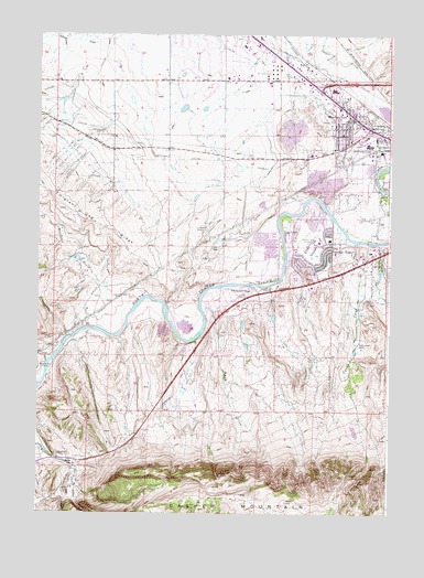
Goose Egg, WY USGS Topographic Map
Click on map above to begin viewing in our Map Viewer.

This topographic map contains these locations and features:
Feature Name Type Latitude Longitude GNIS ID View Map
Blue Hill DepositMineN42.7797°W106.4892°1746857View Map
Boels-Rimrock PitMineN42.8422°W106.3839°1746856View Map
Casper Fire - Emergency Medical Services Station 6BuildingN42.8121°W106.4010°2673429View Map
Custard Massacre SiteLocaleN42.8364°W106.3975°1587305View Map
Goose EggPopulated PlaceN42.7625°W106.4867°1597334View Map
Goose Egg Number One MineMineN42.7691°W106.4714°1746858View Map
Goose Egg Post Office (historical)Post OfficeN42.7625°W106.4939°1782078View Map
Gotheberg DrawValleyN42.7605°W106.4861°1584658View Map
Horsch Stockwater DamDamN42.7983°W106.4023°1606055View Map
Horsch Stockwater ReservoirReservoirN42.7983°W106.4023°1606056View Map
Izaak Walton ParkParkN42.8389°W106.3784°1609108View Map
Jackson CanyonValleyN42.7580°W106.4884°1590028View Map
MacNales CreekStreamN42.8055°W106.4642°1591147View Map
Mills Police DepartmentBuildingN42.8532°W106.3861°2752632View Map
Mills Post OfficePost OfficeN42.8448°W106.3761°2765612View Map
Mills Volunteer Fire DepartmentBuildingN42.8525°W106.3853°2673482View Map
Mohawk WellWellN42.7880°W106.4953°1591676View Map
Mountain ViewPopulated PlaceN42.8536°W106.3886°1591811View Map
Mountain View Census Designated PlaceCensusN42.8683°W106.4116°2408885View Map
Paradise ValleyPopulated PlaceN42.8175°W106.3984°1592570View Map
Paradise Valley Country ClubLocaleN42.8216°W106.4014°1605412View Map
Red ButtePopulated PlaceN42.8061°W106.4342°1853210View Map
Red Butte Census Designated PlaceCensusN42.8050°W106.4339°2409148View Map
Red Buttes Battle SiteLocaleN42.8066°W106.4261°1782077View Map
Red Buttes Burial GroundCemeteryN42.8258°W106.4398°2774500View Map
Red Buttes VillagePopulated PlaceN42.8080°W106.4220°1593247View Map
S P DamDamN42.7933°W106.4239°1606053View Map
S P ReservoirReservoirN42.7933°W106.4239°1606054View Map
Soap Creek Number One MineMineN42.8158°W106.4992°1746859View Map
Squaw CreekStreamN42.8097°W106.3795°1594945View Map
Squaw Creek RanchLocaleN42.7941°W106.3859°1594948View Map
Town of MillsCivilN42.8473°W106.3819°2413001View Map
Vista WestPopulated PlaceN42.8669°W106.4347°2413680View Map
Vista West Census Designated PlaceCensusN42.8620°W106.4361°2409519View Map
Webb DrawValleyN42.8036°W106.4414°1596104View Map
Wolf CreekStreamN42.8208°W106.3789°1596575View Map

Note: Coordinates in the location and feature list above are referenced to NAD83 datum.


Copyright (C) 2008-2024 Ryan Niemi / Sunset Dynamics ... All Rights Reserved