TopoQuest Logo
Do you find TopoQuest useful?
Help keep TopoQuest running and adding new maps/features by donating!
Bitcoin:  19c7KJd3qBynnjoSw5npx9KScwjBe4ifkT
Litecoin:  LXs6TkuXGGXo1vDsWCkWVdjQX94eUKd6ui
Home View Maps Find Maps Find Places Resources & Links


Freeland, Wyoming Topographic Map

USGS Map Title: Freeland, WY
USGS Map MRC: 42106F4
DRG (GeoTIFF) Download: o42106f4.tif


Neighboring USGS Topographic Map Quads:


  Emigrant Gap, WY  
42106G5
 

  Goose Egg, WY  
42106G4
 

  Casper, WY  
42106G3
 

  Bessemer Mountain, WY  
42106F5
 

  Freeland, WY  
42106F4
 

  Crimson Dawn, WY  
42106F3
 

  Alcova SE, WY  
42106E5
 

  Twin Buttes, WY  
42106E4
 

  Sheep Creek, WY  
42106E3


Map MRC Location:

N43°
W107°
N43°
W106°
H8 H7 H6 H5 H4 H3 H2 H1
G8 G7 G6 G5 G4 G3 G2 G1
F8 F7 F6 F5 F4 F3 F2 F1
E8 E7 E6 E5 E4 E3 E2 E1
D8 D7 D6 D5 D4 D3 D2 D1
C8 C7 C6 C5 C4 C3 C2 C1
B8 B7 B6 B5 B4 B3 B2 B1
A8 A7 A6 A5 A4 A3 A2 A1
N42°
W107°
N42°
W106°

Freeland, WY USGS 1:24K Topographic Map Preview:
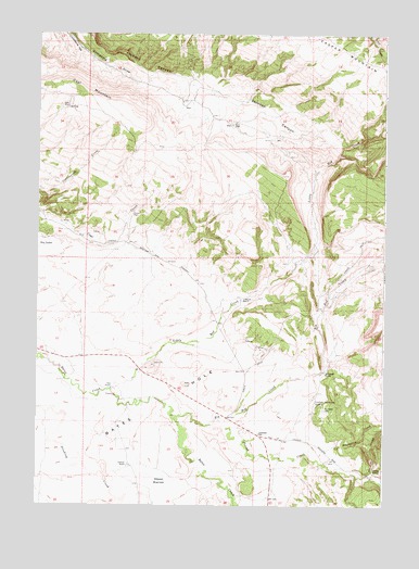
Freeland, WY USGS Topographic Map
Click on map above to begin viewing in our Map Viewer.

This topographic map contains these locations and features:
Feature Name Type Latitude Longitude GNIS ID View Map
Bates Creek Area Number One MineMineN42.6669°W106.4178°1746845View Map
Bates Creek Area Number Two MineMineN42.6972°W106.4800°1746846View Map
Bates HoleBendN42.6527°W106.4553°1585198View Map
Big Red CreekStreamN42.6480°W106.4500°1585493View Map
Coal MountainSummitN42.7358°W106.4848°1586851View Map
Corral CreekStreamN42.6477°W106.4345°1586998View Map
Crescent RanchLocaleN42.6794°W106.4261°1587211View Map
Dry LakesLakeN42.6930°W106.4975°1587866View Map
Freeland CemeteryCemeteryN42.6506°W106.3966°1588734View Map
Freeland Community BuildingLocaleN42.6522°W106.3998°1588735View Map
Freeland SchoolSchoolN42.6436°W106.4200°1588736View Map
Garden CreekStreamN42.6325°W106.3822°1588799View Map
Greene Place (historical)LocaleN42.7016°W106.4664°1597337View Map
Limestone HillSummitN42.7458°W106.4875°1590691View Map
Little Red CreekStreamN42.6552°W106.4739°1590855View Map
Martin RanchLocaleN42.6336°W106.3778°1591233View Map
McGraugh RanchLocaleN42.6600°W106.3964°1591334View Map
Mills PlaceLocaleN42.7302°W106.4895°1597411View Map
Nall RanchLocaleN42.6558°W106.4728°1591952View Map
Pitchpine CreekStreamN42.6364°W106.3967°1592860View Map
Price Place (historical)LocaleN42.7266°W106.4309°1597463View Map
Schnoor DamDamN42.6350°W106.4573°1605915View Map
Schnoor RanchLocaleN42.6355°W106.4664°1593994View Map
Schnoor ReservoirReservoirN42.6350°W106.4573°1605916View Map
Schnoor ReservoirReservoirN42.6316°W106.4559°1593995View Map

Note: Coordinates in the location and feature list above are referenced to NAD83 datum.


Copyright (C) 2008-2025 Ryan Niemi / Sunset Dynamics ... All Rights Reserved