TopoQuest Logo
Do you find TopoQuest useful?
Help keep TopoQuest running and adding new maps/features by donating!
Bitcoin:  19c7KJd3qBynnjoSw5npx9KScwjBe4ifkT
Litecoin:  LXs6TkuXGGXo1vDsWCkWVdjQX94eUKd6ui
Home View Maps Find Maps Find Places Resources & Links


Pinconning, Michigan Topographic Map

USGS Map Title: Pinconning, MI
USGS Map MRC: 43083G8
DRG (GeoTIFF) Download: o43083g8.tif


Neighboring USGS Topographic Map Quads:


  Mount Forest, MI  
43084H1
 

  Standish, MI  
43083H8
 

  Standish NE, MI  
43083H7
 

  Crump, MI  
43084G1
 

  Pinconning, MI  
43083G8


  Willard, MI  
43084F1
 

  Kawkawlin, MI  
43083F8
 

  Bay City NE, MI  
43083F7


Map MRC Location:

N44°
W84°
N44°
W83°
H8 H7 H6 H5 H4 H3 H2 H1
G8 G7 G6 G5 G4 G3 G2 G1
F8 F7 F6 F5 F4 F3 F2 F1
E8 E7 E6 E5 E4 E3 E2 E1
D8 D7 D6 D5 D4 D3 D2 D1
C8 C7 C6 C5 C4 C3 C2 C1
B8 B7 B6 B5 B4 B3 B2 B1
A8 A7 A6 A5 A4 A3 A2 A1
N43°
W84°
N43°
W83°

Pinconning, MI USGS 1:24K Topographic Map Preview:
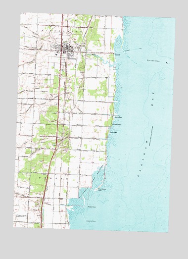
Pinconning, MI USGS Topographic Map
Click on map above to begin viewing in our Map Viewer.

This topographic map contains these locations and features:
Feature Name Type Latitude Longitude GNIS ID View Map
Almeda BeachPopulated PlaceN43.8175°W83.9230°620007View Map
Apostolic Lighthouse ChurchChurchN43.8486°W83.9658°2547376View Map
Bartlett DrainCanalN43.8467°W83.9694°620659View Map
Bay County Pinconning ParkParkN43.8628°W83.9250°2547386View Map
Bible Baptist ChurchChurchN43.8556°W83.9689°2547378View Map
Branch Number One Johnson DrainStreamN43.8220°W83.9878°621876View Map
Branch Number One Lambert DrainStreamN43.7567°W83.9883°621877View Map
Branch Number Two Johnson DrainStreamN43.8214°W83.9875°621879View Map
Central Elementary SchoolSchoolN43.8514°W83.9700°2547391View Map
City of PinconningCivilN43.8573°W83.9638°1626901View Map
Esseltine Extension DrainStreamN43.8297°W83.9867°625645View Map
Fanger DrainStreamN43.8603°W83.9817°625822View Map
Fraser Garfield DrainStreamN43.7678°W83.9803°626435View Map
Fraser Township CemeteryCemeteryN43.8047°W83.9581°2548204View Map
Gilmans Landing RampLocaleN43.7964°W83.9275°1618153View Map
Green Hills Golf CourseLocaleN43.7861°W83.9744°2547405View Map
Gregory DrainCanalN43.7734°W83.9917°627404View Map
Gregory DrainStreamN43.7636°W83.9522°627405View Map
Indian CemeteryCemeteryN43.8572°W83.9311°2548203View Map
Jerry Genows MarinaLocaleN43.8439°W83.9239°1618523View Map
Johnson DrainStreamN43.8172°W83.9183°629333View Map
Kingdom Hall of Jehovah's WitnessesChurchN43.8617°W83.9592°2547374View Map
Lambert DrainStreamN43.7678°W83.9800°630092View Map
Lengsville PointCapeN43.7553°W83.9414°630310View Map
Lengsville Post Office (historical)Post OfficeN43.7533°W83.9575°2548107View Map
Lengsville Station (historical)LocaleN43.7533°W83.9575°2547447View Map
Mallard PointCapeN43.7636°W83.9400°631356View Map
Meddough DrainStreamN43.7995°W83.9803°632068View Map
Meyers BeachPopulated PlaceN43.8072°W83.9255°632179View Map
Michalski DrainStreamN43.8253°W83.9714°632188View Map
Michie Post Office (historical)Post OfficeN43.8039°W83.9578°2547917View Map
Michie Station (historical)LocaleN43.8039°W83.9578°2547446View Map
Nayanquing PointCapeN43.7736°W83.9341°633240View Map
Nayanquing Point Wildlife AreaParkN43.7814°W83.9347°633241View Map
Northern Bay Ambulance and RescueBuildingN43.8549°W83.9669°2661950View Map
Northern Bay Healthcare ClinicHospitalN43.8681°W83.9664°2547372View Map
Nu-Crest BeachLocaleN43.8120°W83.9230°633780View Map
PinconningPopulated PlaceN43.8536°W83.9650°634899View Map
Pinconning - Fraser Fire Department Station 15BuildingN43.8682°W83.9759°2626911View Map
Pinconning - Fraser Fire Department Station 16BuildingN43.7826°W83.9867°2626772View Map
Pinconning Area CemeteryCemeteryN43.8433°W83.9469°2548202View Map
Pinconning BarBarN43.8500°W83.8833°634900View Map
Pinconning Branch LibraryBuildingN43.8558°W83.9614°2547389View Map
Pinconning City HallBuildingN43.8575°W83.9625°2547370View Map
Pinconning Medical CenterHospitalN43.8556°W83.9639°2547371View Map
Pinconning Police DeptBuildingN43.8562°W83.9624°2547385View Map
Pinconning Post OfficePost OfficeN43.8560°W83.9610°2547388View Map
Pinconning RiverStreamN43.8470°W83.9208°634901View Map
Pinconning Senior High SchoolSchoolN43.8528°W83.9689°2547390View Map
Pinconning StationLocaleN43.8544°W83.9617°2547380View Map
Pinconning Township HallBuildingN43.8683°W83.9758°2547387View Map
Pinconning WaterworksLocaleN43.8528°W83.9236°1623565View Map
Saint John Memorial CemeteryCemeteryN43.8526°W83.9504°636706View Map
Saint John's Lutheran ChurchChurchN43.8536°W83.9731°2547379View Map
Saint Michael's ChurchChurchN43.8558°W83.9575°2547375View Map
Saint Michaels CemeteryCemeteryN43.8538°W83.9476°636955View Map
Saint Michaels SchoolSchoolN43.8561°W83.9589°2547381View Map
Tebo DrainStreamN43.8034°W83.9247°1614651View Map
Tebo Post Office (historical)Post OfficeN43.8111°W83.9864°2547912View Map
Thume DrainStreamN43.7961°W83.9269°1614836View Map
Township of FraserCivilN43.7829°W83.9802°1626309View Map
Township of PinconningCivilN43.8685°W83.9732°1626902View Map
United Methodist ChurchChurchN43.8553°W83.9719°2547377View Map
Walk DrainStreamN43.8539°W83.9833°1615687View Map
Wesleyan ChurchChurchN43.8608°W83.9706°2547373View Map
Wharf MarinaLocaleN43.8672°W83.9169°1618524View Map
Willette DrainStreamN43.8109°W83.9233°1616494View Map

Note: Coordinates in the location and feature list above are referenced to NAD83 datum.


Copyright (C) 2008-2024 Ryan Niemi / Sunset Dynamics ... All Rights Reserved