TopoQuest Logo
Do you find TopoQuest useful?
Help keep TopoQuest running and adding new maps/features by donating!
Bitcoin:  19c7KJd3qBynnjoSw5npx9KScwjBe4ifkT
Litecoin:  LXs6TkuXGGXo1vDsWCkWVdjQX94eUKd6ui
Home View Maps Find Maps Find Places Resources & Links


Pine, Louisiana Topographic Map

USGS Map Title: Pine, LA
USGS Map MRC: 30090H1
DRG (GeoTIFF) Download: o30090h1.tif


Neighboring USGS Topographic Map Quads:


  Tylertown, MS  
31090A2
 

  Tylertown SE, MS  
31090A1
 

  Dexter, MS  
31089A8
 

  Clifton, LA  
30090H2
 

  Pine, LA  
30090H1
 

  State Line, LA  
30089H8
 

  Franklinton, LA  
30090G2
 

  Sheridan, LA  
30090G1
 

  Bogalusa West, LA  
30089G8


Map MRC Location:

N31°
W91°
N31°
W90°
H8 H7 H6 H5 H4 H3 H2 H1
G8 G7 G6 G5 G4 G3 G2 G1
F8 F7 F6 F5 F4 F3 F2 F1
E8 E7 E6 E5 E4 E3 E2 E1
D8 D7 D6 D5 D4 D3 D2 D1
C8 C7 C6 C5 C4 C3 C2 C1
B8 B7 B6 B5 B4 B3 B2 B1
A8 A7 A6 A5 A4 A3 A2 A1
N30°
W91°
N30°
W90°

Pine, LA USGS 1:24K Topographic Map Preview:
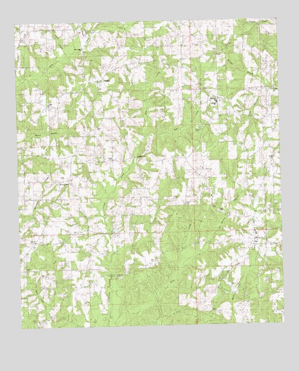
Pine, LA USGS Topographic Map
Click on map above to begin viewing in our Map Viewer.

This topographic map contains these locations and features:
Feature Name Type Latitude Longitude GNIS ID View Map
Aces Creek School (historical)SchoolN30.9135°W90.0706°543914View Map
Acys CreekStreamN30.9057°W90.0823°553319View Map
Acys Creek Baptist ChurchChurchN30.8952°W90.0773°559624View Map
Beard CemeteryCemeteryN30.8991°W90.1223°543882View Map
Black Jack School (historical)SchoolN30.9641°W90.1084°543912View Map
Boggy BranchStreamN30.9407°W90.0718°543915View Map
Breland CemeteryCemeteryN30.9266°W90.0131°543884View Map
Camp Seven (historical)Populated PlaceN30.9552°W90.0279°543923View Map
Crain CemeteryCemeteryN30.9546°W90.0015°534232View Map
Crains Creek School (historical)SchoolN30.9677°W90.0062°543927View Map
Curter CemeteryCemeteryN30.8777°W90.1176°543885View Map
Duncan CemeteryCemeteryN30.9224°W90.0009°543887View Map
East Fork Burch CreekStreamN30.8832°W90.1118°534712View Map
East Fork Lawrence CreekStreamN30.9524°W90.0643°554319View Map
Faith CemeteryCemeteryN30.9238°W90.0334°543888View Map
Faith ChurchChurchN30.9285°W90.0326°534890View Map
Fisher CemeteryCemeteryN30.9363°W90.1029°543889View Map
Gay CemeteryCemeteryN30.9482°W90.0181°543890View Map
Gerald CemeteryCemeteryN30.9427°W90.0034°543891View Map
HackleyPopulated PlaceN30.9760°W90.0856°535479View Map
Hays ChurchChurchN30.9666°W90.1095°543893View Map
Hunt CemeteryCemeteryN30.8810°W90.0320°543894View Map
Hurricane School (historical)SchoolN30.9113°W90.1168°543910View Map
Indian CreekStreamN30.9849°W90.1006°535922View Map
Knight CemeteryCemeteryN30.8935°W90.0056°543917View Map
Lawrences Creek Baptist ChurchChurchN30.9435°W90.0679°559691View Map
Magee CemeteryCemeteryN30.9430°W90.0801°536829View Map
Magee CemeteryCemeteryN30.9568°W90.0876°543895View Map
Martin CemeteryCemeteryN30.9141°W90.1006°536915View Map
Millers Creek School (historical)SchoolN30.8966°W90.0645°543913View Map
Missionary ChurchChurchN30.9105°W90.0129°543896View Map
Morgan BranchStreamN30.9718°W90.0040°555372View Map
Mount Zion Holiness ChurchChurchN30.9349°W90.1034°543897View Map
Noble CemeteryCemeteryN30.9218°W90.0287°555503View Map
Orrs Store (historical)LocaleN30.9077°W90.0134°543918View Map
Parish Governing Authority District 10 (historical)CivilN30.9313°W90.1081°1929793View Map
Parish Governing Authority District 6CivilN30.9196°W90.1111°1930164View Map
Payne CemeteryCemeteryN30.9871°W90.0287°555610View Map
PinePopulated PlaceN30.9077°W90.0137°538156View Map
Pine CemeteryCemeteryN30.9096°W90.0142°543920View Map
Pine First Baptist ChurchChurchN30.9091°W90.0140°543919View Map
Pine Junior Senior High SchoolSchoolN30.9250°W90.0150°543921View Map
Pine School (historical)SchoolN30.9141°W90.0062°543922View Map
Pine Volunteer Fire DepartmentBuildingN30.9188°W90.0115°2691817View Map
Rodgers Mill (historical)LocaleN30.9135°W90.0843°543911View Map
Schilling CemeteryCemeteryN30.8868°W90.0970°539211View Map
ThomasPopulated PlaceN30.9680°W90.0287°543724View Map
Thomas BranchStreamN30.9007°W90.0484°539873View Map
Thomas CemeteryCemeteryN30.9563°W90.0390°539875View Map
Thomas Elementary SchoolSchoolN30.9665°W90.0294°543924View Map
Thomas First Baptist ChurchChurchN30.9668°W90.0279°543925View Map
Thomas School (historical)SchoolN30.9796°W90.0320°543926View Map
Tom BranchStreamN30.9716°W90.0042°539955View Map
Ward EightCivilN30.9535°W90.1087°545262View Map
Warren CemeteryCemeteryN30.9246°W90.0451°543898View Map
Washington Parish Fire Protection District 3BuildingN30.9633°W90.0827°2332508View Map
Water Valley ChurchChurchN30.9885°W90.0934°540248View Map
West Fork Burch CreekStreamN30.8832°W90.1123°556389View Map
West Fork Lawrence CreekStreamN30.9524°W90.0645°540321View Map

Note: Coordinates in the location and feature list above are referenced to NAD83 datum.


Copyright (C) 2008-2025 Ryan Niemi / Sunset Dynamics ... All Rights Reserved