TopoQuest Logo
Do you find TopoQuest useful?
Help keep TopoQuest running and adding new maps/features by donating!
Bitcoin:  19c7KJd3qBynnjoSw5npx9KScwjBe4ifkT
Litecoin:  LXs6TkuXGGXo1vDsWCkWVdjQX94eUKd6ui
Home View Maps Find Maps Find Places Resources & Links


Clifton, Louisiana Topographic Map

USGS Map Title: Clifton, LA
USGS Map MRC: 30090H2
DRG (GeoTIFF) Download: o30090h2.tif


Neighboring USGS Topographic Map Quads:


  Progress, MS  
31090A3
 

  Tylertown, MS  
31090A2
 

  Tylertown SE, MS  
31090A1
 

  Mount Hermon, LA  
30090H3
 

  Clifton, LA  
30090H2
 

  Pine, LA  
30090H1
 

  Wilmer, LA  
30090G3
 

  Franklinton, LA  
30090G2
 

  Sheridan, LA  
30090G1


Map MRC Location:

N31°
W91°
N31°
W90°
H8 H7 H6 H5 H4 H3 H2 H1
G8 G7 G6 G5 G4 G3 G2 G1
F8 F7 F6 F5 F4 F3 F2 F1
E8 E7 E6 E5 E4 E3 E2 E1
D8 D7 D6 D5 D4 D3 D2 D1
C8 C7 C6 C5 C4 C3 C2 C1
B8 B7 B6 B5 B4 B3 B2 B1
A8 A7 A6 A5 A4 A3 A2 A1
N30°
W91°
N30°
W90°

Clifton, LA USGS 1:24K Topographic Map Preview:
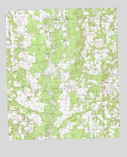
Clifton, LA USGS Topographic Map
Click on map above to begin viewing in our Map Viewer.

This topographic map contains these locations and features:
Feature Name Type Latitude Longitude GNIS ID View Map
Alford CemeteryCemeteryN30.9616°W90.2312°542046View Map
Bankston CemeteryCemeteryN30.9580°W90.2040°532307View Map
Bayou BethStreamN30.9918°W90.1443°543883View Map
Bethel ChurchChurchN30.8916°W90.1687°532973View Map
Bickham CemeteryCemeteryN30.9691°W90.1834°542048View Map
Bogue Chitto Baptist ChurchChurchN30.9793°W90.2045°559663View Map
Bogue Chitto MountainSummitN30.9755°W90.1612°543908View Map
Bridges Mill (historical)LocaleN30.9571°W90.1537°543907View Map
Brockdale ChurchChurchN30.9999°W90.2268°533416View Map
Brown BranchStreamN30.9513°W90.1370°553784View Map
Brown CemeteryCemeteryN30.9177°W90.1337°542054View Map
Brumfield CemeteryCemeteryN30.9271°W90.1434°542055View Map
Brumfield CemeteryCemeteryN30.9124°W90.1287°533446View Map
Bulloch CemeteryCemeteryN30.9152°W90.2259°554145View Map
Burch CemeteryCemeteryN30.8960°W90.2292°533553View Map
CliftonPopulated PlaceN30.9255°W90.1798°534002View Map
Clifton Church (historical)ChurchN30.9224°W90.1823°543902View Map
Clifton Post Office (historical)Post OfficeN30.9249°W90.1793°1632370View Map
Cumnock (historical)Populated PlaceN30.9518°W90.1798°543901View Map
Delany BranchStreamN30.9030°W90.2256°534481View Map
Dyson (historical)Populated PlaceN30.9971°W90.2465°559732View Map
Haley CemeteryCemeteryN30.9343°W90.1320°542069View Map
Hays CreekStreamN30.8816°W90.2026°559685View Map
Hays Creek ChurchChurchN30.9416°W90.1506°535582View Map
Hays Creek ChurchChurchN30.9788°W90.1290°535583View Map
Hays Creek School (historical)SchoolN30.9410°W90.1487°543904View Map
Hinson CemeteryCemeteryN30.9968°W90.2337°535681View Map
James CemeteryCemeteryN30.9471°W90.1326°553626View Map
Jamieson CreekStreamN30.9105°W90.1529°535996View Map
Jerusalem ChurchChurchN30.9274°W90.1573°536028View Map
Jimson Creek School (historical)SchoolN30.9138°W90.1315°543903View Map
Kemp CemeteryCemeteryN30.9152°W90.2468°536166View Map
Lear Hill ChurchChurchN30.9299°W90.1690°536380View Map
Lighthouse ChurchChurchN30.8766°W90.1554°542073View Map
Little Silver CreekStreamN30.9099°W90.2390°555097View Map
Magee CemeteryCemeteryN30.9235°W90.1873°536828View Map
Miller CemeteryCemeteryN30.8930°W90.2206°537133View Map
Miller CemeteryCemeteryN30.8982°W90.2145°542077View Map
Moriah CemeteryCemeteryN30.9441°W90.1573°555232View Map
Morris CemeteryCemeteryN30.9421°W90.2409°542079View Map
Morris CemeteryCemeteryN30.9530°W90.2401°542080View Map
Mount Pisgah ChurchChurchN30.8930°W90.2298°537384View Map
Mount Point School (historical)SchoolN30.9496°W90.2240°543899View Map
Mud CreekStreamN30.9646°W90.1359°555428View Map
Oak Grove School (historical)SchoolN30.9805°W90.2454°543900View Map
Pierces Mill (historical)LocaleN30.9491°W90.1345°543906View Map
Saint James CemeteryCemeteryN30.9330°W90.1604°542085View Map
Seale CemeteryCemeteryN30.9216°W90.2445°542086View Map
Silver CreekStreamN30.8980°W90.2029°556045View Map
Simmons CemeteryCemeteryN30.9493°W90.2218°539383View Map
Smith CemeteryCemeteryN30.9518°W90.2348°539435View Map
Smith CemeteryCemeteryN30.9863°W90.1854°542090View Map
Smith CemeteryCemeteryN30.8941°W90.1526°542091View Map
Star Creek School (historical)SchoolN30.9543°W90.1609°543905View Map
Star Hill Baptist ChurchChurchN30.9899°W90.1370°556135View Map
Star Hill CemeteryCemeteryN30.9891°W90.1376°544000View Map
Toomer CemeteryCemeteryN30.9124°W90.1290°542100View Map
Ward NineCivilN30.8793°W90.2470°545263View Map
Warner CemeteryCemeteryN30.9818°W90.1670°540235View Map
WarnertonPopulated PlaceN30.9902°W90.1831°559723View Map
Washington Parish Fire District 3 Hays Creek Volunteer Fire DepartmentBuildingN30.9412°W90.1308°2691818View Map
Wildblood BranchStreamN30.8771°W90.2020°540399View Map
Wilson CemeteryCemeteryN30.8960°W90.1520°542104View Map
Winan CemeteryCemeteryN30.8946°W90.1526°542105View Map

Note: Coordinates in the location and feature list above are referenced to NAD83 datum.


Copyright (C) 2008-2025 Ryan Niemi / Sunset Dynamics ... All Rights Reserved