TopoQuest Logo
Do you find TopoQuest useful?
Help keep TopoQuest running and adding new maps/features by donating!
Bitcoin:  19c7KJd3qBynnjoSw5npx9KScwjBe4ifkT
Litecoin:  LXs6TkuXGGXo1vDsWCkWVdjQX94eUKd6ui
Home View Maps Find Maps Find Places Resources & Links


Dexter, Mississippi Topographic Map

USGS Map Title: Dexter, MS
USGS Map MRC: 31089A8
DRG (GeoTIFF) Download: o31089a8.tif


Neighboring USGS Topographic Map Quads:


  Kokomo, MS  
31090B1
 

  Sandy Hook NW, MS  
31089B8
 

  Columbia South, MS  
31089B7
 

  Tylertown SE, MS  
31090A1
 

  Dexter, MS  
31089A8
 

  Sandy Hook, MS  
31089A7
 

  Pine, LA  
30090H1
 

  State Line, LA  
30089H8
 

  Angie, LA  
30089H7


Map MRC Location:

N32°
W90°
N32°
W89°
H8 H7 H6 H5 H4 H3 H2 H1
G8 G7 G6 G5 G4 G3 G2 G1
F8 F7 F6 F5 F4 F3 F2 F1
E8 E7 E6 E5 E4 E3 E2 E1
D8 D7 D6 D5 D4 D3 D2 D1
C8 C7 C6 C5 C4 C3 C2 C1
B8 B7 B6 B5 B4 B3 B2 B1
A8 A7 A6 A5 A4 A3 A2 A1
N31°
W90°
N31°
W89°

Dexter, MS USGS 1:24K Topographic Map Preview:
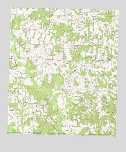
Dexter, MS USGS Topographic Map
Click on map above to begin viewing in our Map Viewer.

This topographic map contains these locations and features:
Feature Name Type Latitude Longitude GNIS ID View Map
Andersons Canal Structure Two DamDamN31.1168°W89.8767°680579View Map
Carson Springs Baptist ChurchChurchN31.0477°W89.9000°668105View Map
Carson Springs CemeteryCemeteryN31.0477°W89.9006°709234View Map
Centerville CemeteryCemeteryN31.0235°W89.9892°709235View Map
Centerville ChurchChurchN31.0235°W89.9890°668267View Map
Crystal Springs Baptist ChurchChurchN31.0738°W89.9924°687117View Map
Crystal Springs CemeteryCemeteryN31.0730°W89.9926°709239View Map
DexterPopulated PlaceN31.0743°W89.9929°691813View Map
Dexter Attendance CenterSchoolN31.0732°W89.9937°709241View Map
Dexter Oil and Gas FieldOilfieldN31.0832°W89.9698°669246View Map
East Dexter Oil FieldOilfieldN31.0835°W89.8779°687119View Map
East Mount Olive Baptist ChurchChurchN31.0490°W89.9841°674119View Map
Fortenberry CemeteryCemeteryN31.1063°W89.9195°670111View Map
Hinds CemeteryCemeteryN31.0046°W89.9301°671230View Map
Lowes Temple ChurchChurchN31.1185°W89.9520°672932View Map
Mount Bethel ChurchChurchN31.0752°W89.8851°673929View Map
Mount Bethel Number 2 ChurchChurchN31.0885°W89.9248°673931View Map
Supervisor District 3CivilN31.0569°W89.9763°712117View Map
Supervisor District 4CivilN31.1233°W89.8786°711980View Map
Tom Nat Stogner CemeteryCemeteryN31.0338°W89.9748°709264View Map
Walthall County Third District Fire Department Station 1BuildingN31.0466°W89.8996°2332868View Map
Walthall County Third District Fire Department Station 2BuildingN31.0740°W89.9940°2667679View Map

Note: Coordinates in the location and feature list above are referenced to NAD83 datum.


Copyright (C) 2008-2025 Ryan Niemi / Sunset Dynamics ... All Rights Reserved