TopoQuest Logo
Do you find TopoQuest useful?
Help keep TopoQuest running and adding new maps/features by donating!
Bitcoin:  19c7KJd3qBynnjoSw5npx9KScwjBe4ifkT
Litecoin:  LXs6TkuXGGXo1vDsWCkWVdjQX94eUKd6ui
Home View Maps Find Maps Find Places Resources & Links


Pine Buttes, New Mexico Topographic Map

USGS Map Title: Pine Buttes, NM
USGS Map MRC: 36104E2
DRG (GeoTIFF) Download: o36104e2.tif


Neighboring USGS Topographic Map Quads:


  Tinaja Mountain, NM  
36104F3
 

  Mesa Larga, NM  
36104F2
 

  Kiowa, NM  
36104F1
 

  Tres Hermanos Peak, NM  
36104E3
 

  Pine Buttes, NM  
36104E2
 

  Palo Blanco Mountain, NM  
36104E1
 

  Sauble Circle Dot Ranch, NM  
36104D3
 

  Point of Rocks Mesa, NM  
36104D2
 

  Lawrence Arroyo, NM  
36104D1


Map MRC Location:

N37°
W105°
N37°
W104°
H8 H7 H6 H5 H4 H3 H2 H1
G8 G7 G6 G5 G4 G3 G2 G1
F8 F7 F6 F5 F4 F3 F2 F1
E8 E7 E6 E5 E4 E3 E2 E1
D8 D7 D6 D5 D4 D3 D2 D1
C8 C7 C6 C5 C4 C3 C2 C1
B8 B7 B6 B5 B4 B3 B2 B1
A8 A7 A6 A5 A4 A3 A2 A1
N36°
W105°
N36°
W104°

Pine Buttes, NM USGS 1:24K Topographic Map Preview:
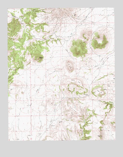
Pine Buttes, NM USGS Topographic Map
Click on map above to begin viewing in our Map Viewer.

This topographic map contains these locations and features:
Feature Name Type Latitude Longitude GNIS ID View Map
BarelaLocaleN36.5370°W104.1933°924624View Map
Black HillSummitN36.6181°W104.1730°899533View Map
Chico HillsRangeN36.5314°W104.1675°920577View Map
CowanLocaleN36.5989°W104.1925°927292View Map
Devils PointCliffN36.5142°W104.2011°888351View Map
El Rancho GrandeLocaleN36.5428°W104.1580°888824View Map
HenneganLocaleN36.6220°W104.2214°928341View Map
Hogeye MesaSummitN36.5481°W104.1469°890055View Map
Jimmy SpringSpringN36.6221°W104.2154°890466View Map
Jimmy Spring CanyonValleyN36.6164°W104.2355°890467View Map
Lone Tree HillSummitN36.5175°W104.1919°899732View Map
Loughlin PeakMineN36.5886°W104.2330°916124View Map
MartinezLocaleN36.5409°W104.1733°927329View Map
Pine ButtesSummitN36.5839°W104.1683°893275View Map
Raspberry MountainSummitN36.5784°W104.2139°899865View Map
Temple PeakSummitN36.5036°W104.1430°895580View Map
The CraterSummitN36.5672°W104.1780°899950View Map
TrujilloLocaleN36.5459°W104.1894°928416View Map
Trujillo MesaSummitN36.5514°W104.1641°895850View Map
Wilson CemeteryCemeteryN36.5622°W104.2430°896681View Map

Note: Coordinates in the location and feature list above are referenced to NAD83 datum.


Copyright (C) 2008-2024 Ryan Niemi / Sunset Dynamics ... All Rights Reserved