TopoQuest Logo
Do you find TopoQuest useful?
Help keep TopoQuest running and adding new maps/features by donating!
Bitcoin:  19c7KJd3qBynnjoSw5npx9KScwjBe4ifkT
Litecoin:  LXs6TkuXGGXo1vDsWCkWVdjQX94eUKd6ui
Home View Maps Find Maps Find Places Resources & Links


Pine Ridge, Mississippi Topographic Map

USGS Map Title: Pine Ridge, MS
USGS Map MRC: 31091F3
DRG (GeoTIFF) Download: o31091f3.tif


Neighboring USGS Topographic Map Quads:


  Waterproof, LA  
31091G4
 

  Chamblee, LA  
31091G3
 

  Rodney, MS  
31091G2
 

  Spokane, LA  
31091F4
 

  Pine Ridge, MS  
31091F3
 

  Church Hill, MS  
31091F2
 

  Natchez, MS  
31091E4
 

  Washington, MS  
31091E3
 

  Cranfield, MS  
31091E2


Map MRC Location:

N32°
W92°
N32°
W91°
H8 H7 H6 H5 H4 H3 H2 H1
G8 G7 G6 G5 G4 G3 G2 G1
F8 F7 F6 F5 F4 F3 F2 F1
E8 E7 E6 E5 E4 E3 E2 E1
D8 D7 D6 D5 D4 D3 D2 D1
C8 C7 C6 C5 C4 C3 C2 C1
B8 B7 B6 B5 B4 B3 B2 B1
A8 A7 A6 A5 A4 A3 A2 A1
N31°
W92°
N31°
W91°

Pine Ridge, MS USGS 1:24K Topographic Map Preview:
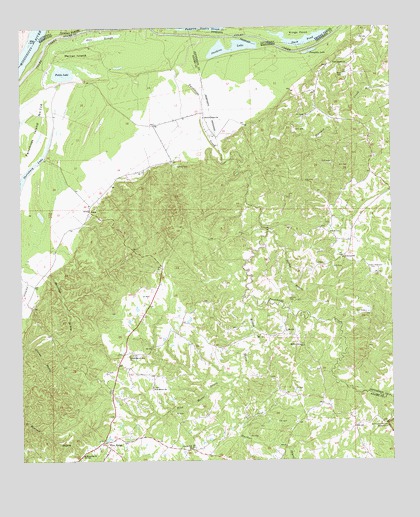
Pine Ridge, MS USGS Topographic Map
Click on map above to begin viewing in our Map Viewer.

This topographic map contains these locations and features:
Feature Name Type Latitude Longitude GNIS ID View Map
Adams CemeteryCemeteryN31.6910°W91.2704°666150View Map
AnnaPopulated PlaceN31.6968°W91.3515°666272View Map
Anna Oil FieldOilfieldN31.6918°W91.3362°685896View Map
Blueskin CreekStreamN31.7132°W91.3001°667327View Map
Carl Anderson Lake DamDamN31.7368°W91.3634°680868View Map
Clover Hill ChurchChurchN31.6285°W91.3179°668613View Map
Daughters of Zion ChurchChurchN31.6557°W91.3384°669121View Map
Dies SloughGutN31.7474°W91.3476°669266View Map
Drake-Magruder CemeteryCemeteryN31.6804°W91.2551°669379View Map
Duck PondLakeN31.7455°W91.2810°554289View Map
Dunbar BayouStreamN31.6488°W91.3029°669497View Map
Edgewood Oil FieldOilfieldN31.6391°W91.3432°685935View Map
Fairchilds CreekStreamN31.7474°W91.3129°669870View Map
Fairchilds Creek Oil FieldOilfieldN31.6891°W91.3140°685943View Map
Fields LakeLakeN31.7370°W91.3604°669955View Map
Greens Bayou Oil FieldOilfieldN31.6460°W91.3598°685977View Map
Junkins LakeLakeN31.7444°W91.3074°672063View Map
Linwood ChurchChurchN31.6835°W91.2659°672522View Map
Mercer IslandIslandN31.7424°W91.3554°673479View Map
Mercer Oil FieldOilfieldN31.7182°W91.3626°686010View Map
Milford ChurchChurchN31.6582°W91.2818°673572View Map
Milford School (historical)SchoolN31.6621°W91.2857°686011View Map
Oakland Oil FieldOilfieldN31.6713°W91.3321°686037View Map
Painters CemeteryCemeteryN31.7102°W91.3221°675390View Map
Painters Oil FieldOilfieldN31.7127°W91.3237°686042View Map
Painters School (historical)SchoolN31.7188°W91.3273°686043View Map
Pine Mount BayouStreamN31.6474°W91.3043°675862View Map
Pine Mount ChurchChurchN31.6463°W91.3307°675863View Map
Pine Mount Oil FieldOilfieldN31.6388°W91.3232°686049View Map
Pine Mount School (historical)SchoolN31.6457°W91.3307°686050View Map
Pine RidgePopulated PlaceN31.6288°W91.3451°675866View Map
Pine Ridge Oil FieldOilfieldN31.6377°W91.2973°686051View Map
Pine Ridge Presbyterian ChurchChurchN31.6310°W91.3493°686052View Map
Pine Ridge School (historical)SchoolN31.6302°W91.3484°686053View Map
Pumping Station SloughGutN31.7496°W91.3193°694489View Map
Pumpkin LakeLakeN31.7430°W91.2772°676415View Map
Quitman Bayou Oil FieldOilfieldN31.6807°W91.3696°686058View Map
Quitman School (historical)SchoolN31.6793°W91.3665°686059View Map
Reeves School (historical)SchoolN31.7402°W91.2684°686432View Map
Riverside ChurchChurchN31.6268°W91.3543°676683View Map
Saint Luke Church (historical)ChurchN31.6968°W91.3526°686067View Map
Sandy BayouStreamN31.6913°W91.2912°677371View Map
Second Union ChurchChurchN31.7241°W91.3126°677493View Map
Shields CemeteryCemeteryN31.6715°W91.2843°677662View Map
Smithland ChurchChurchN31.7396°W91.2687°677942View Map
Stanton Oil FieldOilfieldN31.6357°W91.2626°686086View Map
Vernon Oil FieldOilfieldN31.6271°W91.3265°686091View Map
Wades BayouStreamN31.6724°W91.2996°679239View Map
West Fairchilds Creek Oil FieldOilfieldN31.6891°W91.3237°686100View Map
West Pine Ridge Oil FieldOilfieldN31.6377°W91.3112°686101View Map

Note: Coordinates in the location and feature list above are referenced to NAD83 datum.


Copyright (C) 2008-2025 Ryan Niemi / Sunset Dynamics ... All Rights Reserved