TopoQuest Logo
Do you find TopoQuest useful?
Help keep TopoQuest running and adding new maps/features by donating!
Bitcoin:  19c7KJd3qBynnjoSw5npx9KScwjBe4ifkT
Litecoin:  LXs6TkuXGGXo1vDsWCkWVdjQX94eUKd6ui
Home View Maps Find Maps Find Places Resources & Links


Cranfield, Mississippi Topographic Map

USGS Map Title: Cranfield, MS
USGS Map MRC: 31091E2
DRG (GeoTIFF) Download: o31091e2.tif


Neighboring USGS Topographic Map Quads:


  Pine Ridge, MS  
31091F3
 

  Church Hill, MS  
31091F2
 

  Fayette, MS  
31091F1
 

  Washington, MS  
31091E3
 

  Cranfield, MS  
31091E2
 

  Roxie, MS  
31091E1
 

  Kingston, MS  
31091D3
 

  Jeannette, MS  
31091D2
 

  Knoxville, MS  
31091D1


Map MRC Location:

N32°
W92°
N32°
W91°
H8 H7 H6 H5 H4 H3 H2 H1
G8 G7 G6 G5 G4 G3 G2 G1
F8 F7 F6 F5 F4 F3 F2 F1
E8 E7 E6 E5 E4 E3 E2 E1
D8 D7 D6 D5 D4 D3 D2 D1
C8 C7 C6 C5 C4 C3 C2 C1
B8 B7 B6 B5 B4 B3 B2 B1
A8 A7 A6 A5 A4 A3 A2 A1
N31°
W92°
N31°
W91°

Cranfield, MS USGS 1:24K Topographic Map Preview:
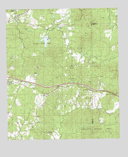
Cranfield, MS USGS Topographic Map
Click on map above to begin viewing in our Map Viewer.

This topographic map contains these locations and features:
Feature Name Type Latitude Longitude GNIS ID View Map
Bates CreekStreamN31.5046°W91.1901°692468View Map
Blake CemeteryCemeteryN31.5690°W91.2165°692635View Map
Buckles CemeteryCemeteryN31.5552°W91.1587°692747View Map
Cedar Grove ChurchChurchN31.6024°W91.2354°692864View Map
Collins CemeteryCemeteryN31.5166°W91.2379°692945View Map
Correctional Institution Adams CountyBuildingN31.5563°W91.2216°2739798View Map
CranfieldPopulated PlaceN31.5441°W91.2059°693005View Map
Cranfield ChurchChurchN31.5504°W91.1932°705172View Map
Cranfield Oil and Gas FieldOilfieldN31.5607°W91.1707°693006View Map
Evans CemeteryCemeteryN31.5118°W91.2240°693189View Map
Farrar CemeteryCemeteryN31.5754°W91.1582°693202View Map
FenwickPopulated PlaceN31.5560°W91.2490°693206View Map
Fenwick Oil FieldOilfieldN31.5793°W91.2237°705174View Map
Forest Home Oil FieldOilfieldN31.6071°W91.1671°693245View Map
Foster CemeteryCemeteryN31.5149°W91.2351°693250View Map
Galilee Oil FieldOilfieldN31.5988°W91.1626°705175View Map
Greenfield BayouStreamN31.6052°W91.2040°693360View Map
Helena (historical)LocaleN31.5224°W91.1279°705200View Map
Hickory Grove CemeteryCemeteryN31.5724°W91.1545°693469View Map
Higgland CemeteryCemeteryN31.6063°W91.2287°693474View Map
Hoggatt CemeteryCemeteryN31.5160°W91.2176°693497View Map
LeesdalePopulated PlaceN31.5468°W91.1579°693706View Map
Mock CemeteryCemeteryN31.5424°W91.1382°694015View Map
Moss Grove Oil FieldOilfieldN31.5891°W91.1682°705178View Map
Natchez State ParkParkN31.5918°W91.2057°705289View Map
New Hope ChurchChurchN31.5299°W91.2118°705526View Map
New Hope ChurchChurchN31.5327°W91.2115°705290View Map
Prys TempleChurchN31.6071°W91.1893°694483View Map
Roaring Dale CemeteryCemeteryN31.5579°W91.2168°694571View Map
Robinson ChapelChurchN31.5641°W91.2171°694584View Map
Rowardale School (historical)SchoolN31.5454°W91.2223°705182View Map
Rucker CemeteryCemeteryN31.6046°W91.1907°694626View Map
Saint Charles ChurchChurchN31.5493°W91.2198°694640View Map
Saint Johns ChurchChurchN31.5157°W91.2234°694646View Map
Saint Marks ChurchChurchN31.6227°W91.2484°694654View Map
Saint Peter Rock Number 1 ChurchChurchN31.5585°W91.1765°705523View Map
Saint Peter Rock Number 1 ChurchChurchN31.5568°W91.1765°705291View Map
Saint Peter Rock Number 2 ChurchChurchN31.5502°W91.1626°705524View Map
Saint Peter Rock Number 2 ChurchChurchN31.5502°W91.1623°705292View Map
Saint Peters Church Number 1ChurchN31.5502°W91.1626°705183View Map
Saint Peters Church Number 2ChurchN31.5502°W91.1604°705184View Map
Sandy BayouStreamN31.5038°W91.2126°666114View Map
Sessions CemeteryCemeteryN31.5093°W91.2243°677520View Map
Sessions CemeteryCemeteryN31.5790°W91.2451°705293View Map
Southwest Cranfield Oil FieldOilfieldN31.5321°W91.2182°705191View Map
StantonPopulated PlaceN31.6160°W91.2404°694882View Map
Stanton Baptist ChurchChurchN31.6182°W91.2393°705192View Map
Stanton ChurchChurchN31.6188°W91.2384°705522View Map
Tate CemeteryCemeteryN31.5702°W91.1765°694945View Map
Tate Magnolia ChurchChurchN31.5679°W91.1793°694946View Map
Thompson CemeteryCemeteryN31.6154°W91.1395°694969View Map
Thompson CreekStreamN31.6213°W91.1323°694970View Map
Turners (historical)LocaleN31.5293°W91.1334°705207View Map
Walker CemeteryCemeteryN31.5532°W91.1473°705525View Map
Walker CemeteryCemeteryN31.5532°W91.1470°705296View Map
Whitens CreekStreamN31.6135°W91.1829°695158View Map
Windy Hill Number 1 ChurchChurchN31.5063°W91.2007°695193View Map
Windy Hill Number 2 ChurchChurchN31.5224°W91.2184°695194View Map

Note: Coordinates in the location and feature list above are referenced to NAD83 datum.


Copyright (C) 2008-2025 Ryan Niemi / Sunset Dynamics ... All Rights Reserved