TopoQuest Logo
Do you find TopoQuest useful?
Help keep TopoQuest running and adding new maps/features by donating!
Bitcoin:  19c7KJd3qBynnjoSw5npx9KScwjBe4ifkT
Litecoin:  LXs6TkuXGGXo1vDsWCkWVdjQX94eUKd6ui
Home View Maps Find Maps Find Places Resources & Links


Wheatland, Michigan Topographic Map

USGS Map Title: Wheatland, MI
USGS Map MRC: 41084H4
DRG (GeoTIFF) Download: o41084h4.tif


Neighboring USGS Topographic Map Quads:


  Hanover, MI  
42084A5
 

  Somerset Center, MI  
42084A4
 

  Cement City, MI  
42084A3
 

  North Adams, MI  
41084H5
 

  Wheatland, MI  
41084H4
 

  Addison, MI  
41084H3
 

  Frontier, MI  
41084G5
 

  Pittsford, MI  
41084G4
 

  Hudson, MI  
41084G3


Map MRC Location:

N42°
W85°
N42°
W84°
H8 H7 H6 H5 H4 H3 H2 H1
G8 G7 G6 G5 G4 G3 G2 G1
F8 F7 F6 F5 F4 F3 F2 F1
E8 E7 E6 E5 E4 E3 E2 E1
D8 D7 D6 D5 D4 D3 D2 D1
C8 C7 C6 C5 C4 C3 C2 C1
B8 B7 B6 B5 B4 B3 B2 B1
A8 A7 A6 A5 A4 A3 A2 A1
N41°
W85°
N41°
W84°

Wheatland, MI USGS 1:24K Topographic Map Preview:
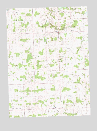
Wheatland, MI USGS Topographic Map
Click on map above to begin viewing in our Map Viewer.

This topographic map contains these locations and features:
Feature Name Type Latitude Longitude GNIS ID View Map
Ames LakeLakeN41.9922°W84.3768°620060View Map
Bloomer LakeLakeN41.9719°W84.4221°621613View Map
Church Post Office (historical)Post OfficeN41.9275°W84.4206°2418317View Map
Church's Corners CemeteryCemeteryN41.9283°W84.4208°2418471View Map
Churchs CornersLocaleN41.9275°W84.4205°623312View Map
Dibble CemeteryCemeteryN41.9711°W84.3874°624646View Map
Embach LakeLakeN41.8977°W84.4072°625554View Map
Emmaus Lutheran ChurchChurchN41.8853°W84.4197°2418434View Map
Fowler CemeteryCemeteryN41.9567°W84.4166°626355View Map
Freedom Farm Bible ChurchChurchN41.8833°W84.4722°2418437View Map
Freedom Farm Christian SchoolSchoolN41.8833°W84.4722°2418436View Map
Hoxie CemeteryCemeteryN41.9578°W84.4861°2418468View Map
Hoxie DrainStreamN41.9828°W84.4366°628729View Map
Hoxie Post Office (historical)Post OfficeN41.9569°W84.4403°2418315View Map
Locust Corner CemeteryCemeteryN41.8858°W84.4194°2418458View Map
Locust CornersPopulated PlaceN41.8839°W84.4202°630867View Map
Locust Post Office (historical)Post OfficeN41.8839°W84.4203°2418312View Map
Mercer LakesLakeN41.9996°W84.4103°632110View Map
Peace CemeteryCemeteryN41.9706°W84.4430°634504View Map
Randolph CemeteryCemeteryN41.9975°W84.4799°635629View Map
Stafford Post Office (historical)Post OfficeN41.9458°W84.4006°2418296View Map
Taylor CemeteryCemeteryN41.9083°W84.3811°2419725View Map
Township of WheatlandCivilN41.9423°W84.4196°1627255View Map
WheatlandPopulated PlaceN41.9712°W84.4011°1617938View Map
Wheatland ChurchChurchN41.9272°W84.4186°2418435View Map
Wheatland Post Office (historical)Post OfficeN41.9711°W84.4011°2418293View Map
Williams DrainStreamN41.9453°W84.3961°1616501View Map
Williams LakeLakeN41.9433°W84.4135°1616503View Map
WPCJ-FM (Pittsford)TowerN41.8845°W84.4708°1625474View Map

Note: Coordinates in the location and feature list above are referenced to NAD83 datum.


Copyright (C) 2008-2024 Ryan Niemi / Sunset Dynamics ... All Rights Reserved