TopoQuest Logo
Do you find TopoQuest useful?
Help keep TopoQuest running and adding new maps/features by donating!
Bitcoin:  19c7KJd3qBynnjoSw5npx9KScwjBe4ifkT
Litecoin:  LXs6TkuXGGXo1vDsWCkWVdjQX94eUKd6ui
Home View Maps Find Maps Find Places Resources & Links


Woodville, California Topographic Map

USGS Map Title: Woodville, CA
USGS Map MRC: 36119A2
DRG (GeoTIFF) Download: o36119a2.tif


Neighboring USGS Topographic Map Quads:


  Tulare, CA  
36119B3
 

  Cairns Corner, CA  
36119B2
 

  Lindsay, CA  
36119B1
 

  Tipton, CA  
36119A3
 

  Woodville, CA  
36119A2
 

  Porterville, CA  
36119A1
 

  Pixley, CA  
35119H3
 

  Sausalito School, CA  
35119H2
 

  Ducor, CA  
35119H1


Map MRC Location:

N37°
W120°
N37°
W119°
H8 H7 H6 H5 H4 H3 H2 H1
G8 G7 G6 G5 G4 G3 G2 G1
F8 F7 F6 F5 F4 F3 F2 F1
E8 E7 E6 E5 E4 E3 E2 E1
D8 D7 D6 D5 D4 D3 D2 D1
C8 C7 C6 C5 C4 C3 C2 C1
B8 B7 B6 B5 B4 B3 B2 B1
A8 A7 A6 A5 A4 A3 A2 A1
N36°
W120°
N36°
W119°

Woodville, CA USGS 1:24K Topographic Map Preview:
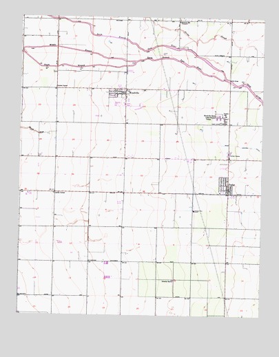
Woodville, CA USGS Topographic Map
Click on map above to begin viewing in our Map Viewer.

This topographic map contains these locations and features:
Feature Name Type Latitude Longitude GNIS ID View Map
Apostolic Church of Jesus ChristChurchN36.0569°W119.1459°1835744View Map
Church of Christ of PoplarChurchN36.0536°W119.1429°1835747View Map
Cotton CenterPopulated PlaceN36.0661°W119.1429°1660519View Map
D and V DairyLocaleN36.0478°W119.2189°2701885View Map
De Jong DairyLocaleN36.0464°W119.2000°2701888View Map
Deboer DairyLocaleN36.0908°W119.2389°2701889View Map
Five Star Dairy Number 2LocaleN36.0669°W119.2458°2701967View Map
Greenleaf FarmsLocaleN36.0664°W119.1336°2546818View Map
HarmonyPopulated PlaceN36.1236°W119.1698°1835758View Map
Harmony Farms DairyLocaleN36.1222°W119.1622°2681557View Map
Harmony SchoolLocaleN36.1227°W119.1693°243232View Map
Lairds CornerPopulated PlaceN36.0513°W119.2321°252918View Map
Lou Mar DairyLocaleN36.0675°W119.2389°2702228View Map
Lowes CornerPopulated PlaceN36.0944°W119.2321°252927View Map
Middle Branch South Branch Tule RiverStreamN36.1094°W119.2493°245852View Map
Northstar DairyLocaleN36.0178°W119.2461°2702265View Map
Oettle BridgeBridgeN36.0983°W119.1426°252071View Map
Pleasant Grove (historical)Populated PlaceN36.0805°W119.1701°1835770View Map
Pleasant View Elementary SchoolSchoolN36.0441°W119.1604°247613View Map
PoplarPopulated PlaceN36.0533°W119.1432°1661250View Map
Poplar Post OfficePost OfficeN36.0558°W119.1434°1835771View Map
Poplar-Cotton Center Census Designated PlaceCensusN36.0564°W119.1493°2409089View Map
Schenley RanchLocaleN36.0150°W119.1704°249197View Map
South Branch South Branch Tule RiverStreamN36.1094°W119.2493°249684View Map
T - Bar DairyLocaleN36.0583°W119.2014°2681682View Map
Tule River Youth CenterBuildingN36.0552°W119.1429°1835787View Map
Van Beek Brothers DairyLocaleN36.0603°W119.2286°2702317View Map
VincentPopulated PlaceN36.0833°W119.1454°1835791View Map
Vincent SchoolSchoolN36.0838°W119.1448°251063View Map
WoodvillePopulated PlaceN36.0936°W119.1990°1661710View Map
Woodville Census Designated PlaceCensusN36.0899°W119.2050°2409628View Map
Woodville Elementary SchoolSchoolN36.0950°W119.1984°1835793View Map
Woodville Farm Labor Supply CenterLocaleN36.0833°W119.1490°1654882View Map

Note: Coordinates in the location and feature list above are referenced to NAD83 datum.


Copyright (C) 2008-2025 Ryan Niemi / Sunset Dynamics ... All Rights Reserved