TopoQuest Logo
Do you find TopoQuest useful?
Help keep TopoQuest running and adding new maps/features by donating!
Bitcoin:  19c7KJd3qBynnjoSw5npx9KScwjBe4ifkT
Litecoin:  LXs6TkuXGGXo1vDsWCkWVdjQX94eUKd6ui
Home View Maps Find Maps Find Places Resources & Links


Pleasant Ridge, Wisconsin Topographic Map

USGS Map Title: Pleasant Ridge, WI
USGS Map MRC: 43090A1
DRG (GeoTIFF) Download: o43090a1.tif


Neighboring USGS Topographic Map Quads:


  Lone Rock, WI  
43090B2
 

  Spring Green, WI  
43090B1
 

  Arena, WI  
43089B8
 

  Clyde, WI  
43090A2
 

  Pleasant Ridge, WI  
43090A1
 

  Barneveld, WI  
43089A8
 

  Dodgeville, WI  
42090H2
 

  Jonesdale, WI  
42090H1
 

  Hollandale, WI  
42089H8


Map MRC Location:

N44°
W91°
N44°
W90°
H8 H7 H6 H5 H4 H3 H2 H1
G8 G7 G6 G5 G4 G3 G2 G1
F8 F7 F6 F5 F4 F3 F2 F1
E8 E7 E6 E5 E4 E3 E2 E1
D8 D7 D6 D5 D4 D3 D2 D1
C8 C7 C6 C5 C4 C3 C2 C1
B8 B7 B6 B5 B4 B3 B2 B1
A8 A7 A6 A5 A4 A3 A2 A1
N43°
W91°
N43°
W90°

Pleasant Ridge, WI USGS 1:24K Topographic Map Preview:
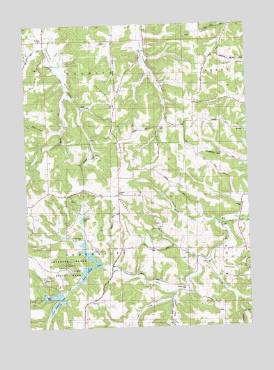
Pleasant Ridge, WI USGS Topographic Map
Click on map above to begin viewing in our Map Viewer.

This topographic map contains these locations and features:
Feature Name Type Latitude Longitude GNIS ID View Map
2 ReservoirReservoirN43.0183°W90.0168°1792341View Map
2 ReservoirReservoirN43.0283°W90.0335°1792343View Map
4.04 ReservoirReservoirN43.0433°W90.0018°1792345View Map
7.98 ReservoirReservoirN43.0117°W90.0435°1792353View Map
Bunker HillSummitN43.0119°W90.0851°1562407View Map
Bunker Hill SchoolSchoolN43.0108°W90.0940°1562410View Map
Canyon Park CreekStreamN43.0139°W90.0429°1577320View Map
Cates Family FarmLocaleN43.1039°W90.0556°2709641View Map
Cox HollowValleyN43.0260°W90.0858°1563467View Map
Cox Hollow LakeReservoirN43.0088°W90.1105°1563468View Map
Cox Hollow Number 2 2WP1783 DamDamN43.0267°W90.0851°1791686View Map
Cox Hollow Number One DamDamN43.0131°W90.1057°1791684View Map
Cutler CreekStreamN43.0111°W90.0440°1577321View Map
East Pleasant Ridge SchoolSchoolN43.0547°W90.0596°1564362View Map
Governor Dodge State ParkParkN43.0144°W90.1101°1581379View Map
Griffith CemeteryCemeteryN43.0325°W90.0532°1565902View Map
Halverson LakeReservoirN43.0451°W90.0941°1577425View Map
Hogan SchoolSchoolN43.1105°W90.0215°1566519View Map
Love CreekStreamN43.0439°W90.0010°1577318View Map
Meudt CreekStreamN43.0422°W90.0201°1577319View Map
Paul CreekStreamN43.0805°W90.1121°1577317View Map
Pine Cliff State Natural AreaParkN43.0089°W90.1073°1988890View Map
Pleasant RidgePopulated PlaceN43.0547°W90.0735°1577773View Map
Pleasant RidgeRidgeN43.0900°W90.0815°1571625View Map
Pleasant ValleyValleyN43.0151°W90.0353°1571635View Map
Pleasant Valley CemeteryCemeteryN43.0372°W90.0957°1571644View Map
Pleasant Valley SchoolSchoolN43.0328°W90.0726°1571655View Map
Rockwell Mills CemeteryCemeteryN43.0169°W90.0365°1837778View Map
Rockwell Mills SchoolSchoolN43.0111°W90.0546°1572491View Map
Ruggles CemeteryCemeteryN43.0494°W90.0048°1572717View Map
Saints Peter and Paul ChurchChurchN43.0406°W90.0507°1573607View Map
Strutt CreekStreamN43.0439°W90.0015°1577316View Map
Town of DodgevilleCivilN43.0075°W90.1244°1583088View Map
Town of WyomingCivilN43.1190°W90.1048°1584490View Map
Twin Parks 12 2WP1782 DamDamN43.0117°W90.0435°1792352View Map
Twin Parks 3 2WP1780 DamDamN43.0183°W90.0168°1792340View Map
Twin Parks 4 2WP1780 DamDamN43.0283°W90.0335°1792342View Map
Twin Parks 6 2WP1780 DamDamN43.0433°W90.0018°1792344View Map
Twin Valley LakeReservoirN43.0235°W90.0924°1577261View Map
Twin Valley Lake 6.07ReservoirN43.0267°W90.0851°1791687View Map
West Pleasant Ridge SchoolSchoolN43.0544°W90.1026°1576544View Map
Wyoming CemeteryCemeteryN43.1075°W90.1107°1577067View Map
Wyoming SchoolSchoolN43.1192°W90.1148°1837786View Map
Yagers Corner SchoolSchoolN43.0419°W90.0162°1577070View Map
Yagers HollowValleyN43.0442°W90.0037°1577071View Map

Note: Coordinates in the location and feature list above are referenced to NAD83 datum.


Copyright (C) 2008-2025 Ryan Niemi / Sunset Dynamics ... All Rights Reserved