TopoQuest Logo
Do you find TopoQuest useful?
Help keep TopoQuest running and adding new maps/features by donating!
Bitcoin:  19c7KJd3qBynnjoSw5npx9KScwjBe4ifkT
Litecoin:  LXs6TkuXGGXo1vDsWCkWVdjQX94eUKd6ui
Home View Maps Find Maps Find Places Resources & Links


Plummer, Idaho Topographic Map

USGS Map Title: Plummer, ID
USGS Map MRC: 47116C8
DRG (GeoTIFF) Download: o47116c8.tif


Neighboring USGS Topographic Map Quads:


  Setters, ID  
47117D1
 

  Worley, ID  
47116D8
 

  Harrison, ID  
47116D7
 

  Tekoa Mountain, WA  
47117C1
 

  Plummer, ID  
47116C8
 

  Chatcolet, ID  
47116C7
 

  Tekoa, WA  
47117B1
 

  Tensed, ID  
47116B8
 

  Benewah, ID  
47116B7


Map MRC Location:

N48°
W117°
N48°
W116°
H8 H7 H6 H5 H4 H3 H2 H1
G8 G7 G6 G5 G4 G3 G2 G1
F8 F7 F6 F5 F4 F3 F2 F1
E8 E7 E6 E5 E4 E3 E2 E1
D8 D7 D6 D5 D4 D3 D2 D1
C8 C7 C6 C5 C4 C3 C2 C1
B8 B7 B6 B5 B4 B3 B2 B1
A8 A7 A6 A5 A4 A3 A2 A1
N47°
W117°
N47°
W116°

Plummer, ID USGS 1:24K Topographic Map Preview:
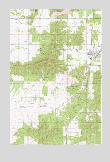
Plummer, ID USGS Topographic Map
Click on map above to begin viewing in our Map Viewer.

This topographic map contains these locations and features:
Feature Name Type Latitude Longitude GNIS ID View Map
Chief MOC-TEL-ME Rest AreaLocaleN47.2560°W116.9241°395208View Map
City of PlummerCivilN47.3301°W116.8849°2411445View Map
Coeur d'Alene Indian Tribal HeadquartersLocaleN47.3121°W116.9549°395232View Map
Evergreen CemeteryCemeteryN47.3379°W116.9064°2019059View Map
Gateway Fire Protection DistrictBuildingN47.3315°W116.8875°2619319View Map
Hn'ya)pqi'nnLocaleN47.3407°W116.8898°2082012View Map
Khwele' GroundsLocaleN47.3683°W116.8831°2081998View Map
Lakeside High SchoolSchoolN47.3334°W116.8906°401544View Map
Lakeside Middle SchoolSchoolN47.3328°W116.8925°401073View Map
McCartney ButteSummitN47.3724°W116.9293°395678View Map
Minkler MountainSummitN47.3732°W116.9663°394777View Map
MowryPopulated PlaceN47.3093°W116.9960°396933View Map
PlummerPopulated PlaceN47.3352°W116.8885°374457View Map
Plummer DivisionCivilN47.3015°W116.8816°1936789View Map
Plummer Post OfficePost OfficeN47.3358°W116.8884°2767322View Map
Sorrento TunnelTunnelN47.3035°W116.9124°375126View Map
Watt HillSummitN47.2957°W116.9057°399623View Map

Note: Coordinates in the location and feature list above are referenced to NAD83 datum.


Copyright (C) 2008-2025 Ryan Niemi / Sunset Dynamics ... All Rights Reserved