TopoQuest Logo
Do you find TopoQuest useful?
Help keep TopoQuest running and adding new maps/features by donating!
Bitcoin:  19c7KJd3qBynnjoSw5npx9KScwjBe4ifkT
Litecoin:  LXs6TkuXGGXo1vDsWCkWVdjQX94eUKd6ui
Home View Maps Find Maps Find Places Resources & Links


Podunk Creek, Utah Topographic Map

USGS Map Title: Podunk Creek, UT
USGS Map MRC: 37112D3
DRG (GeoTIFF) Download: o37112d3.tif


Neighboring USGS Topographic Map Quads:


  George Mountain, UT  
37112E4
 

  Tropic Reservoir, UT  
37112E3
 

  Bryce Point, UT  
37112E2
 

  Alton, UT  
37112D4
 

  Podunk Creek, UT  
37112D3
 

  Rainbow Point, UT  
37112D2
 

  Bald Knoll, UT  
37112C4
 

  Skutumpah Creek, UT  
37112C3
 

  Deer Spring Point, UT  
37112C2


Map MRC Location:

N38°
W113°
N38°
W112°
H8 H7 H6 H5 H4 H3 H2 H1
G8 G7 G6 G5 G4 G3 G2 G1
F8 F7 F6 F5 F4 F3 F2 F1
E8 E7 E6 E5 E4 E3 E2 E1
D8 D7 D6 D5 D4 D3 D2 D1
C8 C7 C6 C5 C4 C3 C2 C1
B8 B7 B6 B5 B4 B3 B2 B1
A8 A7 A6 A5 A4 A3 A2 A1
N37°
W113°
N37°
W112°

Podunk Creek, UT USGS 1:24K Topographic Map Preview:
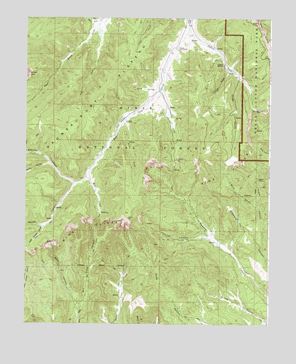
Podunk Creek, UT USGS Topographic Map
Click on map above to begin viewing in our Map Viewer.

This topographic map contains these locations and features:
Feature Name Type Latitude Longitude GNIS ID View Map
Birch CanyonValleyN37.4213°W112.2560°1425587View Map
Black Birch Canyon OverlookLocaleN37.4936°W112.2549°1890891View Map
Cougar HollowValleyN37.4752°W112.2657°1440055View Map
Coyote HollowValleyN37.4786°W112.2715°1440114View Map
Coyote SpringSpringN37.4813°W112.2742°1440121View Map
Crawford CreekStreamN37.4703°W112.3058°1440137View Map
Crawford PassGapN37.4419°W112.2983°1440139View Map
Dairy HollowValleyN37.4701°W112.3071°1440233View Map
East Fork CreekStreamN37.4964°W112.2921°1440799View Map
Gravel CanyonValleyN37.4050°W112.2534°1441447View Map
Gravel SpringSpringN37.4344°W112.2564°1441449View Map
Horse HollowValleyN37.4403°W112.3629°1441882View Map
Left Fork Upper Kanab CreekStreamN37.4958°W112.3380°1442539View Map
Mill CreekStreamN37.4369°W112.3430°1443418View Map
Mill Creek CanyonValleyN37.3822°W112.3466°1443434View Map
Pink Cliffs Viewing AreaLocaleN37.4214°W112.3227°1451332View Map
Pipeline CanyonValleyN37.4104°W112.2811°1444457View Map
Podunk CreekStreamN37.4961°W112.2919°1444491View Map
Podunk Guard StationLocaleN37.4875°W112.2980°1444492View Map
Ponderosa Canyon OverlookLocaleN37.4978°W112.2585°1448864View Map
Right Fork Upper Kanab CreekStreamN37.4989°W112.3352°1444963View Map
Robinson CanyonValleyN37.4320°W112.3503°1445024View Map
Sieler CreekStreamN37.4586°W112.3244°1445577View Map
Sieler MeadowFlatN37.4572°W112.3277°1445578View Map
Swapp CanyonValleyN37.4237°W112.3572°1446277View Map
Upper Straight CanyonValleyN37.4145°W112.3659°1446884View Map
Water CanyonValleyN37.3826°W112.3463°1447030View Map
Yovimpa PassGapN37.4625°W112.2577°1447578View Map

Note: Coordinates in the location and feature list above are referenced to NAD83 datum.


Copyright (C) 2008-2025 Ryan Niemi / Sunset Dynamics ... All Rights Reserved