TopoQuest Logo
Do you find TopoQuest useful?
Help keep TopoQuest running and adding new maps/features by donating!
Bitcoin:  19c7KJd3qBynnjoSw5npx9KScwjBe4ifkT
Litecoin:  LXs6TkuXGGXo1vDsWCkWVdjQX94eUKd6ui
Home View Maps Find Maps Find Places Resources & Links


Poetry, Texas Topographic Map

USGS Map Title: Poetry, TX
USGS Map MRC: 32096G2
DRG (GeoTIFF) Download: o32096g2.tif


Neighboring USGS Topographic Map Quads:


  Royse City, TX  
32096H3
 

  Quinlan, TX  
32096H2
 

  West Tawakoni, TX  
32096H1
 

  Terrell North, TX  
32096G3
 

  Poetry, TX  
32096G2
 

  Ables Springs, TX  
32096G1
 

  Terrell South, TX  
32096F3
 

  Elmo, TX  
32096F2
 

  Wills Point, TX  
32096F1


Map MRC Location:

N33°
W97°
N33°
W96°
H8 H7 H6 H5 H4 H3 H2 H1
G8 G7 G6 G5 G4 G3 G2 G1
F8 F7 F6 F5 F4 F3 F2 F1
E8 E7 E6 E5 E4 E3 E2 E1
D8 D7 D6 D5 D4 D3 D2 D1
C8 C7 C6 C5 C4 C3 C2 C1
B8 B7 B6 B5 B4 B3 B2 B1
A8 A7 A6 A5 A4 A3 A2 A1
N32°
W97°
N32°
W96°

Poetry, TX USGS 1:24K Topographic Map Preview:
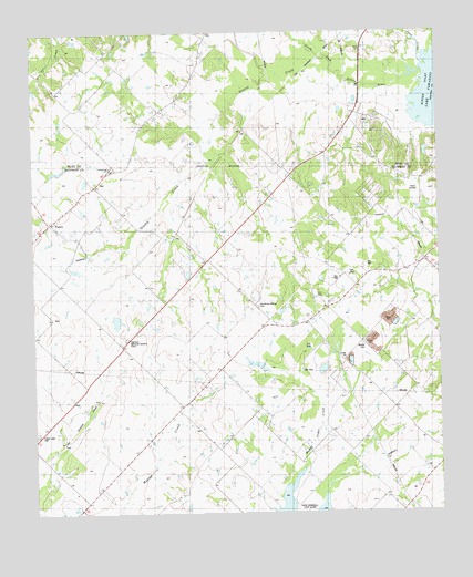
Poetry, TX USGS Topographic Map
Click on map above to begin viewing in our Map Viewer.

This topographic map contains these locations and features:
Feature Name Type Latitude Longitude GNIS ID View Map
Ables Springs Volunteer Fire DepartmentBuildingN32.8137°W96.1321°2551493View Map
Campground CemeteryCemeteryN32.8396°W96.2253°1332040View Map
Campground ChurchChurchN32.8401°W96.2264°1332042View Map
Forest Lawn CemeteryCemeteryN32.7707°W96.2500°1336030View Map
Greasy CreekStreamN32.8615°W96.1533°1336894View Map
HarrisPopulated PlaceN32.8718°W96.1486°1889851View Map
Henderson Mosley CemeteryCemeteryN32.8040°W96.1811°1337602View Map
Highland Memorial GardensCemeteryN32.7954°W96.2216°1337738View Map
Jones CreekStreamN32.8662°W96.1289°1374319View Map
KTLR-FM (Terrell)TowerN32.7707°W96.1761°1388089View Map
KTLR-FM (Terrell)TowerN32.7721°W96.1978°1388090View Map
Phillips Flying Ranch AirportAirportN32.8699°W96.2221°1387419View Map
PoetryPopulated PlaceN32.8257°W96.2458°2034652View Map
Poetry Baptist ChurchChurchN32.8287°W96.2408°1344291View Map
South Fork Sabine RiverStreamN32.8657°W96.1278°1376206View Map
Terrell DivisionCivilN32.7606°W96.2055°1939255View Map
The Library at Cedar Creek LakeBuildingN32.8396°W96.1958°2014734View Map
Weaver CemeteryCemeteryN32.7940°W96.1486°1349579View Map

Note: Coordinates in the location and feature list above are referenced to NAD83 datum.


Copyright (C) 2008-2025 Ryan Niemi / Sunset Dynamics ... All Rights Reserved