TopoQuest Logo
Do you find TopoQuest useful?
Help keep TopoQuest running and adding new maps/features by donating!
Bitcoin:  19c7KJd3qBynnjoSw5npx9KScwjBe4ifkT
Litecoin:  LXs6TkuXGGXo1vDsWCkWVdjQX94eUKd6ui
Home View Maps Find Maps Find Places Resources & Links


Ables Springs, Texas Topographic Map

USGS Map Title: Ables Springs, TX
USGS Map MRC: 32096G1
DRG (GeoTIFF) Download: o32096g1.tif


Neighboring USGS Topographic Map Quads:


  Quinlan, TX  
32096H2
 

  West Tawakoni, TX  
32096H1
 

  Lone Oak South, TX  
32095H8
 

  Poetry, TX  
32096G2
 

  Ables Springs, TX  
32096G1
 

  Iron Bridge Dam, TX  
32095G8
 

  Elmo, TX  
32096F2
 

  Wills Point, TX  
32096F1
 

  Edgewood, TX  
32095F8


Map MRC Location:

N33°
W97°
N33°
W96°
H8 H7 H6 H5 H4 H3 H2 H1
G8 G7 G6 G5 G4 G3 G2 G1
F8 F7 F6 F5 F4 F3 F2 F1
E8 E7 E6 E5 E4 E3 E2 E1
D8 D7 D6 D5 D4 D3 D2 D1
C8 C7 C6 C5 C4 C3 C2 C1
B8 B7 B6 B5 B4 B3 B2 B1
A8 A7 A6 A5 A4 A3 A2 A1
N32°
W97°
N32°
W96°

Ables Springs, TX USGS 1:24K Topographic Map Preview:
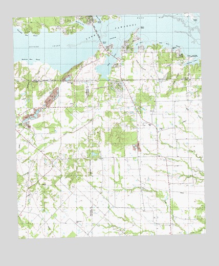
Ables Springs, TX USGS Topographic Map
Click on map above to begin viewing in our Map Viewer.

This topographic map contains these locations and features:
Feature Name Type Latitude Longitude GNIS ID View Map
Ables SpringsSpringN32.8160°W96.1158°1329179View Map
Ables SpringsPopulated PlaceN32.8148°W96.1211°2034631View Map
Ables Springs CemeteryCemeteryN32.8140°W96.1189°1329180View Map
AlsaPopulated PlaceN32.8185°W96.0339°1377928View Map
Arrow PointCapeN32.8698°W96.0714°1329700View Map
Ash CoveBayN32.8585°W96.0416°1329791View Map
Black PointCapeN32.8673°W96.0400°1330778View Map
Cedar GrovePopulated PlaceN32.7579°W96.0866°2034658View Map
Cedar Grove CemeteryCemeteryN32.7582°W96.0869°1332430View Map
Duck CoveBayN32.8490°W96.0616°1334712View Map
Duck Cove BridgeBridgeN32.8515°W96.0577°1334713View Map
Duck CreekStreamN32.8393°W96.0641°1334714View Map
Finger PointCapeN32.8707°W96.0050°1335801View Map
Goettsche LakeReservoirN32.7968°W96.0736°1859884View Map
Goettsche Lake DamDamN32.7968°W96.0736°1859883View Map
Howell CemeteryCemeteryN32.8098°W96.0269°1338194View Map
Iron Bridge Pumping StationBuildingN32.8504°W96.0064°1889852View Map
Kitsee InletBayN32.8560°W96.0939°1374392View Map
Lakeview ChurchChurchN32.8571°W96.0658°1339547View Map
McCoyLocaleN32.8235°W96.1075°1805263View Map
McCoyPopulated PlaceN32.8237°W96.1075°1378659View Map
Medicine Man ReachChannelN32.8512°W96.1116°1341320View Map
Mulberry CoveBayN32.8701°W96.0780°1342239View Map
Mustang CoveBayN32.8468°W96.0055°1342303View Map
Red Bear ParkParkN32.8532°W96.0155°1889853View Map
Red Bear ReachChannelN32.8571°W96.0219°1344888View Map
Red Deer ParkParkN32.8554°W96.0164°1344907View Map
Rolling Oaks Volunteer Fire DepartmentBuildingN32.8288°W96.0536°2655653View Map
Sand Branch Number OneStreamN32.8446°W96.0114°1346504View Map
Sand Branch Number TwoStreamN32.8535°W96.0444°1346505View Map
Sycamore CreekStreamN32.8490°W96.1047°1348167View Map
Waco BayBayN32.8668°W96.0522°1349334View Map
White PointCapeN32.8590°W96.0589°1349973View Map
White Point CausewayBridgeN32.8646°W96.0689°1349974View Map
Whites Prairie CemeteryCemeteryN32.8376°W96.0858°1350017View Map
Wounded Man ReachChannelN32.8648°W96.1141°1350601View Map

Note: Coordinates in the location and feature list above are referenced to NAD83 datum.


Copyright (C) 2008-2025 Ryan Niemi / Sunset Dynamics ... All Rights Reserved