TopoQuest Logo
Do you find TopoQuest useful?
Help keep TopoQuest running and adding new maps/features by donating!
Bitcoin:  19c7KJd3qBynnjoSw5npx9KScwjBe4ifkT
Litecoin:  LXs6TkuXGGXo1vDsWCkWVdjQX94eUKd6ui
Home View Maps Find Maps Find Places Resources & Links


Point Brown, Washington Topographic Map

USGS Map Title: Point Brown, WA
USGS Map MRC: 46124H2
DRG (GeoTIFF) Download: o46124h2.tif


Neighboring USGS Topographic Map Quads:


  Copalis Beach, WA  
47124A2
 

  Copalis Crossing, WA  
47124A1


  Point Brown, WA  
46124H2
 

  Westport, WA  
46124H1


  Grayland, WA  
46124G1


Map MRC Location:

N47°
W125°
N47°
W124°
H8 H7 H6 H5 H4 H3 H2 H1
G8 G7 G6 G5 G4 G3 G2 G1
F8 F7 F6 F5 F4 F3 F2 F1
E8 E7 E6 E5 E4 E3 E2 E1
D8 D7 D6 D5 D4 D3 D2 D1
C8 C7 C6 C5 C4 C3 C2 C1
B8 B7 B6 B5 B4 B3 B2 B1
A8 A7 A6 A5 A4 A3 A2 A1
N46°
W125°
N46°
W124°

Point Brown, WA USGS 1:24K Topographic Map Preview:
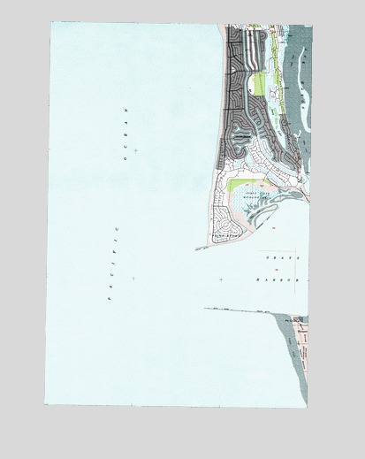
Point Brown, WA USGS Topographic Map
Click on map above to begin viewing in our Map Viewer.

This topographic map contains these locations and features:
Feature Name Type Latitude Longitude GNIS ID View Map
City of Ocean ShoresCivilN46.9701°W124.1520°2411300View Map
Duck LakeLakeN46.9688°W124.1440°1504576View Map
Elds Island (historical)IslandN46.9309°W124.1535°1514710View Map
Faith Community ChurchChurchN46.9793°W124.1556°2608578View Map
Harbour Pointe Shores Retirement and Assisted Living CenterBuildingN46.9534°W124.1301°2607785View Map
North JettyLocaleN46.9268°W124.1774°1507077View Map
Ocean ShoresPopulated PlaceN46.9737°W124.1563°1510681View Map
Ocean Shores Elementary SchoolSchoolN46.9774°W124.1541°1515113View Map
Ocean Shores Fire and Rescue 74BuildingN46.9525°W124.1595°2643274View Map
Ocean Shores Golf CourseLocaleN46.9939°W124.1555°2608369View Map
Ocean Shores MarinaLocaleN46.9489°W124.1301°2610312View Map
Ocean Shores Sewage Treatment PlantLocaleN46.9323°W124.1568°2610706View Map
Oyhut Wildlife Recreation AreaParkN46.9434°W124.1535°1513969View Map
Point BrownCapeN46.9293°W124.1710°1507505View Map
Point ChehalisCapeN46.9045°W124.1332°1531491View Map
Protection IslandCapeN46.9443°W124.1268°1513026View Map
South JettyLocaleN46.9059°W124.1474°1508552View Map
The Church of Jesus Christ of Latter Day SaintsChurchN46.9986°W124.1523°2609730View Map
Westhaven State ParkParkN46.9034°W124.1277°1510025View Map

Note: Coordinates in the location and feature list above are referenced to NAD83 datum.


Copyright (C) 2008-2025 Ryan Niemi / Sunset Dynamics ... All Rights Reserved