TopoQuest Logo
Do you find TopoQuest useful?
Help keep TopoQuest running and adding new maps/features by donating!
Bitcoin:  19c7KJd3qBynnjoSw5npx9KScwjBe4ifkT
Litecoin:  LXs6TkuXGGXo1vDsWCkWVdjQX94eUKd6ui
Home View Maps Find Maps Find Places Resources & Links


Beulahville, Virginia Topographic Map

USGS Map Title: Beulahville, VA
USGS Map MRC: 37077G2
DRG (GeoTIFF) Download: o37077g2.tif


Neighboring USGS Topographic Map Quads:


  Penola, VA  
37077H3
 

  Sparta, VA  
37077H2
 

  Cauthornville, VA  
37077H1
 

  Hanover, VA  
37077G3
 

  Beulahville, VA  
37077G2
 

  Aylett, VA  
37077G1
 

  Studley, VA  
37077F3
 

  Manquin, VA  
37077F2
 

  King William, VA  
37077F1


Map MRC Location:

N38°
W78°
N38°
W77°
H8 H7 H6 H5 H4 H3 H2 H1
G8 G7 G6 G5 G4 G3 G2 G1
F8 F7 F6 F5 F4 F3 F2 F1
E8 E7 E6 E5 E4 E3 E2 E1
D8 D7 D6 D5 D4 D3 D2 D1
C8 C7 C6 C5 C4 C3 C2 C1
B8 B7 B6 B5 B4 B3 B2 B1
A8 A7 A6 A5 A4 A3 A2 A1
N37°
W78°
N37°
W77°

Beulahville, VA USGS 1:24K Topographic Map Preview:
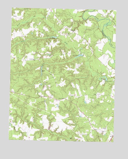
Beulahville, VA USGS Topographic Map
Click on map above to begin viewing in our Map Viewer.

This topographic map contains these locations and features:
Feature Name Type Latitude Longitude GNIS ID View Map
Beulah ChurchChurchN37.8543°W77.1764°1739269View Map
Beulah Church CemeteryCemeteryN37.8543°W77.1758°1956567View Map
BeulahvillePopulated PlaceN37.8549°W77.1786°1492568View Map
Beulahville School (historical)SchoolN37.8507°W77.1816°1739270View Map
Beulahville School (historical)SchoolN37.8529°W77.1811°1739271View Map
Campbells ForkLocaleN37.8257°W77.2216°1464379View Map
Corinth ChurchChurchN37.7732°W77.2486°1465259View Map
Corinth ForkPopulated PlaceN37.7663°W77.2453°1477226View Map
Dorrell CreekStreamN37.8493°W77.1914°1465887View Map
DuanePopulated PlaceN37.8665°W77.2466°1477278View Map
Duane ForkPopulated PlaceN37.8743°W77.2305°1477279View Map
Dublin MillpondReservoirN37.8480°W77.1976°1502005View Map
Dublin Millpond DamDamN37.8468°W77.1955°1490219View Map
EpworthPopulated PlaceN37.7910°W77.2119°1477309View Map
Epworth Methodist Church CemeteryCemeteryN37.7915°W77.2130°1956568View Map
Fork Bridge CreekStreamN37.8335°W77.1619°1466772View Map
GlobePopulated PlaceN37.8124°W77.1997°1493007View Map
Governor SwampStreamN37.7515°W77.1778°1467301View Map
Gravel RunStreamN37.8660°W77.1350°1467393View Map
Gutherie DamDamN37.8185°W77.2097°1490216View Map
Gutherie PondReservoirN37.8185°W77.2097°1490217View Map
Hall DamDamN37.7635°W77.2464°1490223View Map
Herring Creek MillLocaleN37.8076°W77.1364°1467958View Map
Herring Creek MillpondReservoirN37.8116°W77.1388°1502035View Map
Herring Creek Millpond DamDamN37.8088°W77.1339°1490221View Map
Kellys DamDamN37.7868°W77.1597°1490222View Map
Mangohick DistrictCivilN37.8110°W77.2330°1927386View Map
McGeorge PondReservoirN37.8161°W77.2125°1470254View Map
MidwayPopulated PlaceN37.7557°W77.1264°1477540View Map
Mitchell MillLocaleN37.8313°W77.1636°1739288View Map
Mitchell MillpondReservoirN37.8310°W77.1680°1502073View Map
Mitchell Millpond DamDamN37.8315°W77.1630°1490220View Map
Moncuin PondReservoirN37.7536°W77.1756°1470670View Map
Mount Sinai ChurchChurchN37.7599°W77.1358°1471066View Map
Pollards CornerPopulated PlaceN37.7899°W77.1847°1493442View Map
Providence ChurchChurchN37.8515°W77.1794°1472833View Map
Saint Pauls ChurchChurchN37.8138°W77.2022°1473884View Map
TurpinPopulated PlaceN37.7613°W77.1469°1477827View Map
UpshawPopulated PlaceN37.7940°W77.1469°1477836View Map
VenterPopulated PlaceN37.7624°W77.1353°1477841View Map
Venter School (historical)SchoolN37.7660°W77.1330°1739297View Map

Note: Coordinates in the location and feature list above are referenced to NAD83 datum.


Copyright (C) 2008-2024 Ryan Niemi / Sunset Dynamics ... All Rights Reserved