TopoQuest Logo
Do you find TopoQuest useful?
Help keep TopoQuest running and adding new maps/features by donating!
Bitcoin:  19c7KJd3qBynnjoSw5npx9KScwjBe4ifkT
Litecoin:  LXs6TkuXGGXo1vDsWCkWVdjQX94eUKd6ui
Home View Maps Find Maps Find Places Resources & Links


Point Isabel, Indiana Topographic Map

USGS Map Title: Point Isabel, IN
USGS Map MRC: 40085D7
DRG (GeoTIFF) Download: o40085d7.tif


Neighboring USGS Topographic Map Quads:


  Amboy, IN  
40085E8
 

  Sweetser, IN  
40085E7
 

  Marion, IN  
40085E6
 

  Greentown, IN  
40085D8
 

  Point Isabel, IN  
40085D7
 

  Fairmount, IN  
40085D6
 

  Windfall, IN  
40085C8
 

  Elwood, IN  
40085C7
 

  Alexandria, IN  
40085C6


Map MRC Location:

N41°
W86°
N41°
W85°
H8 H7 H6 H5 H4 H3 H2 H1
G8 G7 G6 G5 G4 G3 G2 G1
F8 F7 F6 F5 F4 F3 F2 F1
E8 E7 E6 E5 E4 E3 E2 E1
D8 D7 D6 D5 D4 D3 D2 D1
C8 C7 C6 C5 C4 C3 C2 C1
B8 B7 B6 B5 B4 B3 B2 B1
A8 A7 A6 A5 A4 A3 A2 A1
N40°
W86°
N40°
W85°

Point Isabel, IN USGS 1:24K Topographic Map Preview:
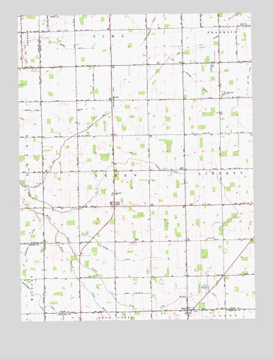
Point Isabel, IN USGS Topographic Map
Click on map above to begin viewing in our Map Viewer.

This topographic map contains these locations and features:
Feature Name Type Latitude Longitude GNIS ID View Map
Alel CemeteryCemeteryN40.4796°W85.8011°430057View Map
Antioch ChurchChurchN40.4611°W85.8439°430214View Map
Clear Water ParkParkN40.4670°W85.7655°432634View Map
ColePopulated PlaceN40.4798°W85.7872°432752View Map
Dupouy Airport (historical)AirportN40.4198°W85.8571°449311View Map
Green Township Volunteer Fire DepartmentBuildingN40.4213°W85.8249°2626249View Map
Hanes DitchCanalN40.3784°W85.8550°435671View Map
Hutcherson DitchCanalN40.3917°W85.8747°436659View Map
Jones ChapelChurchN40.4364°W85.7869°437088View Map
Keaton DitchCanalN40.4667°W85.8239°437184View Map
Knox ChapelChurchN40.4073°W85.8141°437416View Map
Maple Run ChurchChurchN40.4948°W85.7561°438578View Map
NormalPopulated PlaceN40.4650°W85.8253°440203View Map
Pattison DitchCanalN40.4761°W85.7697°440935View Map
Point IsabelPopulated PlaceN40.4217°W85.8244°441391View Map
Point Isabel Census Designated PlaceCensusN40.4206°W85.8220°2583464View Map
Poley WalkStreamN40.4123°W85.8547°441404View Map
Prairie RunStreamN40.4303°W85.8700°441559View Map
RigdonPopulated PlaceN40.3789°W85.7864°442008View Map
Roberts DitchCanalN40.4611°W85.8672°442158View Map
SimsPopulated PlaceN40.4998°W85.8553°443539View Map
Township of GreenCivilN40.4289°W85.8245°453340View Map
Waters DitchCanalN40.4034°W85.8261°445545View Map
Wimmer DitchCanalN40.4881°W85.8525°446161View Map

Note: Coordinates in the location and feature list above are referenced to NAD83 datum.


Copyright (C) 2008-2025 Ryan Niemi / Sunset Dynamics ... All Rights Reserved