TopoQuest Logo
Do you find TopoQuest useful?
Help keep TopoQuest running and adding new maps/features by donating!
Bitcoin:  19c7KJd3qBynnjoSw5npx9KScwjBe4ifkT
Litecoin:  LXs6TkuXGGXo1vDsWCkWVdjQX94eUKd6ui
Home View Maps Find Maps Find Places Resources & Links


Amboy, Indiana Topographic Map

USGS Map Title: Amboy, IN
USGS Map MRC: 40085E8
DRG (GeoTIFF) Download: o40085e8.tif


Neighboring USGS Topographic Map Quads:


  Bunker Hill, IN  
40086F1
 

  Peoria, IN  
40085F8
 

  Somerset, IN  
40085F7
 

  Miami, IN  
40086E1
 

  Amboy, IN  
40085E8
 

  Sweetser, IN  
40085E7
 

  Kokomo East, IN  
40086D1
 

  Greentown, IN  
40085D8
 

  Point Isabel, IN  
40085D7


Map MRC Location:

N41°
W86°
N41°
W85°
H8 H7 H6 H5 H4 H3 H2 H1
G8 G7 G6 G5 G4 G3 G2 G1
F8 F7 F6 F5 F4 F3 F2 F1
E8 E7 E6 E5 E4 E3 E2 E1
D8 D7 D6 D5 D4 D3 D2 D1
C8 C7 C6 C5 C4 C3 C2 C1
B8 B7 B6 B5 B4 B3 B2 B1
A8 A7 A6 A5 A4 A3 A2 A1
N40°
W86°
N40°
W85°

Amboy, IN USGS 1:24K Topographic Map Preview:
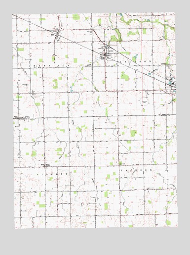
Amboy, IN USGS Topographic Map
Click on map above to begin viewing in our Map Viewer.

This topographic map contains these locations and features:
Feature Name Type Latitude Longitude GNIS ID View Map
AmboyPopulated PlaceN40.6014°W85.9289°430130View Map
Amboy Volunteer Fire CompanyBuildingN40.6039°W85.9288°2626330View Map
Amboy Volunteer Fire DepartmentBuildingN40.6039°W85.9288°2701455View Map
Barnhart CemeteryCemeteryN40.5786°W85.9855°430516View Map
Converse AirportAirportN40.5754°W85.9001°449131View Map
Converse Volunteer Ambulance - SubstationBuildingN40.6038°W85.9288°2719391View Map
Dale Powell DitchCanalN40.5720°W85.8825°433291View Map
Dunkard ChurchChurchN40.5367°W85.9764°433783View Map
Eastern Jackson SchoolSchoolN40.5220°W85.8980°433948View Map
Fisher DitchCanalN40.5200°W85.9517°434520View Map
Fox LakeLakeN40.5866°W85.8775°434740View Map
Friends CemeteryCemeteryN40.6051°W85.9300°434847View Map
Gerber CemeteryCemeteryN40.5792°W85.9855°435033View Map
Harper DitchCanalN40.5011°W85.9130°435765View Map
Herchberger CemeteryCemeteryN40.5839°W85.9883°436053View Map
Honey Creek ChurchChurchN40.5362°W85.9194°436392View Map
Howard Miami ChurchChurchN40.5648°W85.9961°436544View Map
Kendall CemeteryCemeteryN40.5648°W85.9880°437236View Map
Little Pipe CreekStreamN40.6178°W85.8842°438120View Map
Matthew Howell DitchCanalN40.5250°W85.9375°438729View Map
Miller DitchCanalN40.5525°W85.9817°439201View Map
North GrovePopulated PlaceN40.6123°W85.9661°449702View Map
North Grove CemeteryCemeteryN40.6159°W85.9644°440262View Map
Overman DitchCanalN40.5984°W85.9122°440783View Map
Park Lawn CemeteryCemeteryN40.6142°W85.9383°440876View Map
Pipe Creek CemeteryCemeteryN40.5941°W85.8827°441185View Map
PlevnaPopulated PlaceN40.5359°W85.9761°441359View Map
Regan DitchCanalN40.6175°W85.9303°441877View Map
Shrock CemeteryCemeteryN40.5642°W85.9828°443460View Map
Sugar CreekStreamN40.5909°W85.9483°444315View Map
Town of AmboyCivilN40.6019°W85.9275°2397428View Map
Township of HarrisonCivilN40.6076°W85.9764°453392View Map
Township of JacksonCivilN40.5217°W85.9009°453449View Map
Township of JacksonCivilN40.6082°W85.9016°453455View Map
Township of LibertyCivilN40.5057°W85.9762°453557View Map
Turkey CreekStreamN40.5964°W85.8817°444964View Map

Note: Coordinates in the location and feature list above are referenced to NAD83 datum.


Copyright (C) 2008-2024 Ryan Niemi / Sunset Dynamics ... All Rights Reserved