TopoQuest Logo
Do you find TopoQuest useful?
Help keep TopoQuest running and adding new maps/features by donating!
Bitcoin:  19c7KJd3qBynnjoSw5npx9KScwjBe4ifkT
Litecoin:  LXs6TkuXGGXo1vDsWCkWVdjQX94eUKd6ui
Home View Maps Find Maps Find Places Resources & Links


Pollard, Arkansas Topographic Map

USGS Map Title: Pollard, AR
USGS Map MRC: 36090D3
DRG (GeoTIFF) Download: o36090d3.tif


Neighboring USGS Topographic Map Quads:


  Vastus, MO  
36090E4
 

  Oglesville, MO  
36090E3
 

  Glennonville, MO  
36090E2
 

  McDougal, AR  
36090D4
 

  Pollard, AR  
36090D3
 

  Piggott, AR  
36090D2
 

  Boydsville, AR  
36090C4
 

  Rector, AR  
36090C3
 

  Greenway, AR  
36090C2


Map MRC Location:

N37°
W91°
N37°
W90°
H8 H7 H6 H5 H4 H3 H2 H1
G8 G7 G6 G5 G4 G3 G2 G1
F8 F7 F6 F5 F4 F3 F2 F1
E8 E7 E6 E5 E4 E3 E2 E1
D8 D7 D6 D5 D4 D3 D2 D1
C8 C7 C6 C5 C4 C3 C2 C1
B8 B7 B6 B5 B4 B3 B2 B1
A8 A7 A6 A5 A4 A3 A2 A1
N36°
W91°
N36°
W90°

Pollard, AR USGS 1:24K Topographic Map Preview:
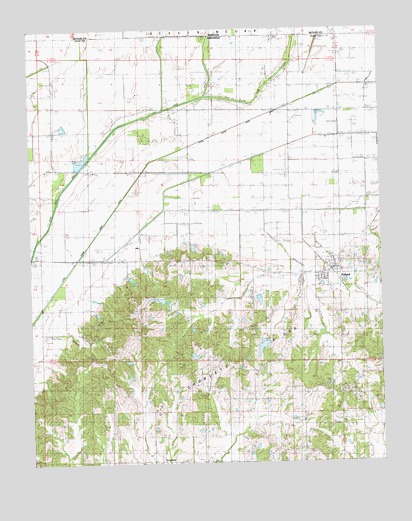
Pollard, AR USGS Topographic Map
Click on map above to begin viewing in our Map Viewer.

This topographic map contains these locations and features:
Feature Name Type Latitude Longitude GNIS ID View Map
Ark-Mo AirportAirportN36.4866°W90.2814°83817View Map
Bell Ann Plantation Airport (historical)AirportN36.4667°W90.2834°83816View Map
Blackshire School (historical)SchoolN36.4767°W90.3176°82605View Map
Brigance LakeReservoirN36.4034°W90.2968°80087View Map
Brigance Lake DamDamN36.4034°W90.2968°80086View Map
Bunker Hill School (historical)SchoolN36.4039°W90.3051°82611View Map
Cache Valley ChurchChurchN36.4345°W90.3457°47265View Map
Cache Valley School (historical)SchoolN36.4339°W90.3448°82613View Map
City of PollardCivilN36.4300°W90.2675°2404546View Map
CrockettPopulated PlaceN36.3759°W90.3307°57609View Map
Crockett CemeteryCemeteryN36.4187°W90.3384°48163View Map
Cummings CemeteryCemeteryN36.4020°W90.2934°82616View Map
Cummings ChapelChurchN36.4023°W90.2948°48261View Map
Cummings Church (historical)ChurchN36.3962°W90.2854°82617View Map
Cummings School (historical)SchoolN36.3962°W90.2854°82618View Map
Ditch Number 17CanalN36.4787°W90.3537°82110View Map
Ditch Number 2CanalN36.4670°W90.2809°82145View Map
Ditch Number 5CanalN36.4887°W90.3107°82297View Map
Ditch Number 6CanalN36.4887°W90.3265°82342View Map
Fish Trap SloughStreamN36.4809°W90.3118°717949View Map
Grazevich LakeReservoirN36.4084°W90.3161°80079View Map
Grazevich Lake DamDamN36.4084°W90.3168°80078View Map
Hardin CemeteryCemeteryN36.3756°W90.3407°49852View Map
Harmony ChurchChurchN36.3756°W90.2662°49871View Map
Headly School (historical)SchoolN36.4334°W90.3054°82633View Map
Housman CreekStreamN36.4473°W90.2915°50354View Map
Little Cache River Ditch Number 1CanalN36.4409°W90.3523°82497View Map
New Hope ChurchChurchN36.4292°W90.2790°52701View Map
New Light ChurchChurchN36.3759°W90.3273°52718View Map
Nicholas LakeReservoirN36.4196°W90.2898°81233View Map
Nicholas Lake DamDamN36.4201°W90.2901°81232View Map
Piggott Junction (historical)LocaleN36.4584°W90.2876°82832View Map
PollardPopulated PlaceN36.4309°W90.2684°78073View Map
Pollard Post OfficePost OfficeN36.4303°W90.2676°84203View Map
Pollard Volunteer Fire DepartmentBuildingN36.4311°W90.2674°2116993View Map
Rogers CemeteryCemeteryN36.3939°W90.3179°54165View Map
Rogers ChapelChurchN36.3756°W90.3104°82662View Map
Sales CreekStreamN36.4339°W90.2826°54506View Map
Styra (historical)Populated PlaceN36.4584°W90.3054°62515View Map
Township of Bradshaw (historical)CivilN36.3764°W90.3168°63712View Map
Township of PollardCivilN36.4454°W90.2831°63729View Map
Underwood School (historical)SchoolN36.4748°W90.2823°82671View Map
Walnut Hill ChurchChurchN36.4776°W90.3187°56014View Map

Note: Coordinates in the location and feature list above are referenced to NAD83 datum.


Copyright (C) 2008-2025 Ryan Niemi / Sunset Dynamics ... All Rights Reserved