TopoQuest Logo
Do you find TopoQuest useful?
Help keep TopoQuest running and adding new maps/features by donating!
Bitcoin:  19c7KJd3qBynnjoSw5npx9KScwjBe4ifkT
Litecoin:  LXs6TkuXGGXo1vDsWCkWVdjQX94eUKd6ui
Home View Maps Find Maps Find Places Resources & Links


Piggott, Arkansas Topographic Map

USGS Map Title: Piggott, AR
USGS Map MRC: 36090D2
DRG (GeoTIFF) Download: o36090d2.tif


Neighboring USGS Topographic Map Quads:


  Oglesville, MO  
36090E3
 

  Glennonville, MO  
36090E2
 

  Valley Ridge, MO  
36090E1
 

  Pollard, AR  
36090D3
 

  Piggott, AR  
36090D2
 

  Campbell, MO  
36090D1
 

  Rector, AR  
36090C3
 

  Greenway, AR  
36090C2
 

  Kennett North, MO  
36090C1


Map MRC Location:

N37°
W91°
N37°
W90°
H8 H7 H6 H5 H4 H3 H2 H1
G8 G7 G6 G5 G4 G3 G2 G1
F8 F7 F6 F5 F4 F3 F2 F1
E8 E7 E6 E5 E4 E3 E2 E1
D8 D7 D6 D5 D4 D3 D2 D1
C8 C7 C6 C5 C4 C3 C2 C1
B8 B7 B6 B5 B4 B3 B2 B1
A8 A7 A6 A5 A4 A3 A2 A1
N36°
W91°
N36°
W90°

Piggott, AR USGS 1:24K Topographic Map Preview:
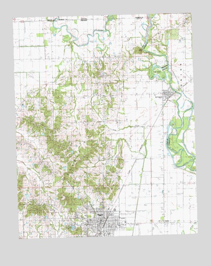
Piggott, AR USGS Topographic Map
Click on map above to begin viewing in our Map Viewer.

This topographic map contains these locations and features:
Feature Name Type Latitude Longitude GNIS ID View Map
Bass IslandIslandN36.4673°W90.1504°713719View Map
Beaver PondLakeN36.4862°W90.1918°75638View Map
Chalk BluffCliffN36.4720°W90.1615°47670View Map
City of PiggottCivilN36.3854°W90.2013°2404517View Map
City of Saint FrancisCivilN36.4550°W90.1424°2405393View Map
Clay County CourthouseBuildingN36.3826°W90.1923°62704View Map
Clay County FairgroundsLocaleN36.3901°W90.1823°62705View Map
Clay County Sheriff's OfficeBuildingN36.3810°W90.1922°2118542View Map
Cole LakeReservoirN36.4167°W90.2184°81235View Map
Cole Lake DamDamN36.4167°W90.2184°81234View Map
Crowleys RidgeRidgeN36.4834°W90.1334°716555View Map
Friendship Church (historical)ChurchN36.4923°W90.1301°746723View Map
Gravel Hill CemeteryCemeteryN36.4651°W90.1906°49585View Map
Gravel Hill ChurchChurchN36.4651°W90.1923°49588View Map
Gravel Hill School (historical)SchoolN36.4764°W90.1834°82627View Map
Harwood Church (historical)ChurchN36.3753°W90.2473°82630View Map
Harwood School (historical)SchoolN36.3756°W90.2473°82631View Map
Hill CemeteryCemeteryN36.4526°W90.1745°50113View Map
Hill ChurchChurchN36.4517°W90.1754°50116View Map
Hitt School (historical)SchoolN36.4187°W90.1757°82637View Map
Hitts ChurchChurchN36.4195°W90.1865°50154View Map
Horse CreekStreamN36.3951°W90.2312°53666View Map
Hughes LakeReservoirN36.3851°W90.2118°80083View Map
Hughes Lake DamDamN36.3851°W90.2118°80082View Map
Langley ChurchChurchN36.4609°W90.2293°50988View Map
Langley School (historical)SchoolN36.4631°W90.2237°82643View Map
Little Flock CemeteryCemeteryN36.3951°W90.2454°51268View Map
Mann School (historical)SchoolN36.4037°W90.1479°82647View Map
McNie CreekStreamN36.4201°W90.1595°51877View Map
Moore LakeReservoirN36.4017°W90.2334°80089View Map
Moore Lake DamDamN36.4017°W90.2334°80088View Map
Mount Zion ChurchChurchN36.4398°W90.2004°52489View Map
Old RiverStreamN36.4676°W90.1432°53015View Map
Old RiverStreamN36.4839°W90.1987°53016View Map
Old RiverLakeN36.4649°W90.1496°723778View Map
PiggottPopulated PlaceN36.3828°W90.1907°58365View Map
Piggott City HallBuildingN36.3815°W90.1918°62700View Map
Piggott Community HospitalHospitalN36.3902°W90.2049°62701View Map
Piggott Community Hospital HeliportAirportN36.3898°W90.2020°83811View Map
Piggott Elementary SchoolSchoolN36.3810°W90.1798°62702View Map
Piggott High SchoolSchoolN36.3813°W90.1849°62703View Map
Piggott LibraryBuildingN36.3839°W90.1948°62699View Map
Piggott Middle SchoolSchoolN36.3812°W90.1795°62698View Map
Piggott Municipal AirportAirportN36.3792°W90.1679°83810View Map
Piggott Police DepartmentBuildingN36.3814°W90.1920°2118541View Map
Piggott Post OfficePost OfficeN36.3834°W90.1926°84228View Map
Piggott Volunteer Fire Department Station 1BuildingN36.3855°W90.1920°2116957View Map
Piggott Volunteer Fire Department Station 2 (historical)BuildingN36.3823°W90.1894°2116958View Map
Pomp CreekStreamN36.4287°W90.1593°53671View Map
Poplar CreekStreamN36.4853°W90.2079°53691View Map
Rocky Hill CemeteryCemeteryN36.4964°W90.1256°725512View Map
Saint FrancisPopulated PlaceN36.4534°W90.1454°58569View Map
Saint Francis Post OfficePost OfficeN36.4543°W90.1425°2781956View Map
Saint Francis Volunteer Fire DepartmentBuildingN36.4552°W90.1396°2117082View Map
Sugar CreekStreamN36.3759°W90.1882°55300View Map
Township of Chalk Bluff (historical)CivilN36.4556°W90.2057°63716View Map
Township of Chalk Bluff-LiddellCivilN36.4565°W90.1950°2063359View Map
Township of Liddell (historical)CivilN36.4501°W90.1584°63725View Map
Township of North Saint FrancisCivilN36.3976°W90.1859°2063363View Map
Township of Saint Francis (historical)CivilN36.3806°W90.1959°63730View Map
TrinnonPopulated PlaceN36.3828°W90.1495°62697View Map
Wanderers Home ChurchChurchN36.4389°W90.2320°56030View Map
Whitaker Cut-offCanalN36.4692°W90.1423°739546View Map
Whitaker PlacePopulated PlaceN36.4617°W90.1284°739547View Map
Wrights ChapelChurchN36.3803°W90.2162°56561View Map

Note: Coordinates in the location and feature list above are referenced to NAD83 datum.


Copyright (C) 2008-2024 Ryan Niemi / Sunset Dynamics ... All Rights Reserved